National Weather Service United States Department of Commerce

Flooding Concerns in Puerto Rico; Thunderstorms Across the Southeast U.S.

Showers and thunderstorms capable of producing widespread heavy rainfall will be possible across much of Puerto Rico today. Heavy rainfall will likely lead to flash, urban and small stream flooding. Some areas may face life-threatening flooding. In the Southeast U.S., strong to marginally severe thunderstorms will be possible this afternoon. Read More >

Click a location below for detailed forecast.

Last Map Update: Fri, Apr. 19, 2024 at 12:20:02 pm MDT
National Weather Service Missoula, MTZoom
Out

National Weather Service Glasgow, MT
National Weather Service Boise, IDNational Weather Service Pocatello, IDNational Weather Service Billings, MT

There is the potential for strong winds on Sunday over the northern Rockies, including areas around Browning, Heart Butte, East Glacier Park and the Cut Bank areas.
West winds will begin to strengthen Sunday morning along the Rocky Mountain Front and over the immediate adjacent plains, becoming strong and gusty during the afternoon hours before slowly decreasing through the evening hours. There is an 80% or great chance that wind gusts will exceed 55 mph along the US Hwy 2 corridor between Cut Bank and East Glacier over this timeframe, with a 50-80% chance that gusts exceed 65 mph. Those traveling on Sunday should be prepared for strong cross winds, especially if operating a high profile vehicle.
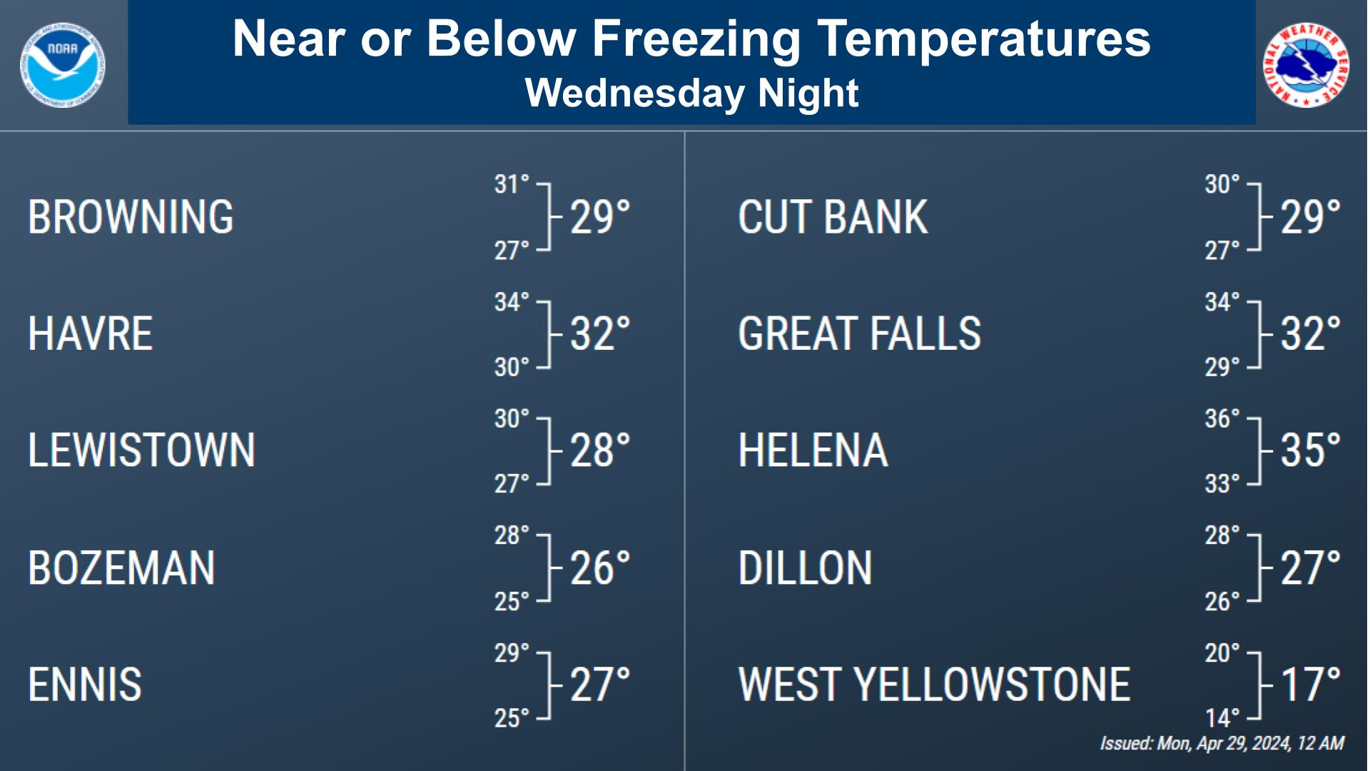
Recent mild weather has resulted in the early onset of spring activities. So with with hard freezes expected each morning through Saturday, don’t forget to protect any temperature sensitive pipes, plants, or pets. #MTwx
(Corrected graphics - sorry for any confusion) Ready to pull out your trowel and begin planting again? Here are some tables providing the climatological probabilities of the last frost, freeze, and hard freeze at major climate sites across the region. #MTwx


Text Product Selector (Selected product opens in current window)