Overview
|
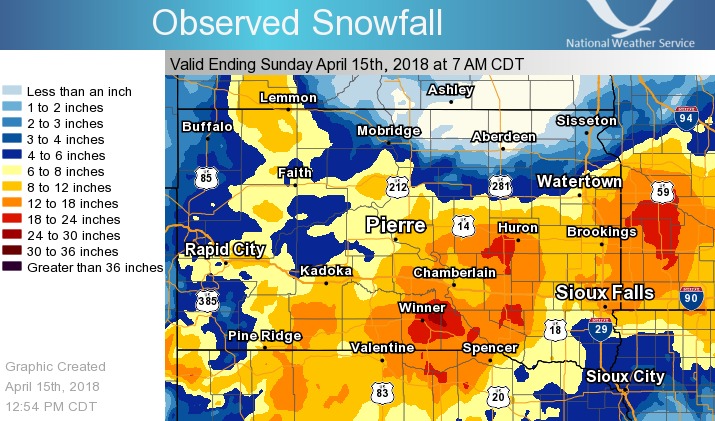
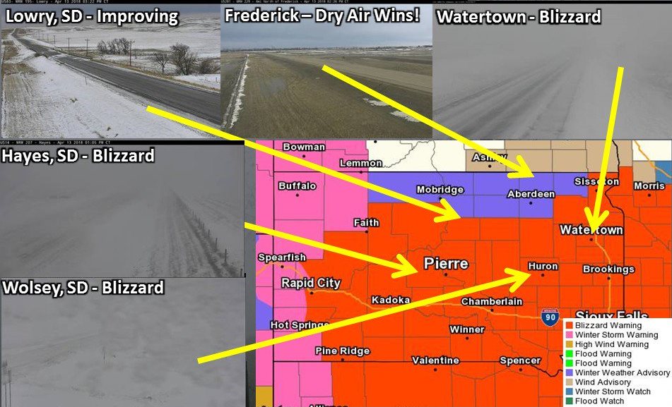
A dynamic springtime storm system severely impacted the Northern Plains on April 13th and 14th. Widespread snowfall totals of one to two feet across the southern half of South Dakota and southern Minnesota combined with winds gusts of up to 50 mph to produce widespread blizzard conditions for many hours. Additionally, snowfall accumulation records were set, snow drifted to 3-4+ feet in some cases, and severe thunderstorms impacted southeastern South Dakota. Both portions of I-29 and I-90 were closed from the afternoon of the 13th through the morning of the 15th. Thanks to everyone who reported snowfall amounts and conditions, and shared photos throughout the course of the event. |
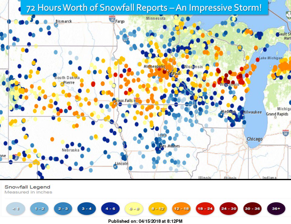 Snowfall reports over the course of the storm |
Snow/Blizzard
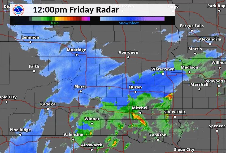
This snowfall total map uses a combination of snowfall reports and radar estimates
Snowfall reports by location through the event
1000 AM Snow CLEAR LAKE 44.75N 96.68W
04/15/2018 M18.0 inch Deuel SD CO-OP Observer
STORM TOTAL. CO-OP OBSERVER STATION CLKS2, CLEAR LAKE.
0600 PM Heavy Snow KENNEBEC 43.92N 99.87W
04/14/2018 M16.5 inch Lyman SD CO-OP Observer
STORM TOTAL SNOWFALL.
0930 AM Heavy Snow 6 NE AMES 44.33N 98.99W
04/14/2018 M14.0 inch Hand SD Emergency Mngr
STORM TOTAL OF 14 INCHES. 3 TO 4 FOOT
DRIFTS. WIND IS BLOWING SNOW AND REDUCING
VISIBILITY TO A MILE.
0700 PM Heavy Snow GARY
04/14/2018 M12.0 inch Deuel SD Trained Spotter
STORM TOTAL
0700 AM Snow PRESHO 43.90N 100.06W
04/14/2018 M11.5 inch Lyman SD Cocorahs
COCORAHS STATION SD-LY-1, PRESHO.
0700 AM Heavy Snow PRESHO 43.90N 100.06W
04/14/2018 M11.5 inch Lyman SD Cocorahs
COCORAHS STATION SD-LY-1, PRESHO.
0600 AM Heavy Snow CASTLEWOOD 44.73N 97.03W
04/15/2018 M11.2 inch Hamlin SD CO-OP Observer
STORM TOTAL. CO-OP OBSERVER STATION CLWS2,
CASTLEWOOD.
0930 AM Heavy Snow MILLER 44.52N 98.99W
04/14/2018 M11.0 inch Hand SD Emergency Mngr
STORM TOTAL.
0700 AM Snow VIVIAN 7 NNE 44.04N 100.27W
04/14/2018 M11.0 inch Lyman SD Cocorahs
COCORAHS STATION SD-LY-5, VIVIAN 7 NNE.
1000 AM Snow CLEAR LAKE #1 44.75N 96.68W
04/14/2018 M10.5 inch Deuel SD CO-OP Observer
CO-OP OBSERVER STATION CLKS2, CLEAR LAKE #1.
1000 AM Heavy Snow CLEAR LAKE 44.75N 96.68W
04/14/2018 M10.5 inch Deuel SD CO-OP Observer
STILL SNOWING. CO-OP OBSERVER STATION CLKS2,
CLEAR LAKE.
1000 AM Heavy Snow REDFIELD 44.87N 98.52W
04/14/2018 E10.0 inch Spink SD Emergency Mngr
ESTIMATED STORM TOTAL OF 10-12 INCHES.
0700 AM Heavy Snow 6 E HAYES 44.37N 100.90W
04/14/2018 M10.0 inch Stanley SD CO-OP Observer
TOTAL STORM SNOWFALL IS 10 INCHES. 8.0
INCHES FELL FROM 7 AM ON THE 13TH TO 7 AM ON
THE 14TH.
0800 AM Snow WATERTOWN 7.5 NNE 45.00N 97.09W
04/14/2018 M10.0 inch Codington SD Cocorahs
COCORAHS STATION SD-CD-5, WATERTOWN 7.5 NNE.
0800 AM Heavy Snow WATERTOWN 7.5 NNE 45.00N 97.09W
04/14/2018 M10.0 inch Codington SD Cocorahs
STILL SNOWING. COCORAHS STATION SD-CD-5,
WATERTOWN 7.5 NNE.
0700 AM Heavy Snow HIGHMORE 12 N 44.70N 99.41W
04/14/2018 M9.5 inch Hyde SD Cocorahs
COCORAHS STATION SD-HY-1, HIGHMORE 12 N.
0700 AM Snow HIGHMORE 12 N 44.70N 99.41W
04/14/2018 M9.5 inch Hyde SD Cocorahs
COCORAHS STATION SD-HY-1, HIGHMORE 12 N.
0730 AM Snow OKATON 3 NW 43.91N 100.94W
04/14/2018 M9.0 inch Jones SD Cocorahs
COCORAHS STATION SD-JN-3, OKATON 3 NW.
0730 AM Snow MILBANK 45.22N 96.63W
04/15/2018 M9.0 inch Grant SD CO-OP Observer
STORM TOTAL. CO-OP OBSERVER STATION MLBS2, MILBANK.
0700 AM Heavy Snow 2 ESE ARTICHOKE
04/15/2018 M9.0 inch Deuel SD Trained Spotter
STORM TOTAL
1045 AM Heavy Snow 1 SW PIERRE 44.36N 100.34W
04/14/2018 M9.0 inch Hughes SD Broadcast Media
STORM TOTAL.
0715 AM Snow PIERRE 44.36N 100.33W
04/14/2018 M8.7 inch Hughes SD CO-OP Observer
CO-OP OBSERVER STATION PRSS2, PIERRE.
1200 PM Heavy Snow WEBSTER 45.34N 97.52W
04/14/2018 M8.0 inch Day SD Trained Spotter
RELAYED VIA SOCIAL.
0800 AM Heavy Snow 1 N ORTONVILLE 45.32N 96.44W
04/14/2018 M8.0 inch Big Stone MN CO-OP Observer
STILL SNOWING.
0700 AM Heavy Snow CLARK
04/15/2018 M8.0 inch Clark SD Trained Spotter
STORM TOTAL
0700 AM Heavy Snow ODESSA
04/15/2018 M8.0 inch Big Stone MN Trained Spotter
STORM TOTAL
0800 AM Snow ORTONVILLE 1 N 45.31N 96.43W
04/14/2018 M8.0 inch Big Stone MN CO-OP Observer
CO-OP OBSERVER STATION ORVM5, ORTONVILLE 1
N.
1230 PM Heavy Snow 4 ESE WATERTOWN 44.89N 97.09W
04/14/2018 M8.0 inch Codington SD Trained Spotter
STILL SNOWING, REPORT RELAYED VIA SOCIAL
MEDIA.
0600 AM Snow HAYES 6 E 44.37N 100.89W
04/14/2018 M8.0 inch Stanley SD CO-OP Observer
CO-OP OBSERVER STATION AYES2, HAYES 6 E.
0700 AM Snow HIGHMORE 19 NNW 44.78N 99.57W
04/14/2018 M8.0 inch Hyde SD Cocorahs
COCORAHS STATION SD-HY-2, HIGHMORE 19 NNW.
0700 AM Heavy Snow FORT PIERRE 44.36N 100.37W
04/14/2018 M7.5 inch Stanley SD Cocorahs
COCORAHS STATION SD-ST-6, FORT PIERRE.
0700 AM Snow FORT PIERRE 44.36N 100.37W
04/14/2018 M7.5 inch Stanley SD Cocorahs
COCORAHS STATION SD-ST-6, FORT PIERRE.
0700 AM Snow PIERRE 1 S 44.35N 100.32W
04/14/2018 M7.0 inch Hughes SD Cocorahs
COCORAHS STATION SD-HG-10, PIERRE 1 S.
0900 AM Snow WESTOVER 2 SSW 43.72N 100.68W
04/14/2018 M7.0 inch Jones SD Cocorahs
COCORAHS STATION SD-JN-4, WESTOVER 2 SSW.
0400 PM Heavy Snow BRENTFORD 45.16N 98.32W
04/14/2018 E7.0 inch Spink SD Public
REPORT RELAYED THROUGH SOCIAL MEDIA.
1000 AM Snow LA BOLT 45.05N 96.68W
04/14/2018 M6.8 inch Grant SD Cocorahs
COCORAHS STATION SD-GT-9, LA BOLT.
0900 AM Snow MURDO 43.88N 100.72W
04/14/2018 M6.8 inch Jones SD CO-OP Observer
STORM TOTAL. CO-OP OBSERVER STATION MURS2,
MURDO.
0600 AM Heavy Snow CASTLEWOOD 44.73N 97.03W
04/14/2018 M6.4 inch Hamlin SD CO-OP Observer
STILL SNOWING. CO-OP OBSERVER STATION CLWS2,
CASTLEWOOD.
0830 AM Snow WATERTOWN 2 E 44.91N 97.11W
04/14/2018 M6.0 inch Codington SD Cocorahs
COCORAHS STATION SD-CD-8, WATERTOWN 2 E.
0730 AM Heavy Snow MILBANK 45.22N 96.63W
04/14/2018 M6.0 inch Grant SD CO-OP Observer
STILL SNOWING. CO-OP OBSERVER STATION MLBS2,
MILBANK.
0700 AM Heavy Snow TURTON 45.05N 98.10W
04/14/2018 M6.0 inch Spink SD Cocorahs
COCORAHS STATION SD-SP-6, TURTON.
0700 AM Snow TURTON #2 45.05N 98.10W
04/14/2018 M6.0 inch Spink SD CO-OP Observer
CO-OP OBSERVER STATION TURS2, TURTON #2.
0700 AM Snow GANN VALLEY 7 WNW 44.08N 99.13W
04/14/2018 M5.2 inch Buffalo SD Cocorahs
COCORAHS STATION SD-BF-1, GANN VALLEY 7 WNW.
0800 AM Snow WATERTOWN 2 S 44.87N 97.12W
04/15/2018 M5.5 inch Codington SD CO-OP Observer
CO-OP OBSERVER STATION WATS2, WATERTOWN 2 S.
0800 AM Snow FAULKTON 1 NW 45.03N 99.13W
04/14/2018 M4.0 inch Faulk SD CO-OP Observer
STORM TOTAL. CO-OP OBSERVER STATION FAUS2,
FAULKTON 1 NW.
0800 AM Snow HAYTI 1 W 44.66N 97.23W
04/14/2018 M4.0 inch Hamlin SD CO-OP Observer
STILL SNOWING. CO-OP OBSERVER STATION HYTS2,
HAYTI 1 W.
0800 AM Snow DOLAND 44.87N 98.10W
04/14/2018 M3.5 inch Spink SD CO-OP Observer
CO-OP OBSERVER STATION DOLS2, DOLAND.
0800 AM Snow HAYES 7 ESE 44.33N 100.88W
04/14/2018 M3.0 inch Stanley SD Cocorahs
COCORAHS STATION SD-ST-7, HAYES 7 ESE.
1200 PM Snow ANDOVER 45.41N 97.91W
04/14/2018 M2.5 inch Day SD CO-OP Observer
CO-OP OBSERVER STATION ANVS2, ANDOVER.
0800 AM Snow WILMOT 45.42N 96.83W
04/14/2018 M0.9 inch Roberts SD CO-OP Observer
CO-OP OBSERVER STATION WMTS2, WILMOT.
0700 AM Snow ROSCOE 45.45N 99.35W
04/14/2018 M0.6 inch Edmunds SD CO-OP Observer
CO-OP OBSERVER STATION ROSS2, ROSCOE.
0700 AM Snow EUREKA 11 WSW 45.66N 99.80W
04/14/2018 M0.1 inch Campbell SD Cocorahs
COCORAHS STATION SD-CP-9, EUREKA 11 WSW.
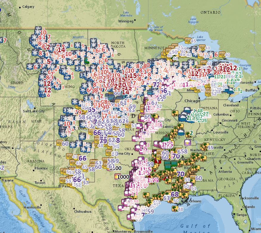
All Local Storm Reports (LSRs) issued by all affected National Weather Service offices across the country as of 230 pm on April 14th. While this strong system produced tremendous snowfall amounts and blizzard conditions on the north-side, it was also responsible for numerous fires, tornadoes, and a myriad of other hazardous weather.
Photos & Video:
 |
 |
 |
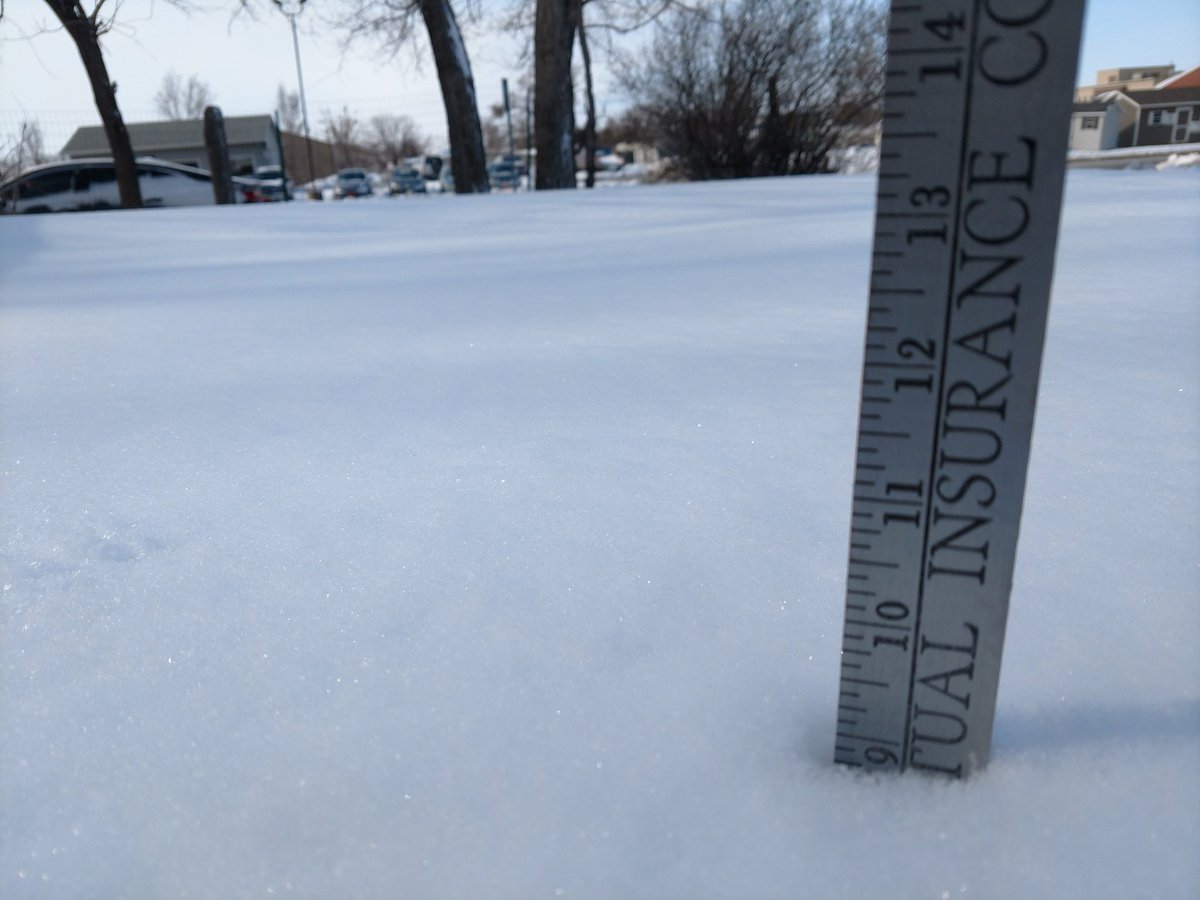 |
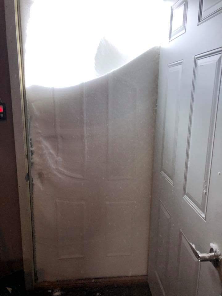
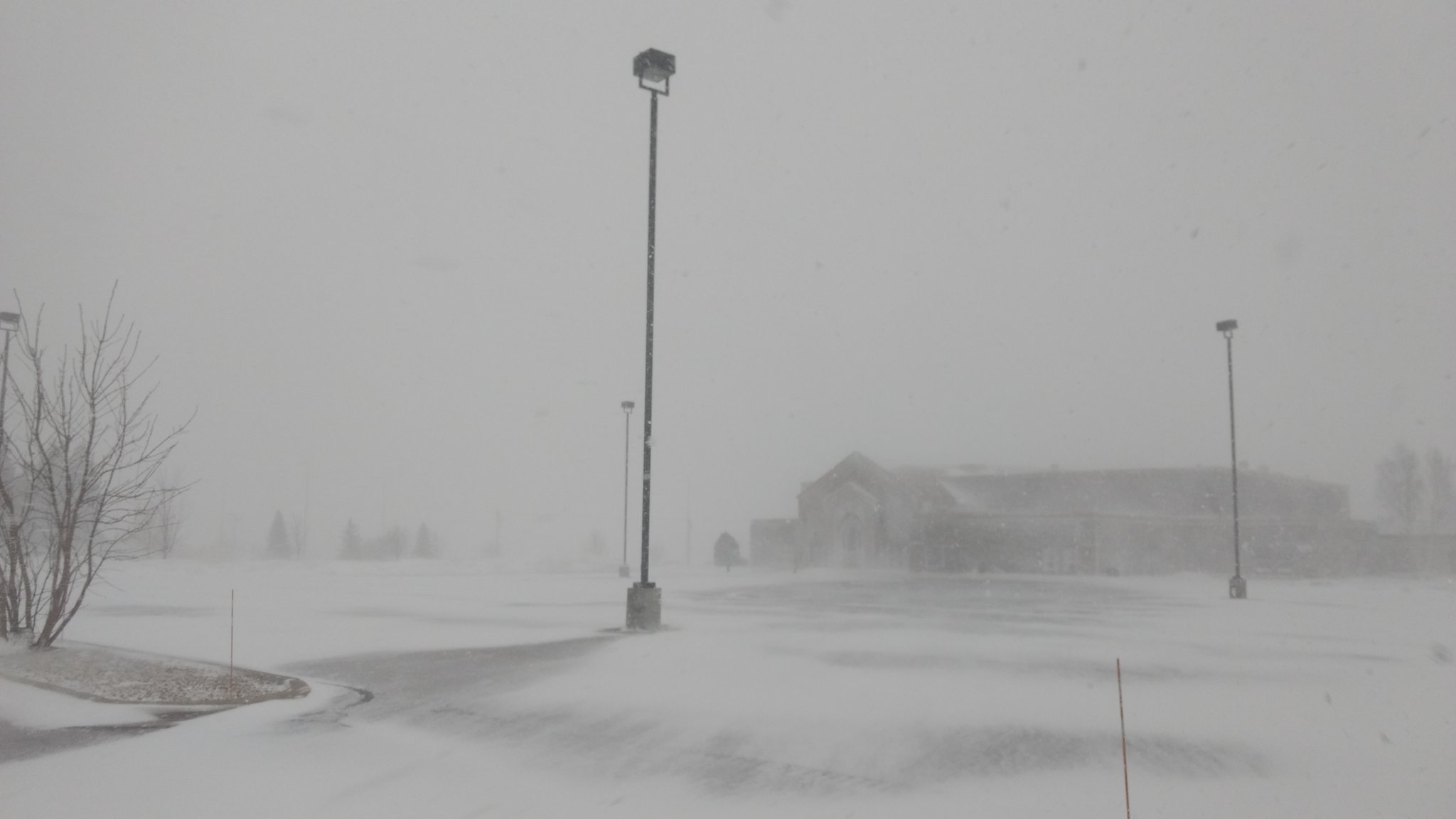
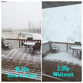
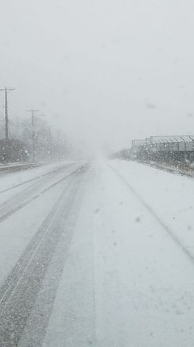
| Morning of April 14th (Sat), 12 mi N of Draper, SD. Courtesy of LyRanda Hatlestad-Fuoss | Afternoon of April 13th (Fri) in Watertown, SD. Courtesy of Alex Resen | Rapidly deteriorating conditions on April 13th near Pelican Lake. Courtesy of Bekah Evenson | Snowfall accumulation by 9 am on April 14th in Pierre, SD. Courtesy of Brent Nathaniel |
 |
 |
 |
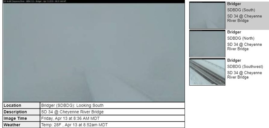 |
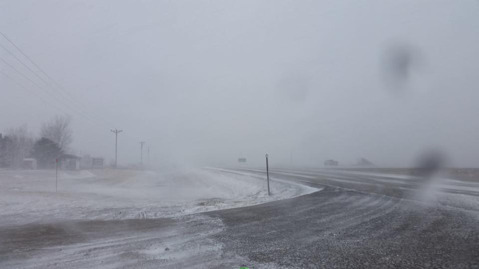
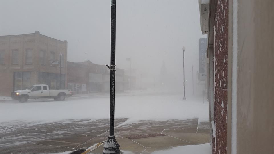
| Wallace, SD on the afternoon of April 13th. Courtesy of Daniel Basler Jr. | Afternoon of April 13th in Watertown, SD. Courtesy of Josh Petersen | Webster, SD on the afternoon of April 13th. Courtesy of Daniel Basler Jr. | SDDOT Camera from Bridger, SD on the morning of April 13th. |
 |
 |
||
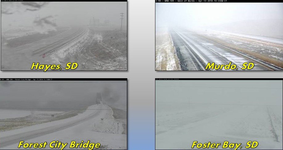
| A composite of SDDOT cameras as of noon on April 13th | A composite of SDDOT cameras as of 330 pm on April 13th |
Radar:
 |
 |
 |
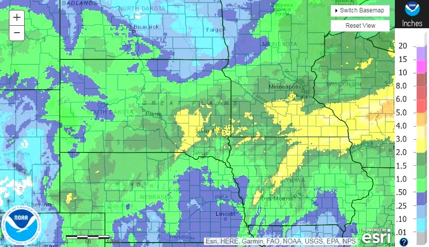 |
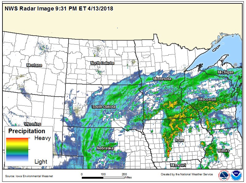
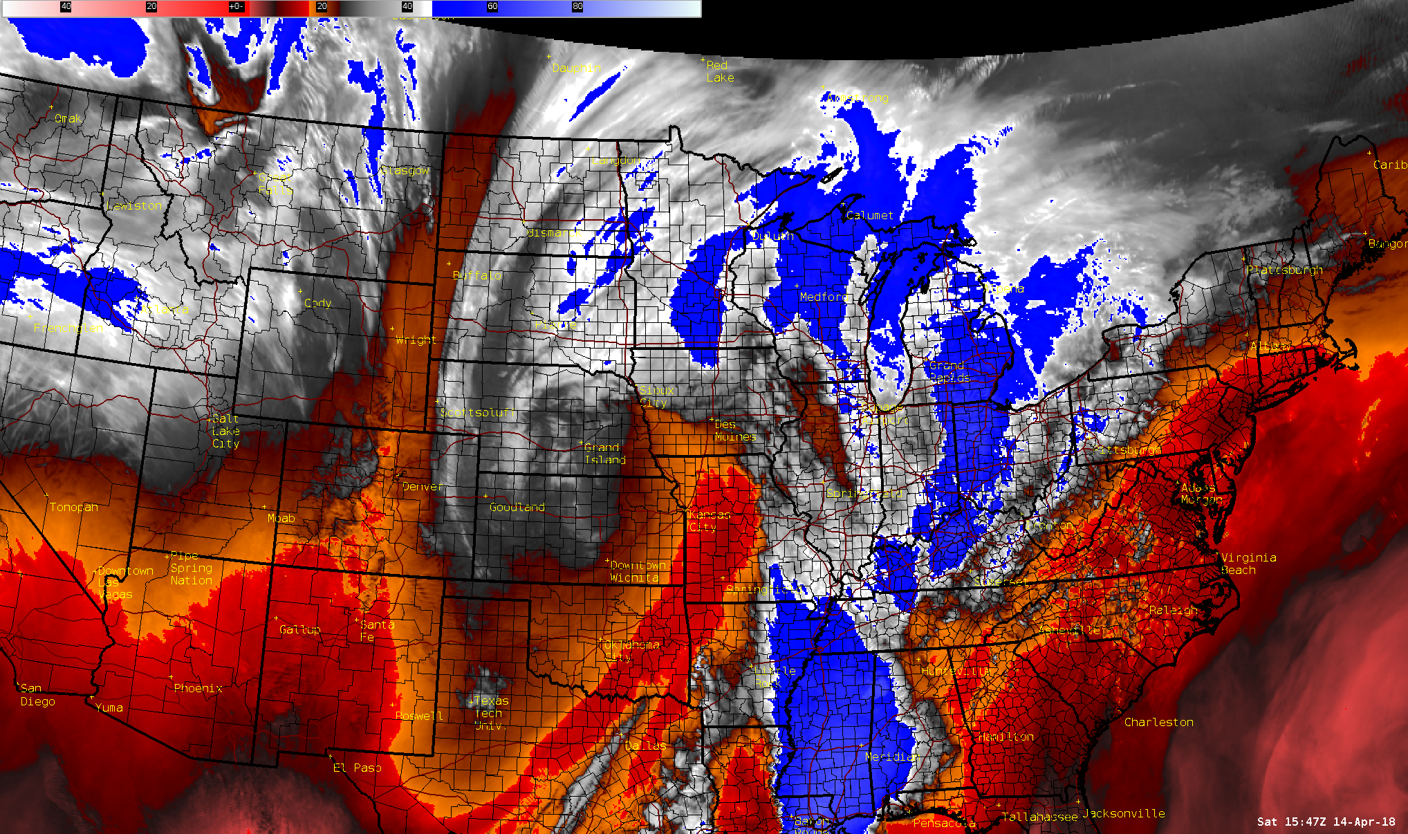
| Thundersnow and thunderstorms were prevalent with this storm system. 1"+ hail was even reported across southeastern SD/southwestern MN | Regional radar snapshot as the blizzard continued into the overnight on the 13th | GOES-16 Water Vapor Satellite imagery of the storm system as a whole across the United States at 11 am on the 14th | Radar estimated precipitation totals from April 10-17th, from https://water.weather.gov/precip/ |
Additional Information
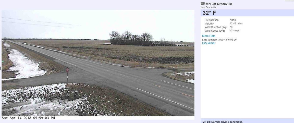
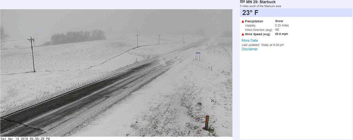
A very sharp cut-off between snow and no snow developed on the north side of this system. Just 30-50 miles made an enormous difference in terms of impacts, essentially separating blizzard conditions from no snow at all.
 |
 |
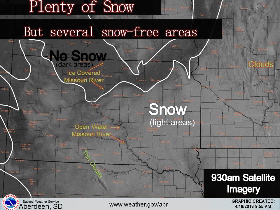 |
| SDDOT camera from Graceville, MN at 6 pm on the 14th | SDDOT camera from Starbuck, MN at 6 pm on the 14th | GOES-16 Visible Satellite on the morning of April 16th, showing the snow/no snow line across the area |
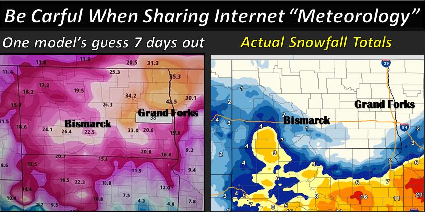
This storm served as an important reminder that weather models need to be vetted, especially in the long range. One model 7 days out forecast 40" of snow across parts of North Dakota for this April 13-14th storm. For perspective, the largest official 3-day total snowfall total in North Dakota's recorded history is 34" at Minot in the late April of 1984 (https://www.ncdc.noaa.gov/snow-and-ice/snowfall-extremes/ND). As the event approached, models continued pushing the system further south and lessening snowfall totals. Just remember to continue monitoring the latest forecast leading up to an event.
 |
 |
||
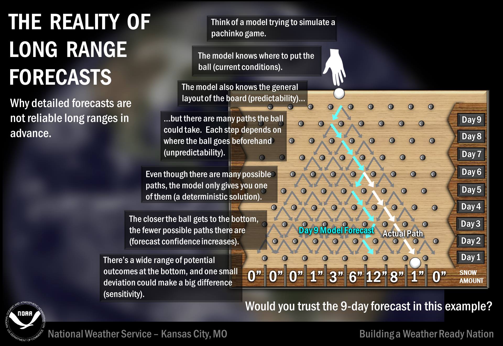
| Long range forecast for the April 13-14 Blizzard vs actual snowfall totals. Note the drastic difference in both location+amounts | The reality of long range forecasts |
Summaries from other NWS Offices
 |
Media use of NWS Web News Stories is encouraged! Please acknowledge the NWS as the source of any news information accessed from this site. |
|


 Follow us on YouTube