Weather History - September 6th
Local and Regional Events:
September 6, 2000:
Eight miles southwest of Miller, ninety mph winds destroyed three barns and a small garage along with severely damaging a creeper feeder and an enclosed trailer. Another building was moved from its foundation and damaged. An empty school bus was rolled several times before it came to rest atop a fence. Also, a window was broken out of the house.
U.S.A and Global Events for September 6th:
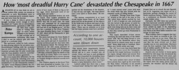
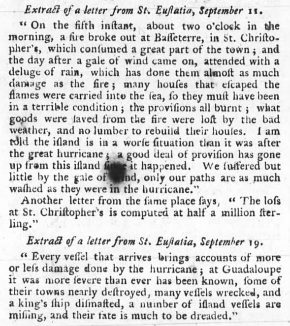
1667: The “dreadful hurricane of 1667” is considered one of the most severe hurricanes ever to strike Virginia. On the first, this same storm was reported in the Lesser Antilles. The hurricane devastated St. Christopher as no other storm had done before. The "great storm" went on to strike the northern Outer Banks of North Carolina and southeastern Virginia. Area crops (including corn and tobacco) were beaten into the ground. Click HERE for more information from the Weather Prediction Center.
1776: Called the Pointe-à-Pitre hurricane, this storm is one of the deadliest Atlantic hurricanes on record. While the intensity and complete track are unknown, this storm struck Guadeloupe on this day, killing 6,000. Click HERE for more information.
1881: Forest fires in “The Thumb” of Michigan and Ontario resulted in “Yellow Day” over the New England states. Twenty villages and over a million acres burned in Michigan. The smoke from these fires caused the sky to appear yellow over several New England cities. Twilight appeared at noon on this day. Click HERE for more information from forgettennewengland.com
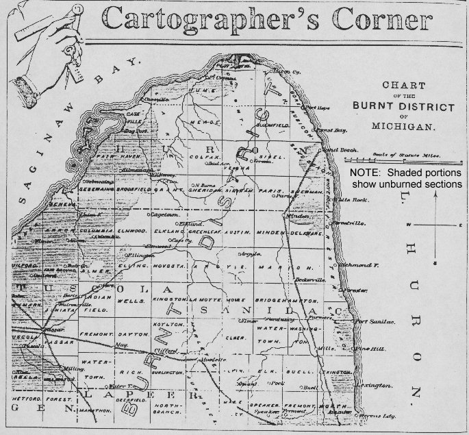
The image above is a map showing Damage in Michigan from the Thumb Fire of 1881.
1933: The remnant low of the Treasure Coast Hurricane dumped 10.33" of rain in Charleston, which is the second-highest 24-hour rainfall total on record for the downtown station. The storm produced wind gusts of 51 mph and also spawned a tornado near the city. Click HERE for more information.
2003: Hurricane Isabel was first named on September 6th, 2003. It would reach Category 5 status and eventually make landfall in North Carolina as a Category 2. Click HERE for more information for the NWS Office in Morehead City, North Carolina.
2017: Category 5 Hurricane Irma affected the US Virgin Island and Puerto Rico. Maximum sustained winds were at 180 mph when the storm hit St. Thomas & St. John. Catastrophic damage was reported over the US Virgin Island & significant damage over Puerto Rico, especially over Culebra. Click HERE for a tweet from the NWS Office in San Juan.
Click HERE for more This Day in Weather History from the Southeast Regional Climate Center.


 Follow us on YouTube