Event Synopsis
A strong surface low pressure system developed over the high plains of Colorado on Saturday afternoon (12/13) then lifted northeastward into northwest Iowa on Sunday morning (12/14). Moisture drawn up from the south interacted with a cold, arctic airmass surging southward from Canada which resulted in a widespread snowfall beginning Saturday night over the western Dakotas. The combination of moderate to occasionally heavy snowfall, and very strong north to northwesterly winds resulted in widespread blizzard conditions over a large portion of central and northeastern South Dakota, and far west-central Minnesota from late Saturday night through the day on Sunday. Visibility at many locations dropped below one quarter mile for several hours, with intermitting visibility reduced to near zero at times. Interstate 29 was closed from Brookings, SD to the Canadian border from Sunday afternoon through Monday (12/15) morning.
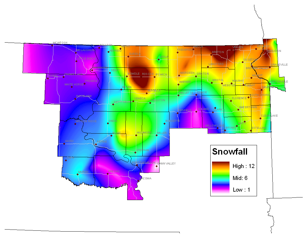
Snowfall amounts varied greatly and generally ranged from around an inch in central South Dakota, to nearly 12” in portions of north-central and northeastern South Dakota, and west-central Minnesota (see image below). However, due to the significant blowing and drifting snow during blizzard events (with snow drifts up to 5 feet reported), accurate snowfall measurements were extremely difficult.
As the arctic airmass moved into the region from Canada, temperatures fell through much of the day on Sunday with many locations experiencing sub-zero high temperatures. Wind chill readings also fell to dangerously cold levels (-35F and -50F) Sunday night through Monday afternoon.
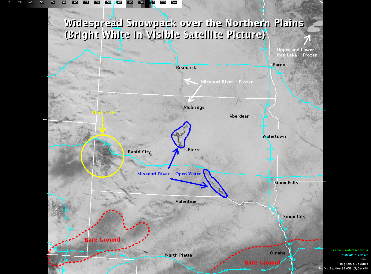
Satellite images can often be very helpful to meteorologists, even when skies are clear. Below is an image taken midday Monday (12/15) over the northern plains. A description of a few interesting features are provided below:
-The "bright white" in the majority of the image is depicting the widespread snowfall that fell over the plains this weekend.
-Several rivers are easily identifiable. Note that the Missouri River is generally ice free in the vicinity of Pierre (dark shade), and ice covered (frozen) between Mobridge and Bismarck.
-A few areas remain snow free. One area can be seen near Omaha, Nebraska, and another over the Nebraska panhandle.
-The Black Hills stand out as a “darker” image due to the presence of trees.
-Upper and Lower Red Lake in Minnesota are easily identifiable (frozen).


 Follow us on YouTube