Meteorological autumn (September - November) will end up as being one of the driest on record for many locations across northeastern South Dakota and west-central Minnesota. In fact, several reporting locations have set or tied their all time record for driest autumn periods on record!
The table below shows the Sep-Nov 2011 precipitation totals for several sites across the Aberdeen forecast area, along with the overall ranking, and year and amount of the record (or previous record) dry autumn.
|
Location |
Sept-Nov Precipitation |
Rank |
Record (or previous record) |
Year |
|
Clark |
1.41 |
1st |
1.44 |
1935 |
|
Watertown |
0.93 |
1st(Tie) |
0.93 |
1935 |
|
Artichoke Lake |
1.44 |
1st(Tie) |
1.44 |
1976 |
|
Browns Valley |
1.33 |
2nd |
1.30 |
1980 |
|
Victor 4NNE |
1.31 |
3rd |
0.91 |
1976 |
|
Wilmot |
1.51 |
4th |
1.39 |
1976 |
|
Summit 1W |
1.59 |
4th |
1.20 |
1980 |
|
Wheaton |
1.33 |
4th |
1.19 |
1976 |
|
Sisseton |
1.64 |
10th |
0.88 |
1935 |
|
Aberdeen |
1.47 |
11th |
0.80 |
1964 |
Figure 1 below depicts the 90-Day Departure from Normal Precipitation. Notice that precipitation departures across far eastern South Dakota range from 2.0” below normal to as much as 5.0” below normal!
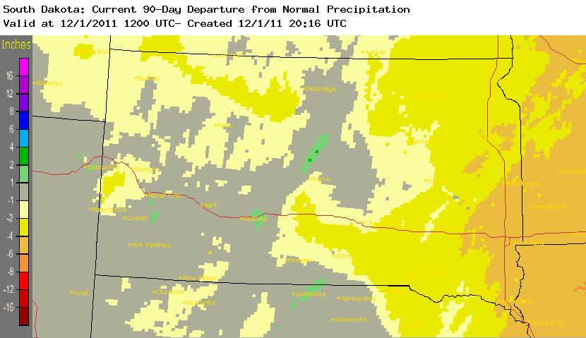
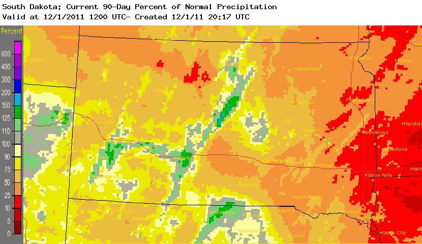
Figure 2 below depicts the 90-Day Percent of Normal Precipitation. Notice that some areas across far eastern South Dakota and western Minnesota have only seen 5% of normal precipitation.


 Follow us on YouTube