
There is an Enhanced Risk (Level 3 of 5) for severe thunderstorms Tuesday with threats for significant severe hail and tornado potential over southern Iowa into northern Missouri and west-central Illinois. Elevated to critical fire weather is possible Tuesday due to gusty winds and dry conditions over parts of the southern High Plains and northeastern Montana. Read More >
Need help navigating our new website?
Let us show you how! Please click on a question to find the answer.
| We understand that there are issues outside of the larger metropolitan areas with slow internet connections. We've added a few options that may help out. First select the Forecasts Menu and select Mobile Friendly. You can also access a text friendly page by clicking the low bandwidth option at the bottom of the page. Need something that is not on these pages? Let us know: nws.ar.pafc.webauthors |
 |
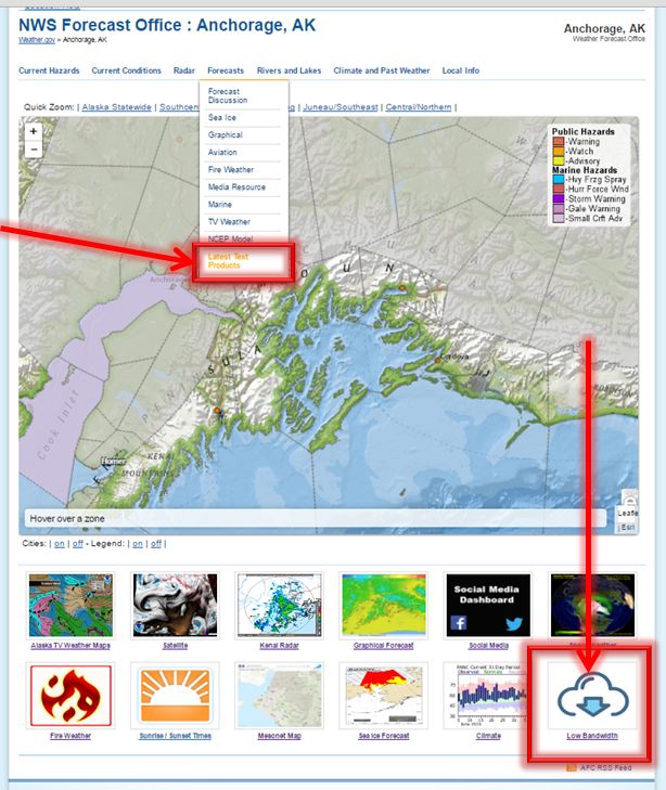
| There are two ways to access the text products and both options are highlighted by a red box below. You can access the text products under the Forecasts Menu and select Latest Text Products or by clicking on the quick link Text Products located below the main map. |
 |
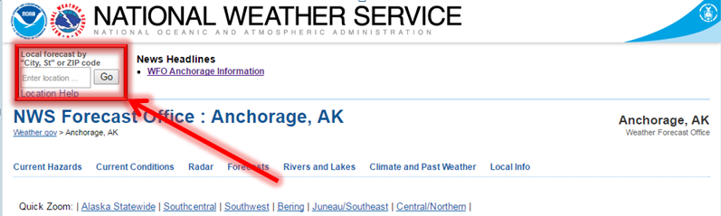
| There are several ways to access the forecast for your area. You can either find your forecast using your zipcode or town/village or by clicking on a polygon on the map as shown below. |
| First Option: Enter your city/village and state (AK) in the Local Forecast by "City, St" or ZIPCODE in the top left hand corner of the page (highlighted by a red box below). It is best to not use your zip code - due to large and multiple areas that Alaskan zip codes occupy. |
 |
| Second Option: Click on the polygon on the map nearest to your location of interest as shown in the image below. This will bring you to the forecast for a specific point representing the area you clicked. |
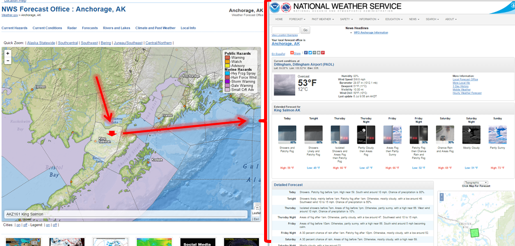 |
| If you want a more detailed forecast for a specific point location of interest: Click on the map on the right of the Detailed Forecast. You can zoom in or out as well as move the map around when the cursor is over the map. Click to select the specific point you want. This bring you to the point specific forecast you selected. |
 |
| There are several ways to access the text products and both options are highlighted by a red box below. You can access the fire forecasts from the Forecasts Menu by selecting Latest Text Products or by clicking on the quick link Fire Weather located below the main map. You can also get the fire weather forecasts directly from the Alaska Region Fire Weather Page at www.weather.gov/arh/fire. |
 |
| Marine forecasts can be accessed from the Forecast menu and then selecting Marine. The menu is highlight by a red box in the image below. |
 |
| River forecasts and observations can be found from the Rivers and Lakes menu. The menu is highlight by a red box in the image below. |
 |
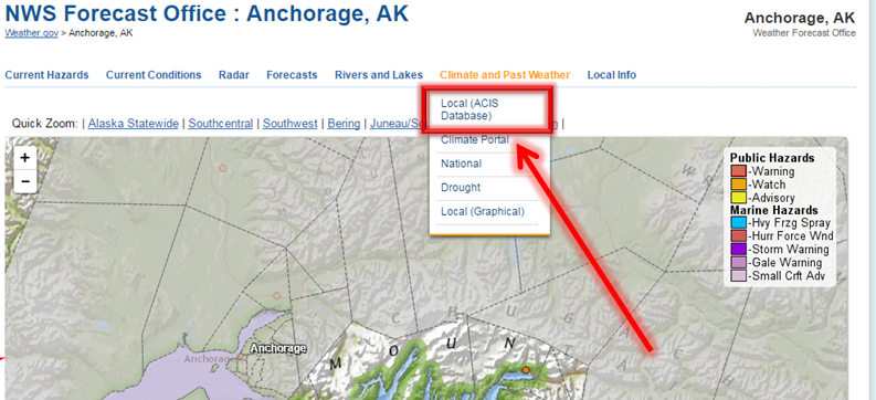
| Daily climate reports can be accessed from the Climate and Past Weather menu and then selecting Local. The menu is highlight by a red box in the image below. |
 |
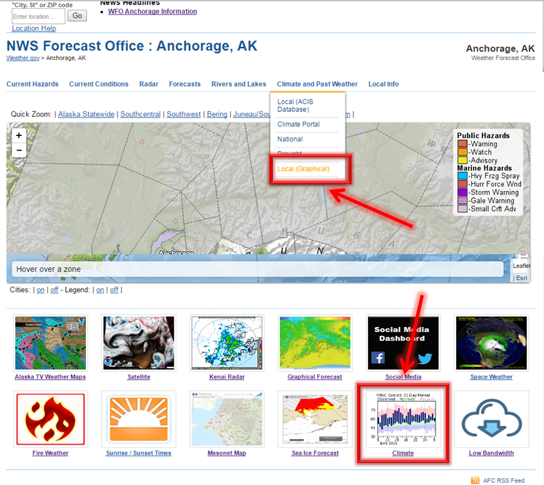
| Local climate records and normals can be accessed from the Climate and Past Weather menu and then selecting Local (Graphical). The menu is highlight by a red box in the image below. You can also access this data by selecting the climate icon at the bottom of the screen. |
 |
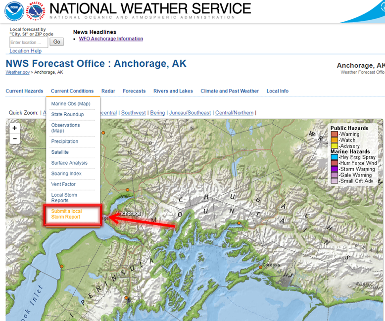
| You can submit a storm report by selecting the Current Conditions menu and the Submit Local Storm Report option. The menu is highlight by a red box in the image below. |
|
|
 |
| Click on the Radar menu and select the radar that you would like to view. |
 |
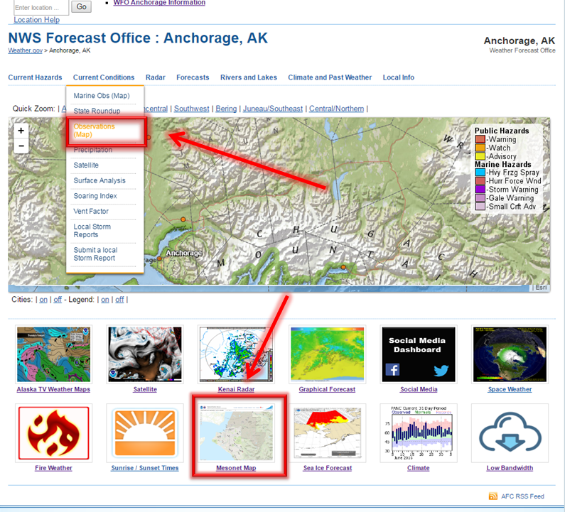
| Click on the Current Conditions menu and select Observations (Map). This will bring you to the Weather and Hazards Data Viewer, which displays the latest observations for locations across Alaska. Zoom in or out and hover over an observation to get more information.You can also access the same information by the quick link at the bottom of the page. |
 |


 Follow us on YouTube