Overview
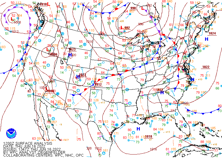
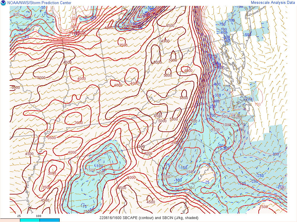
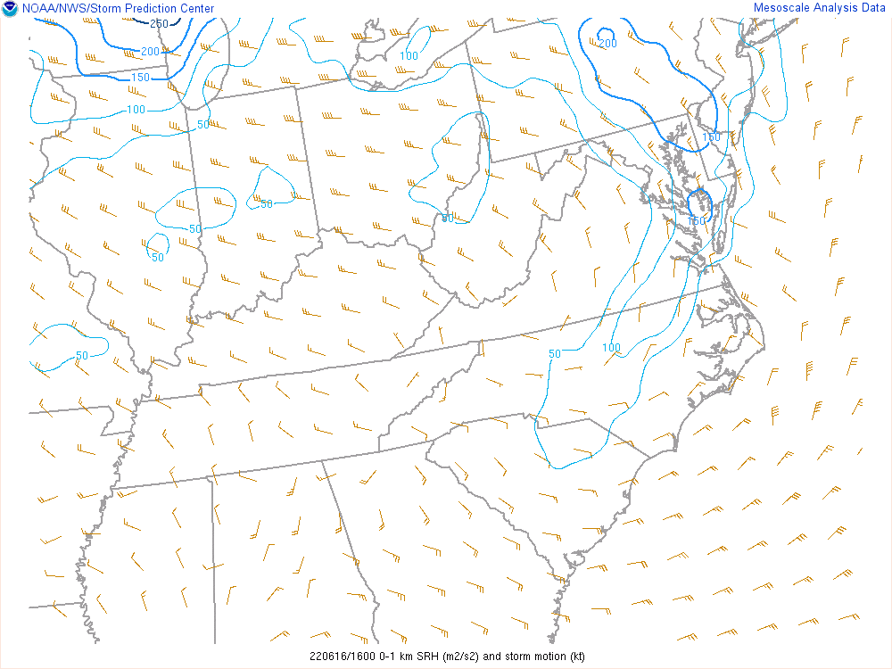
Thunderstorms initiated along a surface trough to our west and northwest during the early-mid afternoon on 6/16. Coupled with northwest flow aloft and steep mid-level lapse rates, the environment was characterized by a decent amount of deep layer shear, fairly steep mid-level lapse rates, and moderate-strong instability. Storms moved into Louisa County from the northwest just before 6 PM. By this time, there was some degree of backing in the surface flow, and lower LCLs than usual during a northwest flow event. In fact, the 21z/5 PM observations at Charlottesville (KCHO) and Louisa were 91/78 and 85/77, respectively (w/ light SSE winds). At 6 PM, KLKU reported 81/76 and an ESE wind around 10 mph. It is also important to note that dew points were ~5F higher from CHO-LYH (near the surface trough) than in areas along the I-95 corridor. Note that the mesoanalysis maps may have underestimated the SRH (due to the localized backing in the wind field) and overestimated the LCLs (the dew points in the analysis were as much as 5°F too low across the Piedmont).
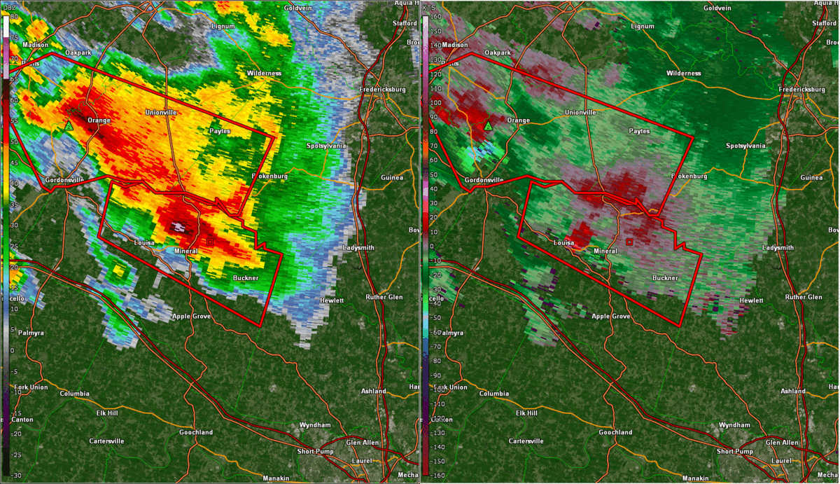
The storms that entered Louisa County eventually spawned three tornadoes across the northwest portion of our area. Radar imagery showed that these were indeed supercells with deep, persistent circulations. Two of the tornadoes were EF-0s and one was an EF-1. All three tornadoes were warned for. Fortunately, no injuries or fatalities were reported.
Tornadoes:
|
Tornado - Louisa/Mineral
Track Map 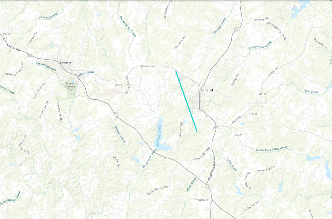 
|
||||||||||||||||
|
Tornado - Kent Store to Maidens
Track Map 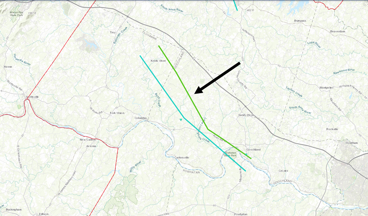
|
||||||||||||||||
|
Tornado - South of Kent Store to South of Maidens (2nd tornado)
Track Map 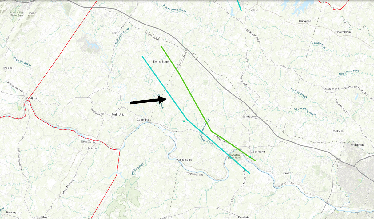
|
||||||||||||||||
The Enhanced Fujita (EF) Scale classifies tornadoes into the following categories:
| EF0 Weak 65-85 mph |
EF1 Moderate 86-110 mph |
EF2 Significant 111-135 mph |
EF3 Severe 136-165 mph |
EF4 Extreme 166-200 mph |
EF5 Catastrophic 200+ mph |
 |
|||||
Photos
Coming Soon...
| Caption (source) |
Caption (source) |
Caption (source) |
Caption (source) |
Radar
Selected Radar Loops
 |
 |
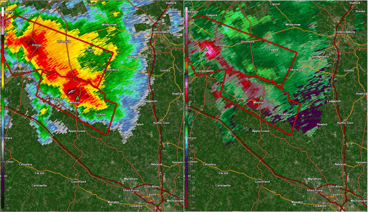
| Loop of KAKQ 0.5° Reflectivity (left) and base velocity (right) in ~5 minute increments from approximately 6:20 to 7:50 PM. | Loop of KLWX 0.5° Reflectivity (left) and base velocity (right) in ~5 minute increments from 6:20 to 7:50 PM. |
Storm Reports
Public Information Statement
National Weather Service Wakefield VA
446 PM EDT Fri Jun 17 2022


...NWS Damage Survey for 06/16/22 Tornado Event in Louisa and
Goochland Counties...

Three separate severe storms produced tornadoes in Louisa and
Goochland counties. In addition to the tornadoes wind damage was
widespread from 60 to 70 mph wind and hail up to 3 inches in
diameter was reported.

.Louisa/Mineral Tornado...

Rating: EF-0
Estimated Peak Wind: 75 mph
Path Length /statute/: 2.5 miles
Path Width /maximum/: 75 yards
Fatalities: 0 Injuries: 0

Start Date:             06/16/2022
Start Time:             636 PM EDT
Start Location:         1 NW Mineral
Start Lat/Lon:          38.02 N / -77.93 W

Start Date:             06/16/2022
Start Time:             640 PM EDT
Start Location:         1.5 S Mineral
Start Lat/Lon:          37.99 N / -77.92 W

A brief EF0 tornado tracked just west of mineral from the High School to Kennon Rd.
Trees and power lines were down with no substantial structural damage.
In addition hail 3 inches in diameter was reported in Mineral resulting in
severe damage.

.Fluvanna / Goochland First Tornado...

Rating:                 EF- 1
Estimated Peak Wind:    95 mph
Path Length /statute/:  23 miles
Path Width /maximum/:   150 yards
Fatalities:             0
Injuries:               0

Start Date:             06/16/2022
Start Time:             705 PM EDT
Start Location:         Kent Store in Fluvanna County
Start Lat/Lon:          37.91 N / -78.13 W

End Date:               06/16/2022
End Time:               756 PM EDT
End Location:           Near Maidens
End Lat/Lon:            37.67 N / -77.88 W

The tornado touched down near Kent Store in Fluvanna county tracking southeast to
Maidens near Goochland. EF 1 damage with winds of 95 mph was noted along Old Stage
Rd and Castle Rock Rd in Goochland.


.Goochland / Fluvanna Second Tornado...

Rating:                 EF-0
Estimated Peak Wind:    75
Path Length /statute/:  24 miles
Path Width /maximum/:   75 yards
Fatalities:             0
Injuries:               0

Start Date:             6/16/2022
Start Time:             736 PM EDT
Start Location:         South of Kent Store
Start Lat/Lon:          37.89 N / -78.18 W

End Date:               6/16/2022
End Time:               812 PM EDT
End Location:           South of Maidens
End Lat/Lon:            37.64 N / -77.89

This second tornado in Fluvanna and Goochland county developed from a
second circulation behind the initial tornado. The track paralleled
the EF1 tornado with damaged noted from south of Kent Store to south of
Maidens.

&&

EF Scale: The Enhanced Fujita Scale classifies tornadoes into the
following categories:

EF0...Weak......65 to 85 mph
EF1...Weak......86 to 110 mph
EF2...Strong....111 to 135 mph
EF3...Strong....136 to 165 mph
EF4...Violent...166 to 200 mph
EF5...Violent...>200 mph

NOTE:
The information in this statement is preliminary and subject to
change pending final review of the events and publication in NWS
Storm Data.

$$
Environment
Synoptic summary.
 |
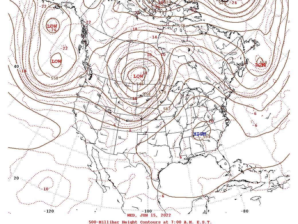 |
| Loop of WPC Surface Analysis from 12z/16 to 06z/17 in 3-h increments | Loop of 500 mb Analysis from 12z/15 to 12z/17 in 24-h increments |
Near-storm environment summary.
 |
 |
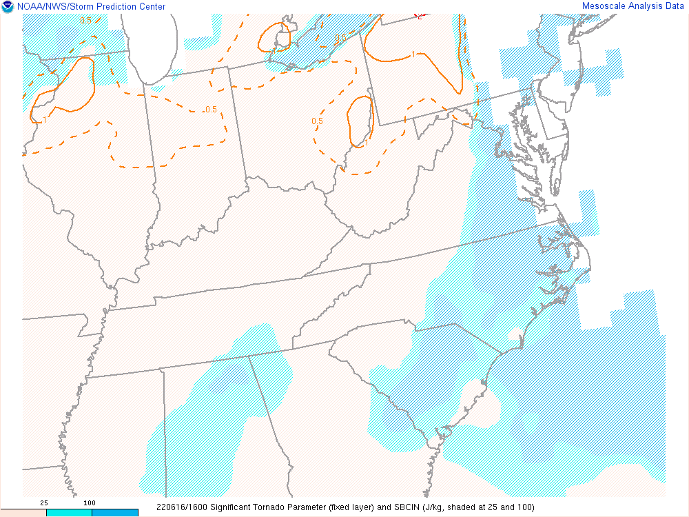 |
| Loop of SBCAPE/CIN from 12 PM/16z to 8 PM/00z | Loop of 0-1km SRH from 12 PM/16z to 8 PM/00z | Loop of Sig Tor Parameter (STP) from 12 PM/16z to 8 PM/00z |
Additional environmental data.
 |
 |
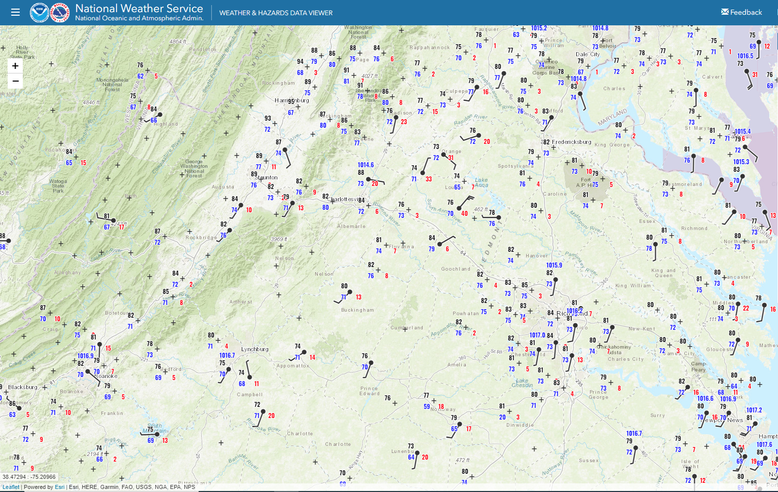 |
| 5 PM Mesoscale Surface Analysis | 6 PM Mesoscale Surface Analysis | 7 PM Mesoscale Surface Analysis |
 |
Media use of NWS Web News Stories is encouraged! Please acknowledge the NWS as the source of any news information accessed from this site. |
|


 Coastal Flood
 Heat
Heat