National Weather Service United States Department of Commerce

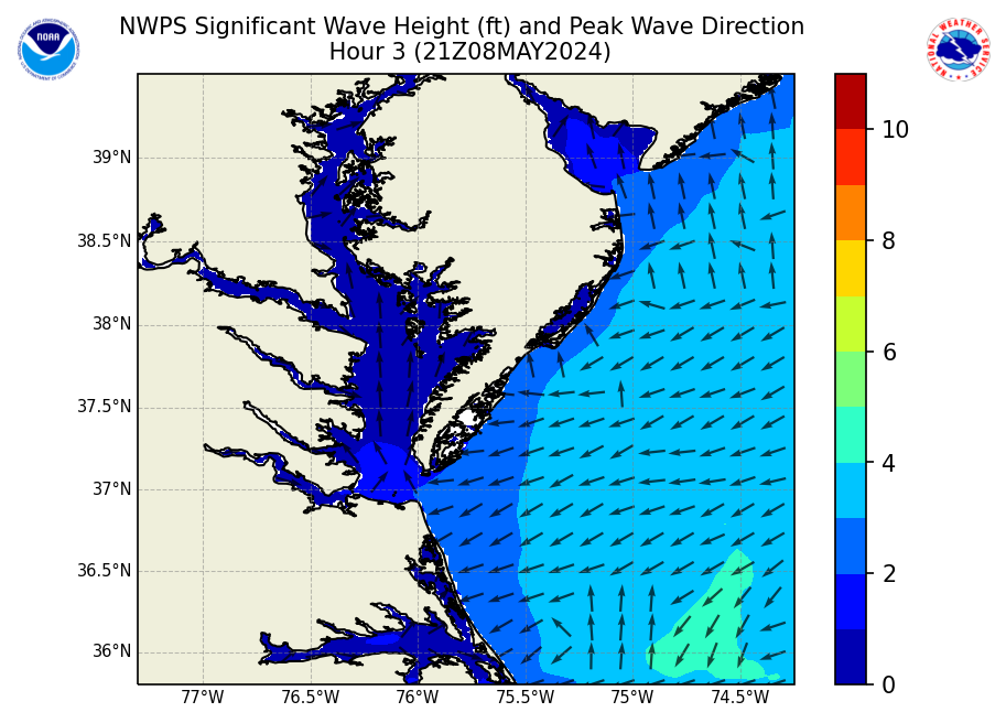
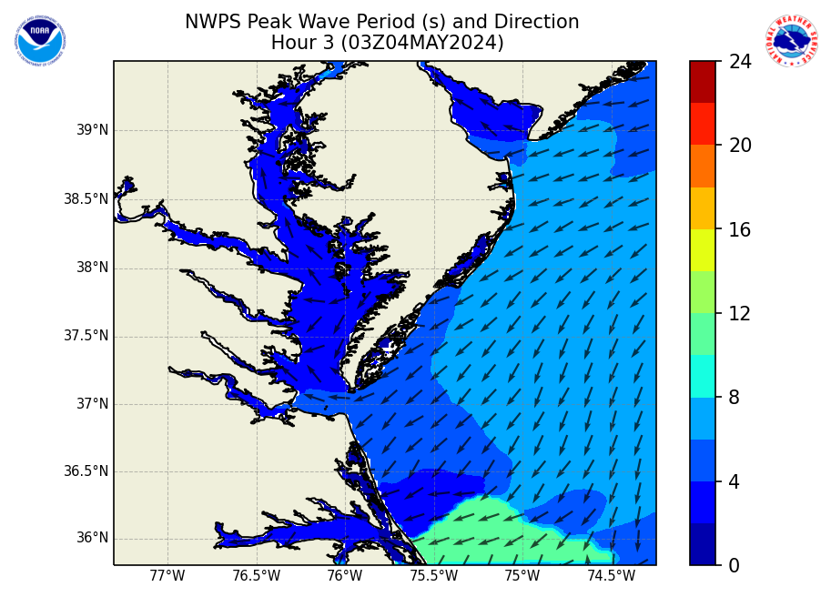
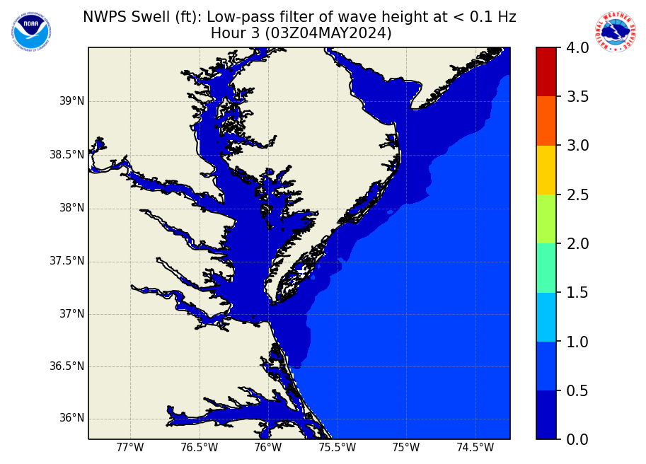
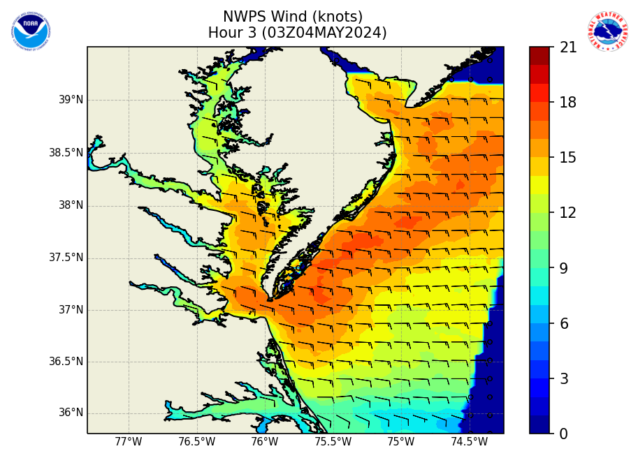
Full Domain Shown Below:  


Wave Height
Wave Height - click to enlarge
Wave Period
Swell Wind  
Wave Period -click to enlarge
Swell - click to enlarge Wind - click to enlarge  


Currents
Currents - click to enlarge
Water Level
Water Level - click to enlarge

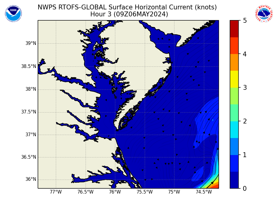
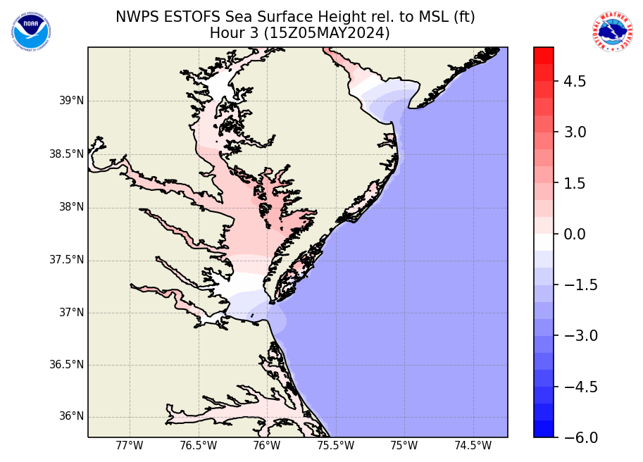
These models forecasts are produced by WFO Wakefield, VA using the NWPS wave models and the Real Time Ocean Forecast System


The NWPS output is used as guidance to produce WFO Wakefield. It is only experimental and it may differ from the official forecast. For the official marine forecast  graphics go to : WFO AKQ Official Marine Forecast Graphics.

NWPS accounts for the following physics:


  • Wave propagation in time and space, shoaling, refraction due to current and depth, frequency shifting due to currents and non-stationary depth.
  • Wave generation by wind.
  • Three- and four-wave interactions.
  • Whitecapping, bottom friction and depth-induced breaking.
  • Dissipation.
  • Wave-induced set-up.
  • Propagation from laboratory up to global scales.
  • Transmission through and reflection (specular and diffuse) against obstacles.
  • Diffraction.

In here you will see 3-hourly forecast outputs for significant wave height, peak wave direction, peak wave period, and significant swell height (heights in feet and periods in seconds). Additionally, individual wave system heights, periods, and directions contributing to the significant wave heights are provided further below. In addition you will see the wind speed and direction used as input for the models. Our local version of NWPS also uses input from WAVEWATCH III for boundary conditions.

 NOTE: Significant Swell Height output from NWPS is the average height of the highest 1/3 of the group of waves with periods of 10 secs or longer.