National Weather Service United States Department of Commerce
Click a location below for detailed forecast.

Last Map Update: Tue, Apr. 23, 2024 at 10:29:18 am CDT

National Weather Service Pueblo, CONational Weather Service Dodge City, KSNational Weather Service Wichita, Kansas
National Weather Service Albuquerque, NMZoom
Out

National Weather Service Norman, OK
National Weather Service Albuquerque, NMNational Weather Service Lubbock, TXNational Weather Service Fort Worth/Dallas, TX

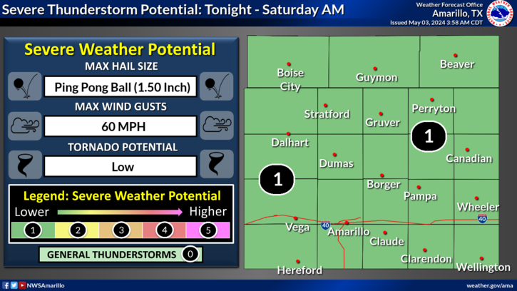
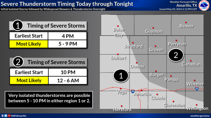
Thunderstorms are favored to develop along a dryline Thursday afternoon. These thunderstorms would become supercellular with the potential for all hazards continuing into Thursday evening. There are still some uncertainties, such as the exact position of the dryline among others. Stay tuned for updates.
Thursday, a more established dryline could make for more widespread thunderstorm chances for areas along and east of the dryline. Some thunderstorms could be strong to severe. For now, the eastern Panhandles are more favored for the thunderstorm chances but be sure to check back for updates this week.
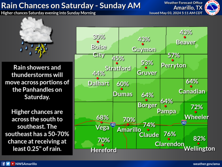
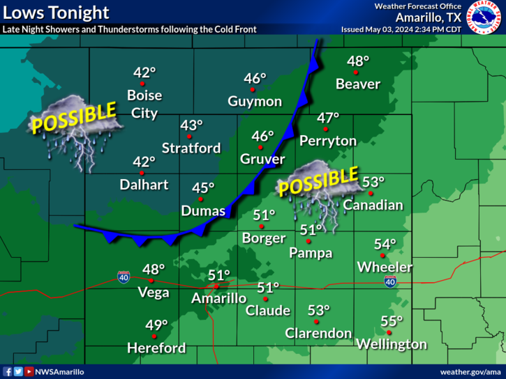
A week cold frontal passage is expected to make it way through the Panhandles this morning. While neither a temperature drop or precipitation are expected to follow this front, do look for winds to shift to northerly this afternoon followed by easterly late tonight. This late easterly shift will aid in bring moisture to the Panhandles as well as a chance for some overnight showers for the east.
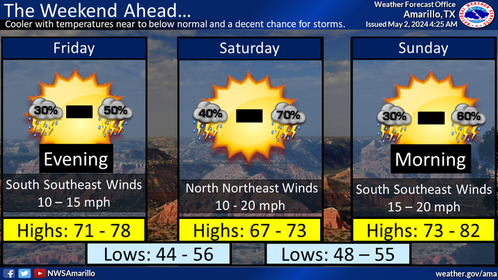
Warmer and drier conditions will look to start the week with most locations returning to the 70s and 80s. However, chances of active weather will look to follow as a system begins to move in for Thursday. Currently, potential is present to see fire weather in the western portions of the Panhandles and severe thunderstorms in the eastern. Another system may look to follow that weekend so make sure to check back for more updates!
The automated weather observing system at the Perryton airport continues to report highly erroneous temperatures and dewpoints. This equipment is not owned or maintained, either directly or indirectly, by the National Weather Service. Thus, we have no estimated time to repair.

Text Product Selector (Selected product opens in current window)


Current Observations ( )
Location Sky/Weather Temp (°F) Dewpt (°F) RH (%) Wind (mph) Pressure (inHg) Remarks
 Amarillo
N/A
N/A
N/A
N/A
N/A
N/A
N/A
 Borger
N/A
N/A
N/A
N/A
N/A
N/A
N/A
 Canadian
N/A
N/A
N/A
N/A
N/A
N/A
N/A
 Dalhart
N/A
N/A
N/A
N/A
N/A
N/A
N/A
 Dumas
N/A
N/A
N/A
N/A
N/A
N/A
N/A
 Guymon
N/A
N/A
N/A
N/A
N/A
N/A
N/A
 Hereford
N/A
N/A
N/A
N/A
N/A
N/A
N/A
 Pampa
N/A
N/A
N/A
N/A
N/A
N/A
N/A
 Perryton
N/A
N/A
N/A
N/A
N/A
N/A
N/A
 Amarillo 9NNE
N/A
N/A
N/A
N/A
N/A
N/A
N/A
 Amarillo 7SSE
N/A
N/A
N/A
N/A
N/A
N/A
N/A
 Bootleg 11WNW
N/A
N/A
N/A
N/A
N/A
N/A
N/A
 Canadian 6E
N/A
N/A
N/A
N/A
N/A
N/A
N/A
 Clarendon 2WSW
N/A
N/A
N/A
N/A
N/A
N/A
N/A
 Claude 12SW
N/A
N/A
N/A
N/A
N/A
N/A
N/A
 Hereford 2NW
N/A
N/A
N/A
N/A
N/A
N/A
N/A
 McLean 1E
N/A
N/A
N/A
N/A
N/A
N/A
N/A
 Palo Duro SP
N/A
N/A
N/A
N/A
N/A
N/A
N/A
 Pampa 2E
N/A
N/A
N/A
N/A
N/A
N/A
N/A
 Umbarger 3NNE
N/A
N/A
N/A
N/A
N/A
N/A
N/A
Note: "N/A" or "MISG" will be displayed if values are not available. In the LOCATION column, click on links for a list of recent observations at sites of interest. In the WIND column, VRB is "variable" and G is "gust". In the REMARKS column, HX is "heat index", WCI is "wind chill index", and VSB is "visibility" (if shown).


Aviation Drought Fire Weather Hydrology Severe Weather Winter Weather
 
Climate Graphs Hourly Forecast Long Range Local Model Data Precip Maps Office Webcam
 
Education Local Research News Skywarn Weather Calculator Weather Radio