|
|
|
|
Severe weather season is in full swing. The Panhandles have already exceeded their normal number of tornadoes in a year. This past event on Saturday April 21st pushed the total tornadoes for the year past 20! Final assessment shows 16 tornadoes occurred on the 21st.
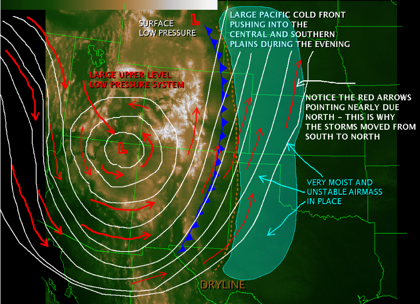
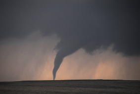
If you viewed the storm information from the March 28th, 2007 event, then you may recognize the image on the right. As it turns out, a nearly identical pattern was in place on March 28th when the previous tornado outbreak occurred. The one major difference between the two events is that on April 21st, the moisture content was not quite as high. This could be the reason that fewer and less intense tornadoes developed on the 21st. The strongest tornado was rated at EF-2. |
 |
 |
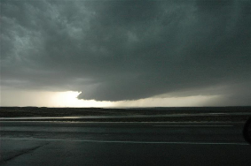
This situation was very similar to March 28th, 2007. A large upper level low pressure system (cut-off low) was positioned over Arizona providing southerly flow in the upper levels. This is why the general storm motion was from south to north. Although there was an easterly component to the winds so the storm did track slowly to the east. Southeasterly winds near the surface were pumping moisture into the Panhandles. The dryline was positioned along the Texas/New Mexico border, and a Pacific cold front was pushing through Eastern New Mexico. The other significant difference between this event and March 28th was that most of the storms with this past event formed along the dryline. On March 28th however, short wave energy triggered storms well east of the dryline. Both situations were set up for tornadic activity though. In fact, the tornadic potential was highlighted 2 days prior on Thursday April, 19th! And what was the result? |
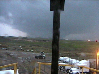
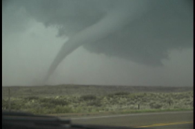
| Large tornadoes in parts of the Panhandle! This picture was taken near Cactus at the Swift Beef processing plant. The photo is actually a still image from the Swift Plants security cameras. (Image courtesy of Mr. Raymond Brady - the image does not enlarge). | |
|
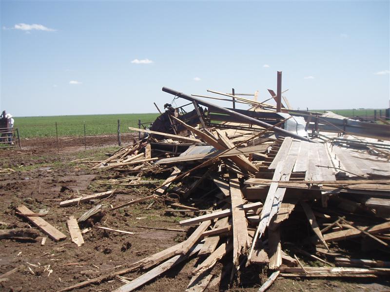
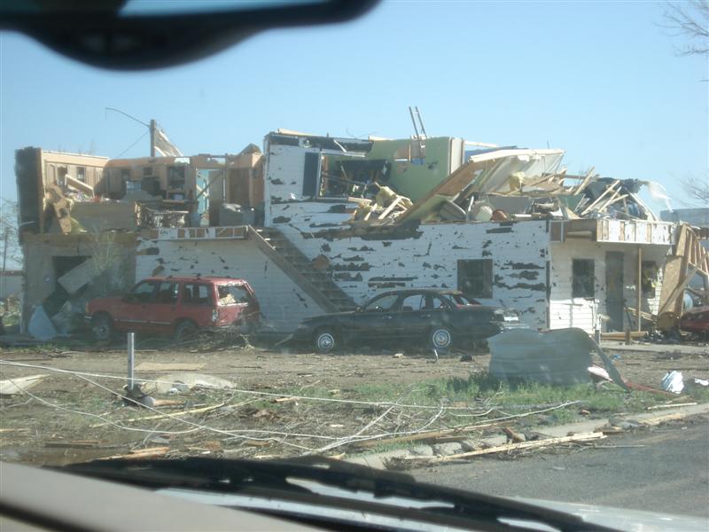
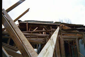
Here are just a few of the damage photos from the recent tornadoes. You may notice a few vehicles in the images. Hopefully you will recognize from these pictures why a vehicle is NOT a safe place to be in a tornado.
|
|
 |
 |
|
This is a picture from around Wildorado, Texas. |
|
 |
 |
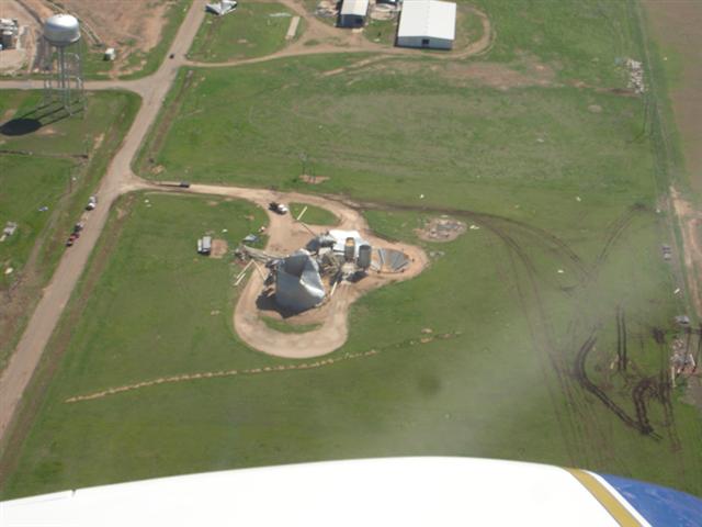
| This is an aerial photograph taken of the damage in and near Cactus. The photographer and pilot is Mr. Scott Plischke - Information Technology Officer and Meteorologist with the NWS here in Amarillo. | This image is from the damage near Channing, Texas. This tornado was preliminarily estimated to be an EF 1 with winds speeds near 90 to 109 mph. |
 |
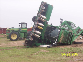 |
| Here is a picture from the tornado near Channing. Notice the small rope tornado that develops horizontally away from the main tornado. This is called a satellite tornado or the entire system is called a multi vortex tornado (meaning more than one tornado occurring at the same time). This image is courtesy of Mr. Gene Rhoden. This tornado was rated as an EF 1. | This is a damage photo from the tornado that moved through Carson county. Once again, it is important to point out just how dangerous vehicles of ANY size can be in a tornado. These pieces of large and heavy farm equipment were tossed about and heavily damaged. The tornado that caused this damage was rated as an EF 2. The photo is courtesy of Mr. Tony Treadwell from the Booker Fire Deptartment. |
 |
 |
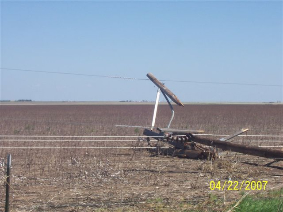
| This image was taken in rural Gray county of the damage from one of the tornadoes that struck near Groom. The three tornadoes that occurred near Groom were rated as EF 0, EF 1, and EF 2. These images are also courtesy of Mr. Treadwell from the Booker Fire Department. | This photo is from the tornado that hit near Dumas, Texas. It was rated as a high end EF 1. The tornado occurred late in the evening during heavy rain and so the lack of light will explain the dark images. The image above is of the wall cloud prior to the tornadoes developing. The image is courtesy of Mr. Robert Hayes who was chasing this storm. |
 |
 |
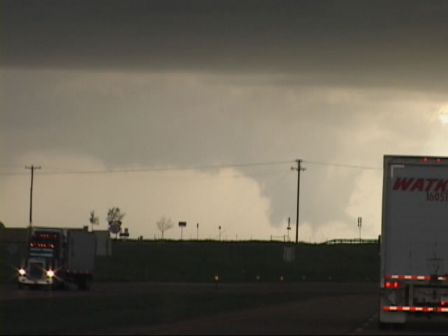
| This image is from the tornado near Channing that moved into Cactus. The picture is actually a still images captured from a video taken by Mr. Alan Gwyn who is a meteorologist with the KFDA-TV news team | This picture is additional damage photos from the tornado that hit Carson and Gray counties near Groom. They were taken by WCM Steve Drillette and Intern Chris Kimble of the NWS here in Amarillo. |
 |
|
| Storm chasers Jonathan Yuhas (KARE TV Minneapolis), Chandler Heath and David Glaser took photos of a tornado, wall cloud and funnels from a storm near Bushland TX just west of the city of Amarillo. | |