January 20th, 2007 Winter Storm |
Heavy Snow Blankets the Panhandles |
|
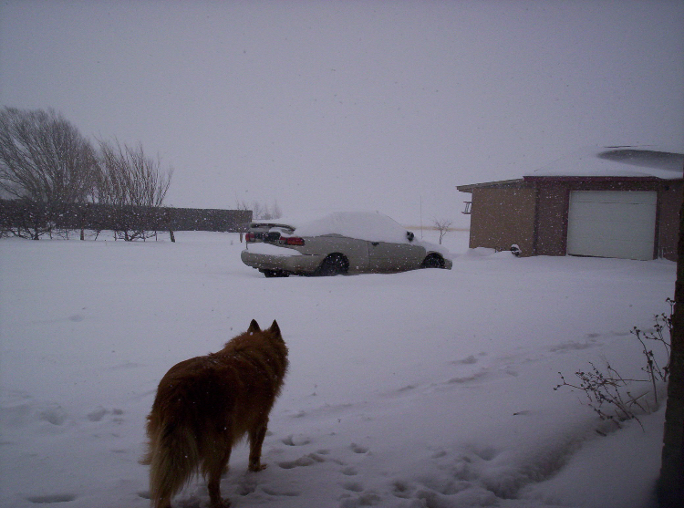
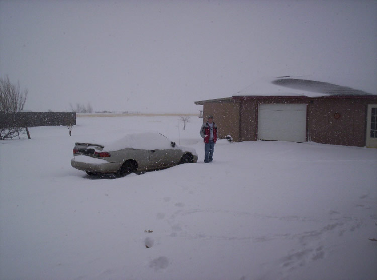
Between the evening of Friday January, 19th and through the day on Saturday January, 20th, heavy snow blanketed the Southern Plains. Most areas across the panhandles received 7 to 10 inches of snow, with a few locations reporting up to 11 or 12 inches. The snow was a result of a strong upper level low pressure system that moved east from southern Arizona through central New Mexico, and eventually turned to the north east traveling across the Oklahoma Panhandle. The slow moving low pressure system allowed moisture to stream up from the eastern Pacific Ocean into the Southern Plains. In addition, southeasterly surface winds pulled moisture from the Gulf of Mexico into the panhandles. The moist airmass was the first key in bringing the heavy snow. The second key was the cold air. Over the last few weeks, a series of upper level low pressure systems have brought cold air and a wintry mix of precipitation to the panhandles. This prevented any substantial warm air from moving over the panhandles. Then, when this last upper level system moved toward the panhandles on Saturday, any remnant warm air (that is to say, air temperatures above freezing in this case) was eroded away allowing for freezing temperatures from the ground up. Once the good supply of moisture met the cold air and forcing from the upper level system, then the moderate to sometimes heavy snowfall began. There was a brief period on Friday evening when a thin warm layer (temperatures above freezing) existed above the surface. This warm layer caused a few sleet and light freezing rain showers, but the ice turned quickly to snow Friday night preventing any significant ice accumulation in the panhandles. The images below were taken during the day on Saturday January 20th, when the snow was still falling. (Additional pictures will be added soon from Sunday January 21st , after the snowfall ended.) These pictures are from the Amarillo National Weather Service and a good indication of the conditions around the panhandles. However, if you have any photographs you would like to see included on this web page, please send them to JJ Brost at John.Brost@noaa.gov . Please indicate where the photo's were taken and any other information you would like to provide (like snow fall total, or impacts in your area). Also included are two visible satellite images that show the general snow cover for the United States and a snow cover map for the panhandles. Please note that the snow map for the panhandles is only accurate for the Texas and Oklahoma Panhandles. The snow lines do not represent reality outside of the panhandles and are meant only to give a general idea of where the heaviest snow accumulations occurred within the panhandles. |
_JPG.jpg) P1200001 (Medium).JPG |
_JPG.jpg) P1200002 (Medium).JPG |
_JPG.jpg) P1200003 (Medium).JPG |
_JPG.jpg) P1200004 (Medium).JPG |
_JPG.jpg) P1200005 (Medium).JPG |
_JPG.jpg) P1200006 (Medium).JPG |
_JPG.jpg) P1200007 (Medium).JPG |
_JPG.jpg) P1200008 (Medium).JPG |
_JPG.jpg) P1200009 (Medium).JPG |
_JPG.jpg) P1200010 (Medium).JPG |
_jpg.jpg) P1200011 (Medium).jpg |
_JPG.jpg) P1200012 (Medium).JPG |
_JPG.jpg) P1200013 (Medium).JPG |
_JPG.jpg) P1200014 (Medium).JPG |
_JPG.jpg) P1200016 (Medium).JPG |
_JPG.jpg) P1210018 (Medium).JPG |
_JPG.jpg) P1210019 (Medium).JPG |
_JPG.jpg) P1210020 (Medium).JPG |
_JPG.jpg) P1210021 (Medium).JPG |
_JPG.jpg) P1210022 (Medium).JPG |
_JPG.jpg) P1210023 (Medium).JPG |
_JPG.jpg) P1210024 (Medium).JPG |
_JPG.jpg) P1210025 (Medium).JPG |
_JPG.jpg) P1210026 (Medium).JPG |
_JPG.jpg) P1210027 (Medium).JPG |
 Amarillo Snow |
 Amarillo Snow 2 |
.jpg) |
.jpg) |

