|
|
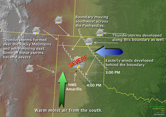
On June 19th, 2008 a severe thunderstorm moved over the National Weather Service Office in Amarillo, Texas and produced the second strongest wind gust ever recorded at this office. The anemometer peaked at 70 knots or 81 mph around 430 in the afternoon. On May 15th, 1949 a tornado touched down within 1 mile of the office and produced a wind gust to 84 mph. The recent gust to 81 mph comes in a close second. So what caused these winds to develop? The primary catalyst to the severe weather that occurred from Tuesday, June 17th and (at least) Thursday, June 19th was a large high pressure system in the upper atmosphere situated over the western United States. At the surface, warm and moist air continued to stream into the Texas and Oklahoma Panhandles from the Gulf of Mexico. This kept moist and highly unstable air in place for multiple days. Thunderstorms developed along the Rocky Mountains and began to move east and southeast. The general motion of the storms was guided by the large high pressure system which provided winds from the northwest in the upper atmosphere over the Panhandles. Initial concerns were for the storms moving into the western Panhandles from New Mexico and Colorado. However, another storm complex had developed earlier in the day over southwest Kansas. This complex moved slowed southeast over the eastern Oklahoma and extreme northeast Texas Panhandles. This complex was generally producing welcomed showers, but soon generated an outflow wind boundary that moved southwest across the Panhandles. As this boundary interacted with the warm moist air residing across the Panhandles, thunderstorms began to form. Eventually, the storms grew in intensity and soon started to produce large hail. The following image shows the general pattern in place during the afternoon hours. |
|
|
|
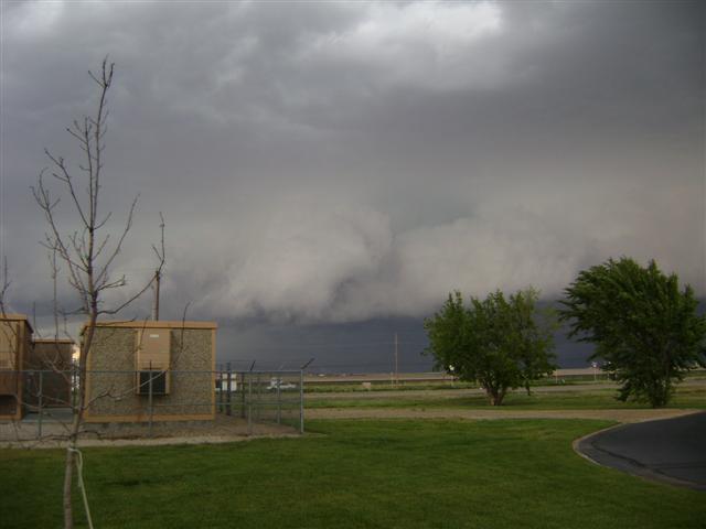
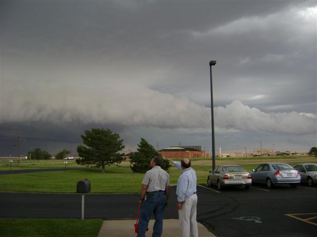
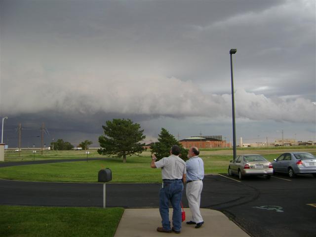
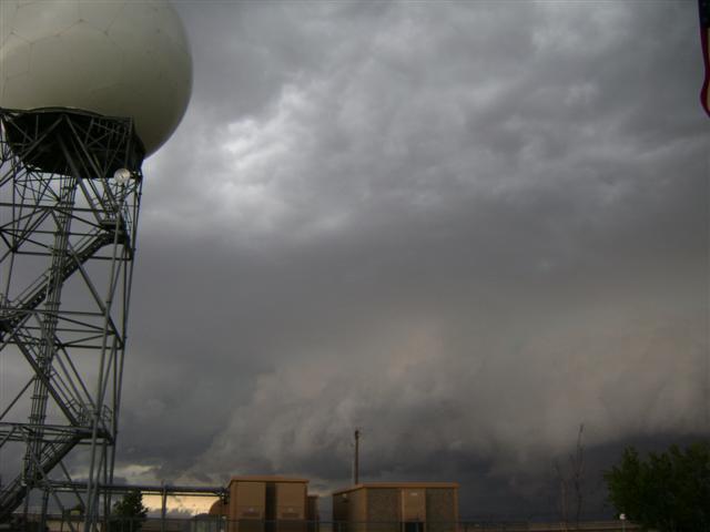
These storms produced a well developed shelf cloud which was visible from the National Weather Service Office in Amarillo. The following pictures were taken a few minutes before the strong winds and hail hit the office. Click on each picture for more images from the event. |
|||
 |
 |
 |
 |
|
Above: Images of a shelf cloud approaching the Amarillo National Weather Service Office. |
|||
 |
 |
 |
 |
|
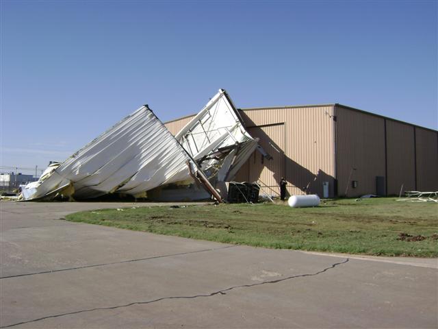
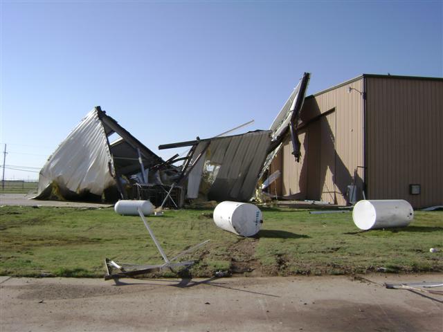
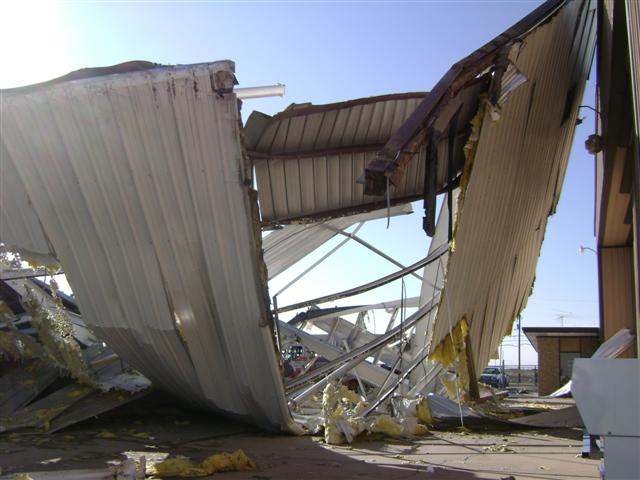
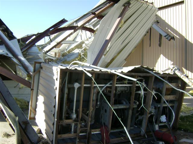
Above: Images of wind damage from Rick Husband International Airport in Amarillo. |
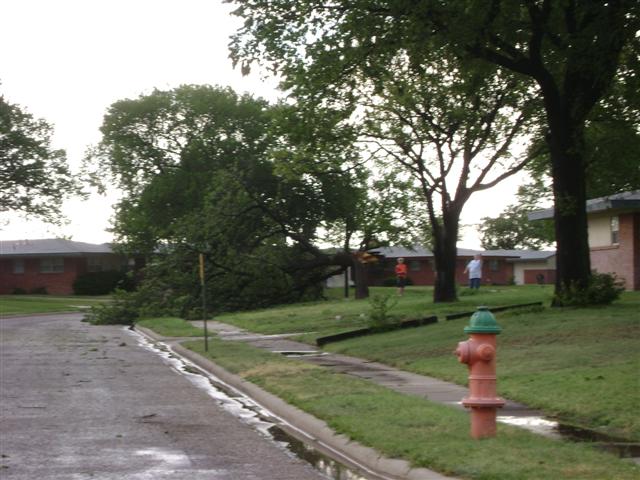
|||
 |
 |
 |
 |
|
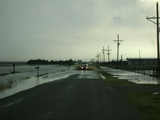
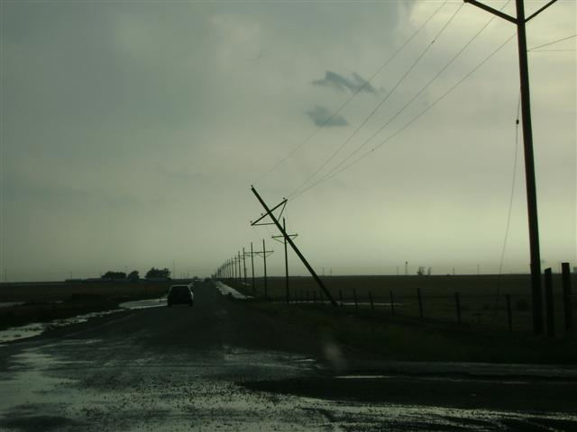
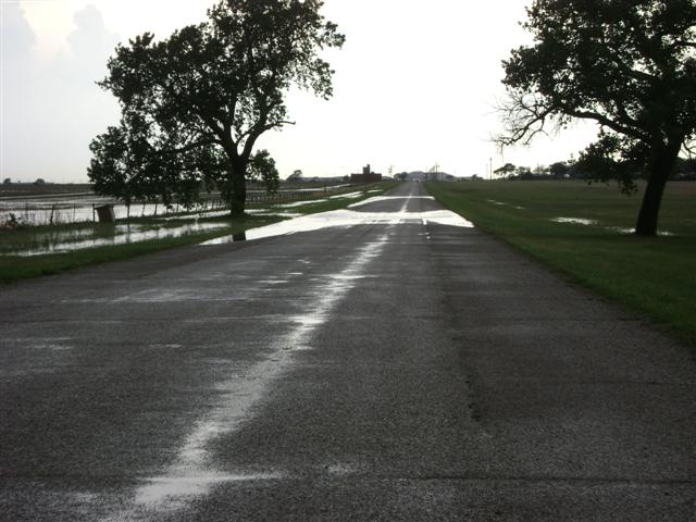
Above: Images of flooding and wind damage from the east side of Amarillo. |
|||
|
A damage survey was completed and it was determined that no tornado touched down at the airport or near Interstate 40 and Lakeside. The damage was a result of straight-line winds. Nonetheless, wind speeds were measured to be over 80 mph during this event. This storm also produced baseball sized hail. |