|
March 28-29, 2007 Tornado Outbreak |
||
|
Now that we know how the atmosphere was set up, let’s take a look at the radar imagery and see how these storms developed. The first set of radar images come from the first severe storm that moved across Armstrong County around 5:30 p.m. CDT. With all of the pictures listed, you can click on the image to enlarge. Also, please note that the time stamp on each image does not indicate the time at which a warning was issued - they are simply the radar images associated with the severe or tornadic storm. |
||
 |
|
 |
|
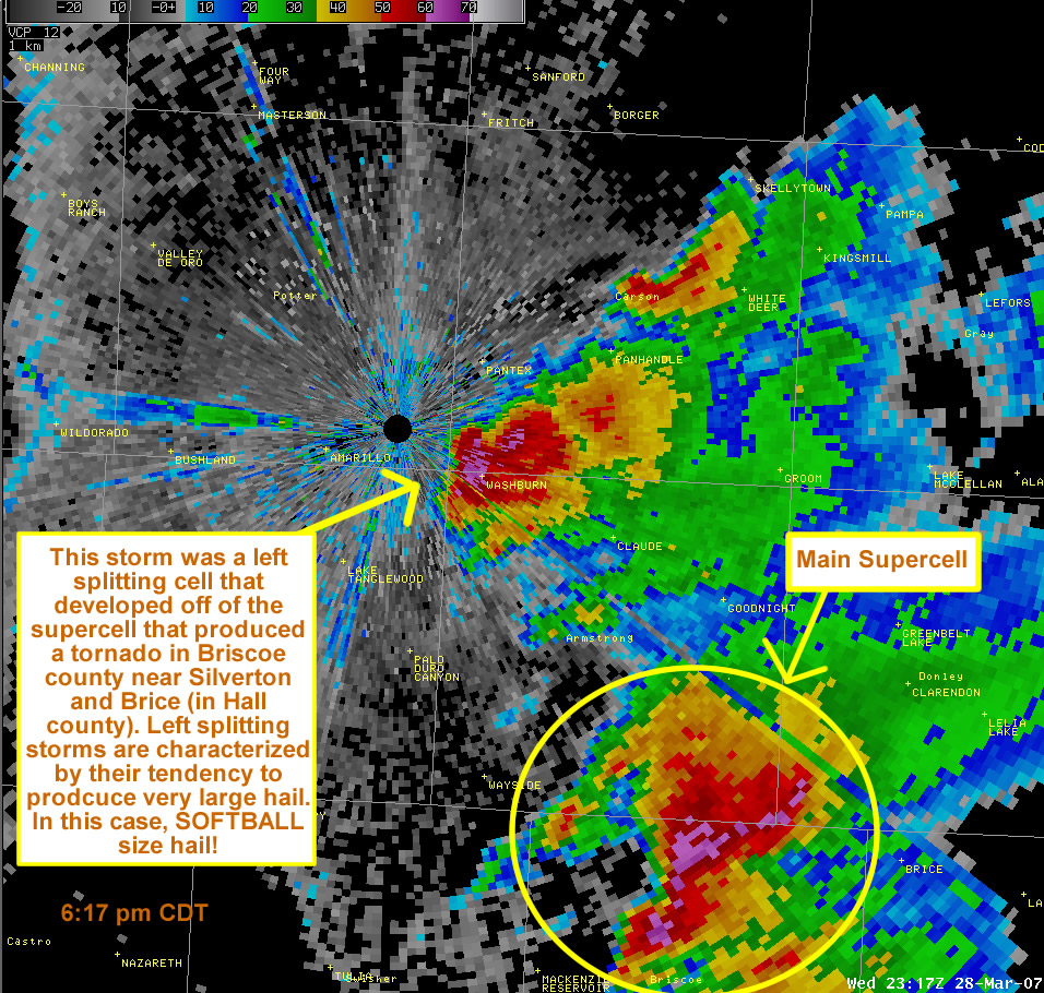
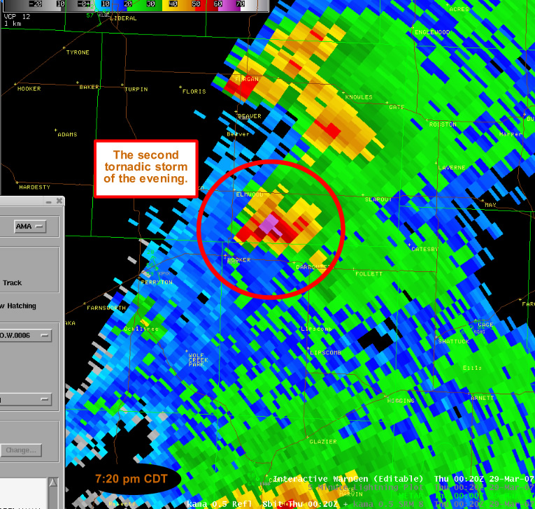
The first radar image here shows the storms in their beginning stages over the Texas Panhandle. The second image shows the first storms that formed in the northern Texas Panhandle. These storms went on to produce tornadoes in Lipscomb and Beaver Counties. The last image shows the left splitting storm that dumped softball sized hail a few miles east of the Amarillo Weather Forecast Office! |
||
 |
 |
 |
 |
 |
 |
|
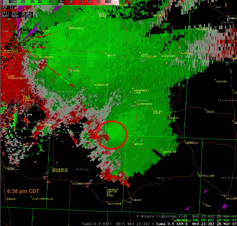
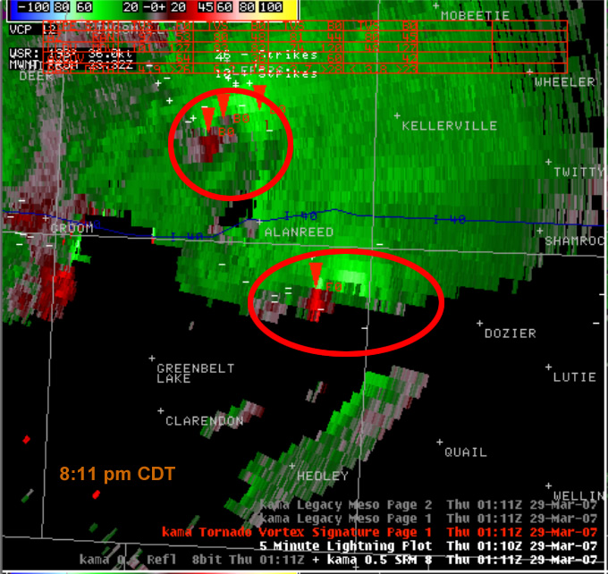
The radar images above show the first few tornadoes of the evening. The images are in pairs, with the reflectivity of the storm followed by the velocity signatures of the storm. For velocity signatures, look for the "couplet" or the point wherever bright green colors are side-by-side to very bright red colors. With the velocity images, green colors indicate winds moving toward the radar and red colors indicate winds moving away from the radar. So what you have are winds moving in conflicting directions right next to each other. This indicates cyclonic rotation and can be a precursor to a storm producing a tornado. |
||
 |
 |
|
|
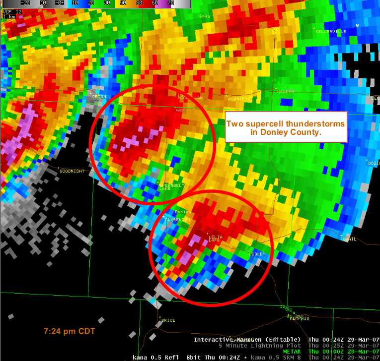
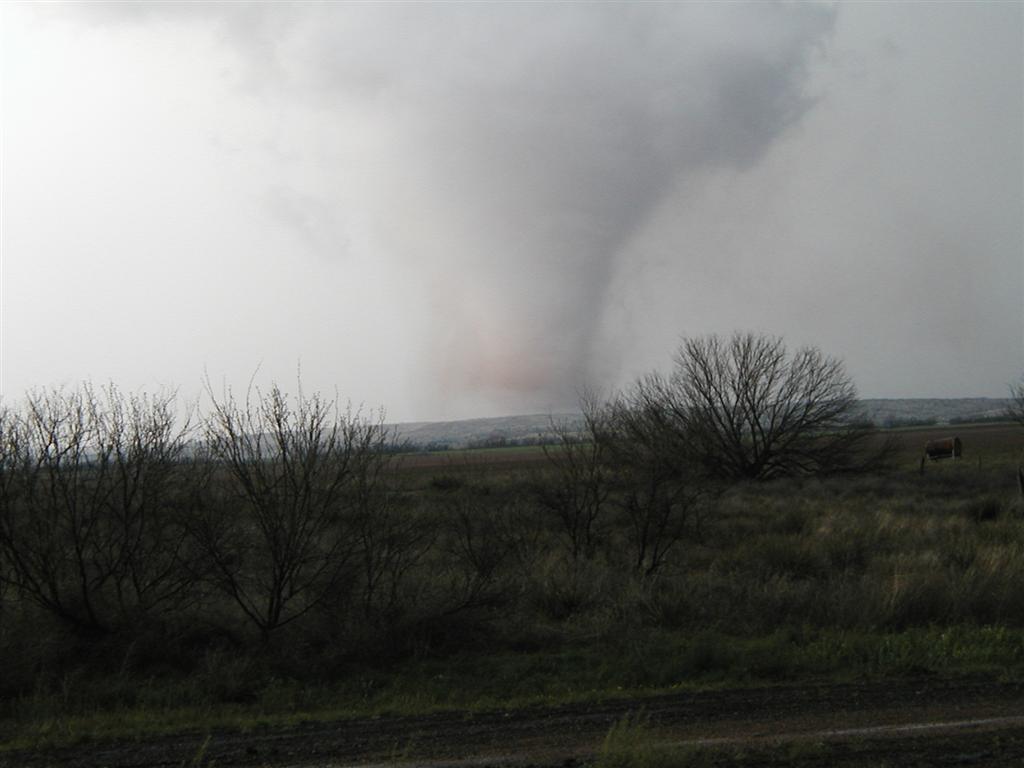
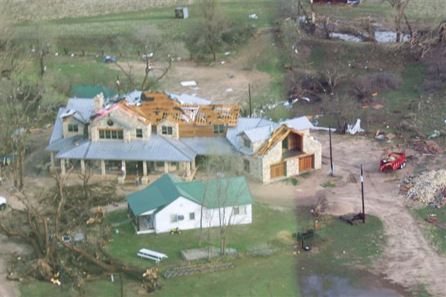
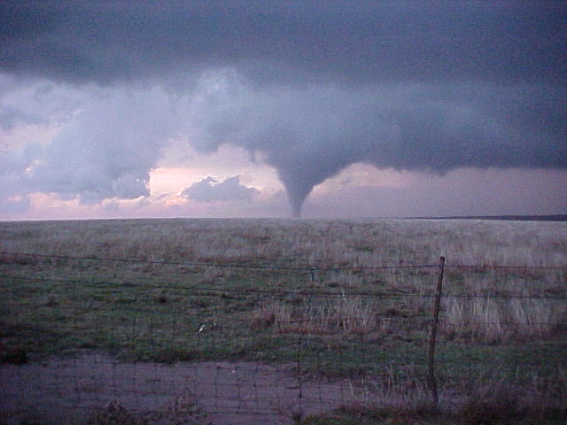
These last two radar images show the storms in Donley and Gray Counties shortly after the previous radar images. The northernmost storm produced a tornado that moved across I-40 and impacted Jericho. The southernmost storm produced the tornado that impacted McLean. With 15 tornadoes across the Texas and Oklahoma Panhandles, this event classifies as one for the March record books. Sadly, there were also three total fatalities. Two of the individuals were from Beaver County, and the other individual was killed in Hemphill County. Our condolences go out to the families who lost or had injured loved ones during this event. Staff members from the National Weather Service in Amarillo went on a few storm surveys and took pictures of some of the damage. In addition, we have received photos of the storms from some of the many weather spotters that were chasing the storms. We would like to send a huge thank you to the spotters, media, emergency personal, and other members of the public that phoned in reports of tornadoes or severe thunderstorms. |
||
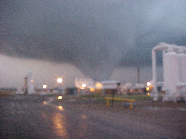
| Images from the March 28, 2007 tornado outbreak | |||
 |
 |
 |
|
 |
 |
 |
|
 |
 |
 |
|
 |
 |
 |
|


