Rare October Tornado in the Texas Panhandle
|
Over the past 26 years, the month of October has witnessed a total of 5 tornadoes within the Texas and Oklahoma Panhandles. In addition, of the nearly 600 tornadoes that ocurred during this time period, only 1% of the tornadoes touched down between midnight and 1 AM. The statistics would indicate that the tornado on October 17th should not have happened, especially considering that it touched down just after Midnight. So what caused this rare tornado? A number of factors played out during the day and nightime hours that allowed the thunderstorms to become tornadic. Normal high temperatures for mid October are right around 72 degrees. The high temperature on October 16th peaked in Amarillo at 78 degrees. This allowed sufficient surface heating to take place. Plus, surface winds were generally out of the south to southeast across the central to eastern panhandles. Surface moisture was able to stream north into the panhandles. The combination of the warm afternoon temperatures and abundant low level moisture provided an unstable atmosphere capable of supporting thunderstorm development. Also, the average wind speed for the day was just over 20 mph. But this was just at the surface. The winds above the surface were even stronger and formed a low level jet...or an area of very fast moving air surrounded by slower moving air. Furthermore, the wind direction was veering with height. This means that winds near the ground were blowing from the southeast while winds above the surface were coming out of the west. This turning of the winds with height allowed the thunderstorms to rotate. Finally, an upper level low pressure system was approaching the panhandles from the west. This system brought short wave energy that move over the panhandles and helped trigger the storms. In other words, the atmosphere was primed for thunderstorms and certainly appeared to support rotating storms which could lead to tornadoes. When the storms began to form during the late evening hours on October 16th, they quickly intensified and became severe. The first storms moved into the southern Texas Panhandle (southern Deaf Smith and Randall Counties) after 10 PM and began producing large hail up to Golf Ball size in Amarillo around 11:30 PM. However, the storm that impacted Amarillo was not the tornadic storm. The tornadic storm moved into southern Randall county near midnight and produced the tornado around 12:16 AM on October 17th. The results from the storm survey rated the tornado as a very high end EF1 and lasted for nearly 20 minutes. Please click HERE to read the full damage survey from this tornado. |
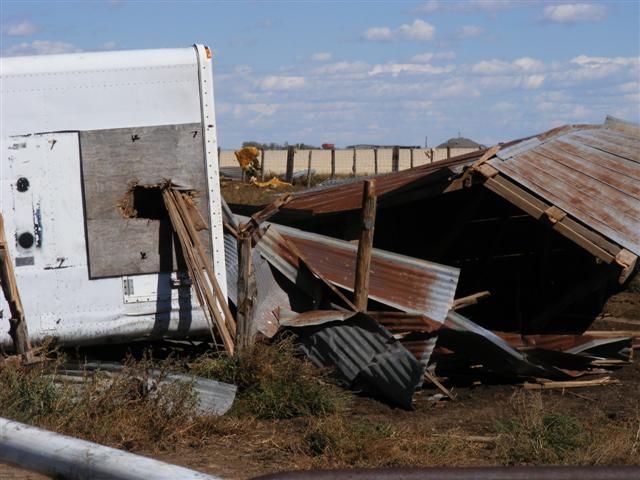 |
Although there were no pictures of the actual tornado, the following image shows the damage left behind. |

