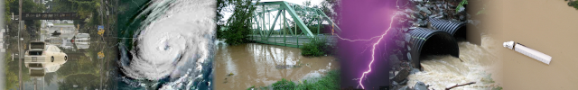
The National Weather Service in Binghamton New York has declared March 10-16, 2024 as Flood Safety Awareness Week in central New York.
The National Weather Service in Binghamton will feature information about a different flood topic each day during the awareness week.
Monday
Flood Safety - Preparedness And Awareness
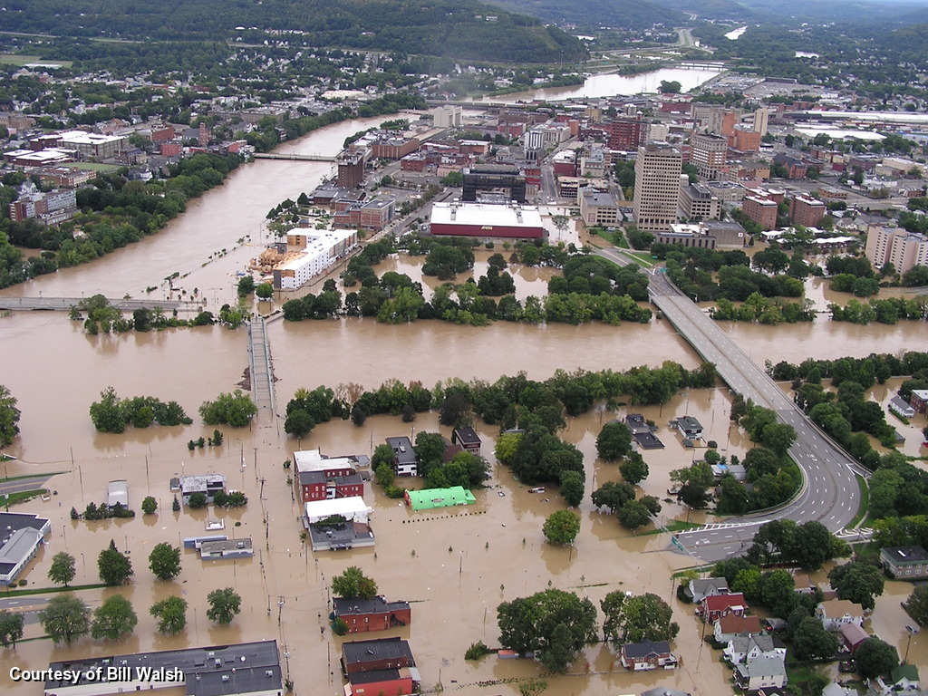 Flooding can occur in the United States at any time of the year. It causes more damage in the United States than any other weather related event. On average, floods cause eight billion dollars in damages and eighty nine fatalities annually. That is why it is so important to be prepared should flooding occur.
Always be Prepare:
Knowing what your flood risk is, is the best way to prepare for a flood. To find out what your flood hazard is, go to: www.weather.gov/safety/flood-hazards
You can also find out if you live in a flood plain by visiting our partners at FEMA at https://msc.fema.gov/portal.
There are many tips for what to do before, during and after a flood on our newly redesigned flood safety website at www.weather.gov/safety/flood/.
Always be aware:
Find the latest forecasts and hazardous weather conditions at weather.gov and water.weather.gov/ahps. National Weather Service Forecast offices across the country work around the clock to ensure Watches, Warnings and Advisories are issued to alert you and your family to hazardous conditions to keep you safe.
The same information is available on your mobile device at https://mobile.weather.gov. Smart phones are now able to receive flash flood warnings via the Wireless Emergency Alerts System. For more information visit Weather Ready Nation's FAQ on Wireless Emergency Alerts.
Another tool to alert you about hazardous weather conditions is NOAA Weather Radio. This nationwide network of radio stations is dedicated to broadcasting continuous weather, river and other emergency information direct from National Weather Service offices. For more information, visit www.nws.noaa.gov/nwr/
Stay safe during a flood by knowing your risk and where to get the latest forecast and hazard information. Be a force of nature!
The term 500-year flood doesn’t necessarily mean that it’s only going to happen one time every 500 years. Rather, it’s a reference to the probability of occurrence.
Tuesday
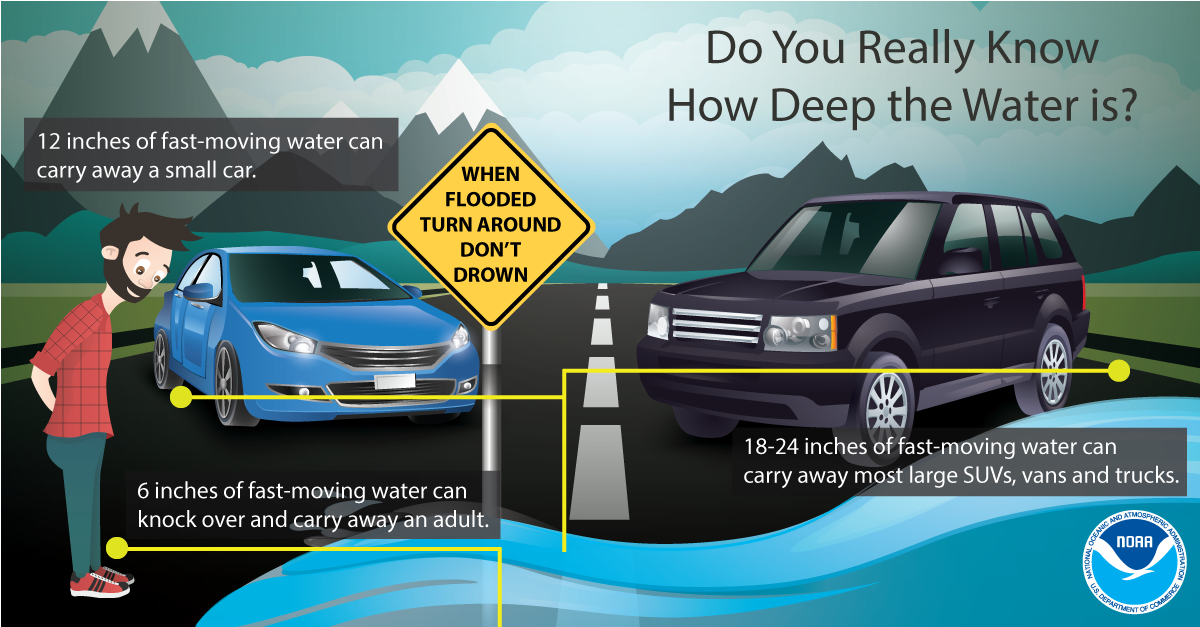
Today's topic: Turn Around Don't Drown
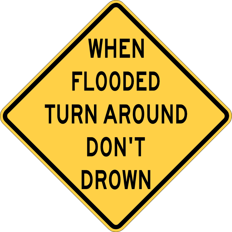
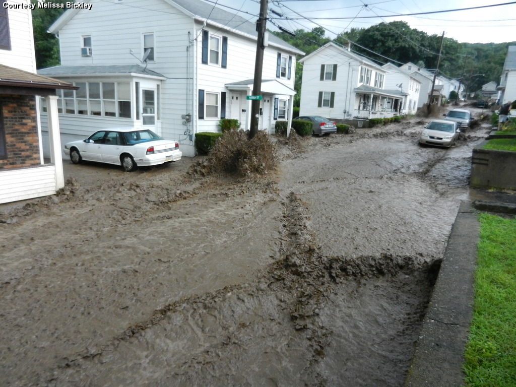
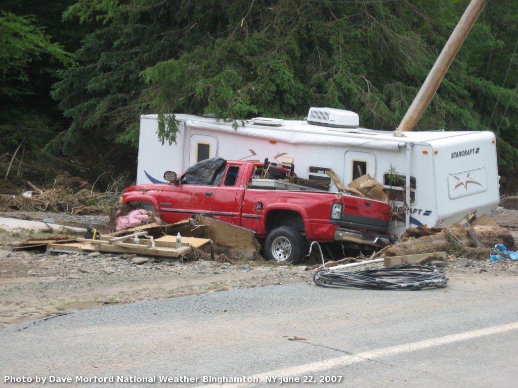
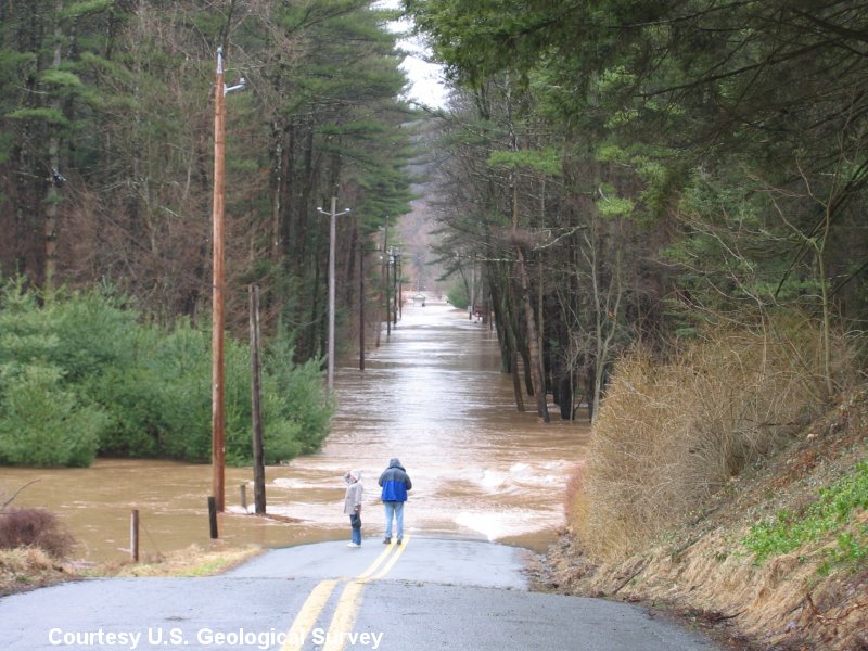
The phrase "Turn Around Don't Drown" has become a catchphrase in the media, classroom and even at home. It's one thing to see or hear the phrase, and another to put it into practice. Turn Around Don't Drown, or TADD for short, is a National Weather Service campaign used to educate people about the hazards of driving a vehicle or walking through flood waters.
Just six inches of fast-moving water can knock an adult off their feet. Twelve inches of moving water can carry away most small cars, and twenty-four inches of rushing water can carry away most large vehicles including school buses. It is never safe to drive or walk into flood waters.
It is impossible to tell the exact depth of water covering a roadway or the condition of the road below the water. This is especially true at night when your vision is limited. It is never safe to drive or walk through flood waters. Any time you come to a flooded road, walkway, or path, follow this simple rule: Turn Around Don't Drown.
Please see the TADD web site for more information.
For flood safety tips, visit www.weather.gov/safety/flood.
Wednesday
Today's topic: Flood Hazards
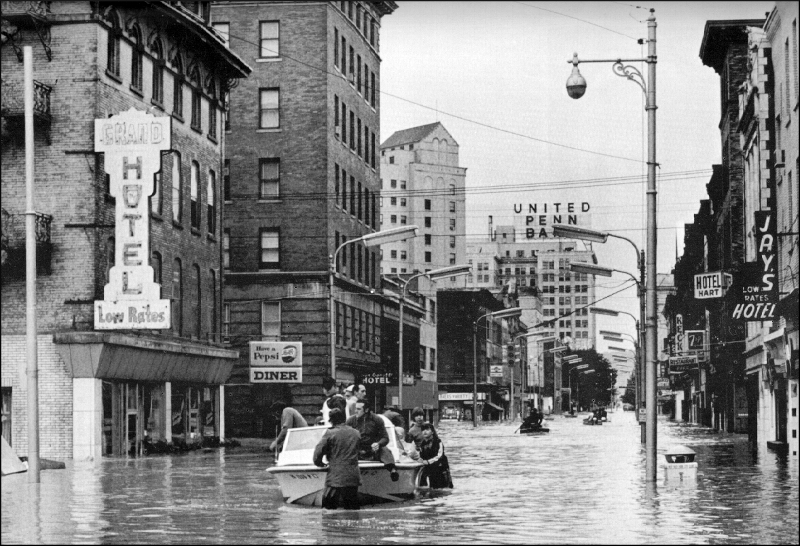
 Flash floods happen very quickly and are rapid rises of streams and creeks which flood roads, bridges, homes and business in as little as an hour or a few hours.
More information about these flood hazards can be found on the National Weather Service flood safety website at: www.weather.gov/safety/flood/.
The following will describe different forms of flooding:
Flash flooding:
Tropical systems and Inland flooding:
River flooding:
Understanding the different types of flood hazards and knowing the actions to take before, during, and after, can help you protect your life, the lives of your loved ones, pets, and your property. Prepare now by visiting www.weather.gov/safety/flood.
Thursday
Today's topic: National Weather Service Water Resources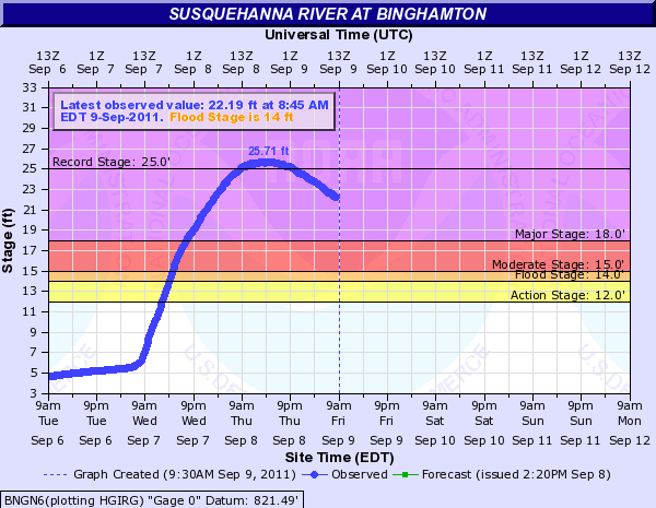
The National Weather Service homepage, www.weather.gov, provides up to date weather and water Advisory, Watch, and Warning information for the United States. However, the National Weather Service provides many additional resources to help emergency managers, public officials and private citizens make water decisions.
Advanced Hydrologic Prediction Service (AHPS):
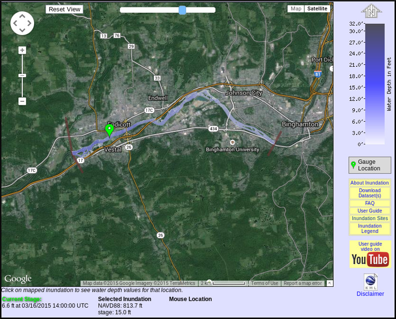
Flood Inundation Mapping:
Weather Prediction Center (WPC) Precipitation Forecasts:
National Weather Service River Forecast Centers (RFC):
The National Weather Service has a network of thirteen River Forecast Centers across the United States. These RFC locations collect, process, and provide water resource and river forecasts and information for major river basins across the country. water.weather.gov/ahps
Flood Safety Awareness Website:
On this page, you will find information on what to do before, during and after a flood. www.weather.gov/safety/flood
Staying aware of an evolving weather situation can help you prepare when flooding or other weather hazards impact your area.
Friday
Today's topic: Partner Resources
 The National Weather Service works with, and relies on strategic partnerships involving river observations, reservoir management, floodplain management, flood hazard mitigation, flood preparedness and safety efforts to reduce the loss of life and property caused by floods. Today we are sharing some great tools from several of our partners.
American Red Cross
Federal Alliance For Safe Homes (FLASH)
Federal Emergency Management Agency (FEMA)
United States Army Corps of Engineers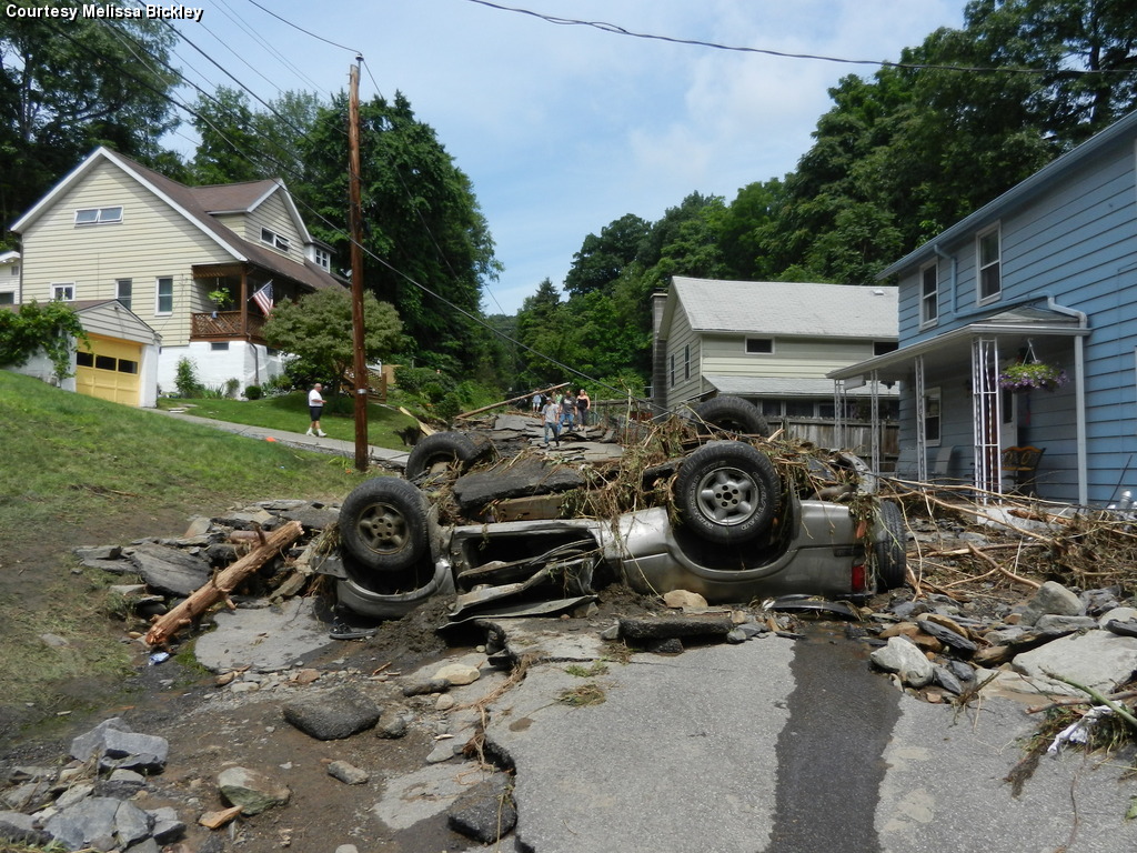
United States Geological Survey
The National Weather Service works with many key partners to complete the mission of protecting life and property. Some additional key partners are the National Hydrologic Warning council, Association of State Floodplain Managers, the National Safety Council, media outlets, and many other government and private sector organizations. For more information about our partners, or to learn about partners local to your area, contact your local National Weather Service office.
Remember, flooding can occur in ANY of the fifty States or United States territories at any time of the year. Prepare yourself, your family, and your home for potential disaster. Be aware of potential flooding in your area, Turn Around Don't Drown, and help make the United States a more Weather Ready Nation!
For more information, contact:
Mitchell Gaines
Meteorologist for NOAA's National Weather Service
Binghamton, NY 13290
Phone: 607-770-9531
Email: mitchell.gaines@noaa.gov


 Follow us on YouTube