August 26, 1996 Verona Tornado
During the afternoon of August 26 1996, a severe thunderstorm moved over Oneida Lake and across Verona Township around 500 PM EDT. This storm downed large tree limbs across Route 13 south of Sylvan Beach, as it moved to the east southeast north of the New York State Thruway.
Several reports of dime size hail were received in Verona. Scattered trees and wires were also downed across Verona Township between the Lake Shore and Route 365.
Based on Skywarn Spotter reports and photographs, it appears that an F0 tornado on the Fujita Tornado Damage Scale briefly touched down in Verona Township in the vicinity of Verona Swamp southwest of Stooks Corners between 500 and 510 PM EDT. There were no injuries or damage to structures reported.
The storm crossed the thruway near Bartlett, however no damage was reported in this area. The storm moved through New Hartford between 515 and 530 PM EDT, with strong winds and lightning downing tree limbs and wires producing widespread power outages. The damage in the New Hartford area was not caused by a tornado.
Another storm later that evening moved through Sherrill around 640 PM EDT. Straight line winds from this storm also downed trees and power lines.
This tornado is particularly noteworthy because it was captured on film by Mr. Frank Hendricks, a SKYWARN ground spotter in Westmoreland, NY. These photographs were taken looking to the northwest shortly after 5:00 PM EDT. The tornado is approximately 5 miles away. Click on the images below for a larger image.
 |
 |
 |
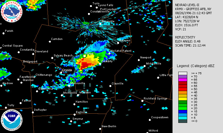
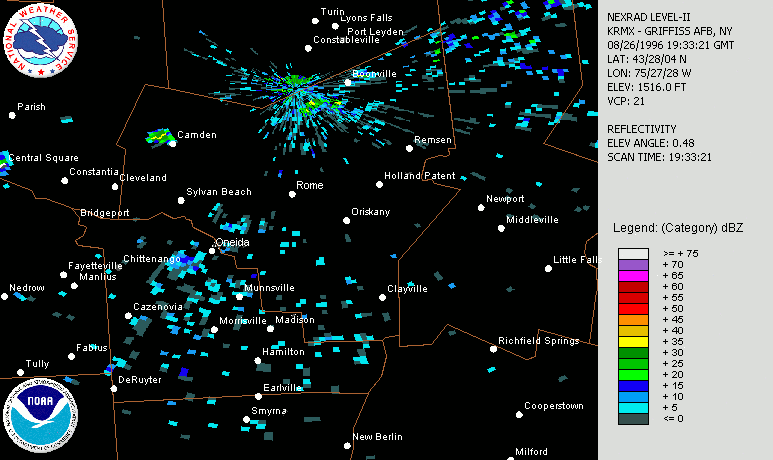
The following images depict the storm as viewed from the WSR-88D Doppler radars in central New York. Mr. Hendricks approximate position in Westmoreland is noted. He is southeast of the storm for at the time of the first two images. The storm then crosses the New York State Thruway as it passes just to the north of his location (third image).
|
This is a base reflectivity (0.5 degrees) from the West Leyden, NY, WSR-88D (KRMX) taken at 5:01 PM EDT. Mr. Hendricks photographs were taken within a few minutes of this image time. Click on image for a larger view. |
This is a base reflectivity (0.5 degrees) from the West Leyden, NY, WSR-88D (KRMX) taken at 5:12 PM EDT. The tornado has disapated at this time. Click on image for a larger view. |
Click on the image for a radar loop. |
The National Weather Service would like to extend special thanks to our Skywarn observers, particularly Mr. Frank Hendricks, and Niagara Mohawk Power Company for their assistance in obtaining information about this storm.


 Follow us on YouTube