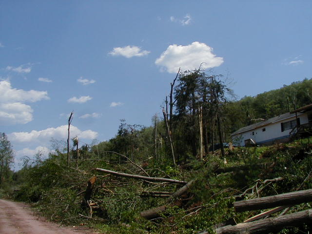
F1 Tornado Owego, NY
A severe thunderstorm developed across eastern Tioga county on the afternoon of Friday, May 31st and traveled east into Broome county. It was determined that the damage that occurred around 3:45 PM in the town of Owego was caused by a tornado, which reached F1 intensity (73-112 mph) with maximum wind speeds around 110 mph.
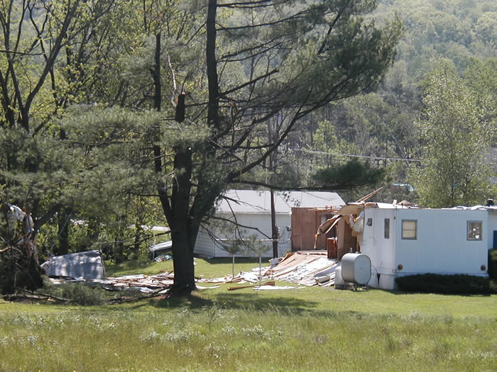
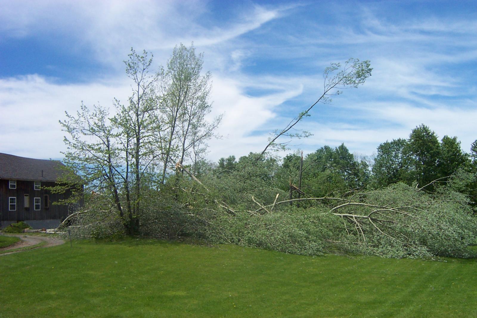
The tornado first touched down about a mile and a half northeast of the village of Owego, along Carmichael Road. As the the tornado passed over a ridge toward Beecher Hill Road, the most extensive damage was found. Along with major tree damage, one mobile home was completely destroyed and a house suffered significant damage. Five people received minor injuries in the mobile home as did the two elderly occupants of the other home. A piece of lumber went through the side of a home across the street. The damage seen here is consistent with a strong F1 tornado, with wind speeds up to 110 mph.
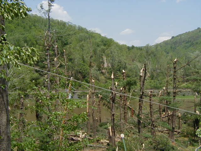
The tornado continued east and crossed Lisle Road. As the tornado came over another ridge toward Lisle Road, a gentleman in his barn witnessed the funnel with swirling debris coming over the ridge. He was able to take shelter before many of the windows were blown out of his barn. Significant tree damage could be seen, especially at the top of the ridge.
The tornado continued east, crossing Gaskill Road. One property saw significant damage, with one barn destroyed and a shed was torn apart. Debris was blown as far as a quarter mile away. Many large trees were uprooted with others twisted and broken off. Significant tree damage was also seen at the top of the ridge west of the property, with many trees broken or twisted off at mid-trunk. Pieces of siding from a home were also found in this area.
At this point, it appears the tornado lifted briefly before touching down again in the area where Ford Road, Foster Road and Whittemore Hill Road meet. The damage here consisted of another mobile home that was destroyed and significant tree damage.
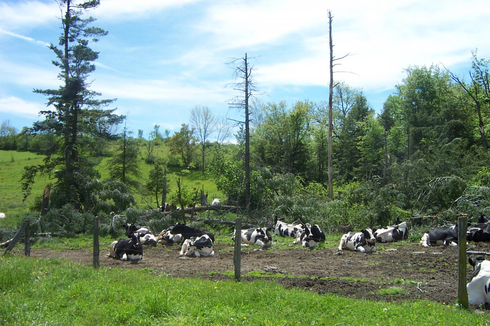
Based on the length of the damage path seen, it is estimated that the tornado was on the ground for approximately 6 miles. The core of the damage...consistent with F1 intensity (73-112 mph)...was around 1/10 to 2/10 mile wide along Gaskill and Foster Roads. F0 damage (40-72 MPH) around the core was observed to be about 1/2 mile wide. Along Beecher Road where the most significant damage occurred, F1 damage was around 1/4 TO 1/2 mile wide with weaker F0 damage about 1 mile wide.
The aforementioned damage is just the more notable damage that was observed. There was a significant amount of tree damage along the entire path of the tornado, with large trees uprooted and twisted off in different directions. More than 30 homes received minor damage in addition to the 2 homes that saw more substantial damage and the 2 mobile homes that were destroyed. Many barns were also damaged and numerous sheds were destroyed.
 |
 |
 |
 |
F0 Tornado Cooperstown, NY
On May 31st, 2002, a severe thunderstorm produced a tornado that touched down 5 miles south-southwest of Cooperstown, and tracked about 3 miles east to Phoenix Mills before dissipating. The tornado was confirmed to be an F0 on the Fujita tornado scale, with estimated wind speeds around 70 mph.
The tornado initially touched down just west of Brunner Road in Hartwick Township with some minor damage to a barn. Most of the damage in this area was to a grove of hemlocks with diameters up to 1 foot. Most of this tree damage was twisted and lying in several directions. The damage was consistent with F0 intensity which has winds between 40 and 72 mph.
The tornado then tracked due east across the hillside parallel and north of Old Kinney Road where the most significant tree damage was observed. Numerous trees were snapped off and uprooted in several directions. Most of the tree diameters ranged from 6 to 18 inches. The tornado then tracked across a swamp with lessor tree damage noted. There were two more areas with minor tree damage along the path of the tornado close to where it lifted in Phoenix Mills.
One barn sustained some damage on Brunner Road with some very minor damage to some of the siding at a Ford dealership in Phoenix Mills. The overall path length of the tornado was about 3 miles. Most of the significant damage was found over the first two miles of it's path. The damage then was more sporadic over the last mile of it's track near Phoenix Mills.
The maximum width of the tornado damage was about 150 to 200 yards...with most of the path length having damage widths of 50 yards or less.
 |
 |
 |
 |
F0 Tornado Lordville, NY
A severe thunderstorm moving east along the Delaware River spawned a tornado around 5:00 P.M. on Friday, May 31, 2002. The tornado initially touched down on the Pennsylvania side of the river in rural sections of the township of Manchester, then raced across the river into the Town of Hancock New York near the hamlet of Lordville. The tornado continued for a total of 1.5 miles up into the heavily wooded ridges on the New York side of the river. The tornado then lifted back into it's parent thunderstorm near the state forest preserve around Bouchoux Brook.
The strongest damage produced along the path of the tornado was only about 300 yards wide, however, straight line winds in the vicinity of the tornado, contributed to toppling hundreds of trees both in New York and Pennsylvania. One person in Lordville received minor injuries when his trailer was overturned and destroyed. Most other property damage was a result of trees falling on homes, cabins and vehicles. The assessment determined that the damage was consistent with a strong F0, or a weak F1 tornado with estimated wind speeds of 70 to 80 mph.
 |
 |
 |
 |
F0 Tornado Sanford, NY
On May 31st, a severe thunderstorm produced a tornado that touched down in parts of western Broome county. The National Weather Service confirmed that there was  an F0 tornado touchdown about 5 miles southwest of Deposit, New York in Sanford Township. Wind speeds associated with this tornado were estimated to be around 60 mph which places it within the F0 range on the Fujita tornado intensity scale.
The tornado initially touched down close to a campground off H. Decker Road. The tornado then traveled northeast across a small lake with minor tree damage observed. An eyewitness reported seeing a swirling mass of debris which was mainly composed of leaves. He also saw a picnic table get lifted up and thrown about 50 yards into the lake. The tornado tracked to the northeast and lifted close to Blueberry Lake in Sanford Township.
There was no significant damage reported to structures from this tornado. The path length was less than one mile with maximum width about 100 yards. Most of the damage from this tornado was to trees.
There was another F0 tornado touchdown along Bean Hill Road in western Broome county Friday, May 31st. There were several trees snapped and twisted consistent with an F0 intensity tornado with maximum wind speeds up to 60 mph. There was no structural damage associated with this tornado even though it passed near a home. This tornado touchdown was likely associated with the same storm which caused more significant damage north of Owego in Tioga county.
This is a base reflectivity radar loop from the National Weather Service radar Binghamton, NY. This loop shows several waves of thunderstorms moving across parts of central NY and northeast PA from 08:02 AM EDT (12:02 UTC) May 31, 2002 through 11:04 PM EDT May 31, 2002 (03:04 UTC June 1, 2002).
References:


 Follow us on YouTube