Overview
|
On the evening of Thursday, May 16th, 1996, an area of thunderstorms developed off the Bighorns Mountains in northeast Wyoming, moving northeast into south central North Dakota. These thunderstorms formed into a bow echo, which is a band of storms that takes on a curved, or bowed shape, that is typically associated with a threat of strong winds. The first reports of damage came in Hettinger County when a barn in North Lemmon was damaged and its debris was carried over 1/2 mile away. As the bow echo moved into Grant and Sioux Counties, it caused a significant amount of damage in the towns of Leith, Carson, and Raleigh with wind gusts around 80 mph. In Carson, a 400 gallon gasoline tank was tipped over and spilled the majority of its contents, and the roof of a local grain elevator was ripped off. Nearby in Leith and Raleigh, a grain elevator was destroyed, large trees were downed, and many buildings were damaged or destroyed. The highest measured wind gust of the day was 126 mph, reported by a farmer in Heil, whose equipment broke soon after measuring that gust. The line of storms continued to move northeast, with damage in Cannonball, before reaching the Bismarck/Mandan area with wind gusts around 80 mph. Boats in the dry dock at Marina Bay were overturned, a small plane at the Bismarck Airport was flipped, and a mobile home was destroyed. The storm continued its path northeast, with more homes damaged or destroyed in Steele. Winds finally subsided to around 60 mph in Jamestown and Ellendale as the storm weakened and moved into eastern North Dakota. Damage from the entire event was estimated to be well into the millions, with 5 injuries reported. For a complete list of storm reports, click here. |
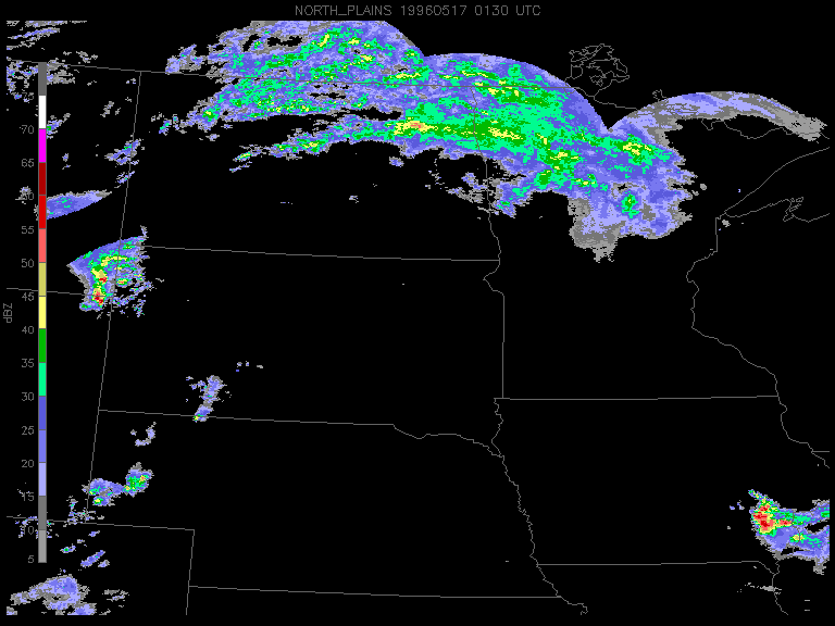
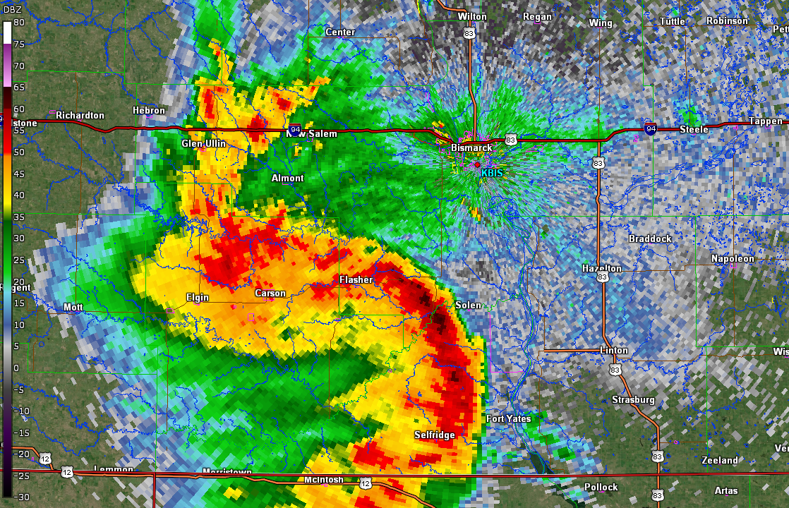 Radar imagery from KBIS around 11:20 PM CDT on Thursday, May 16th. |
May 16th (all times in CDT, some report times are estimated)
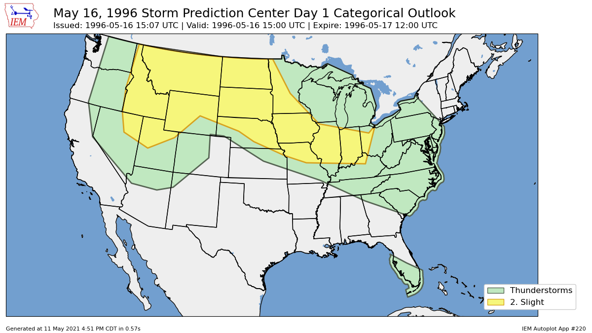
10:07 AM: Storm Prediction Center (SPC) Day 1 Outlook has a Slight Risk of severe weather across the Northern Plains. Severe thunderstorms were possible over western and central North Dakota during the afternoon, and again at night. Image below from the Iowa Environmental Mesonet.
2:00 PM: SPC updates their Day 1 Outlook, discussing how strong mid level flow is spreading northeastward across the Northern Rockies into the Northern Plains, with supercells possible across this region with a threat of tornadoes.
3:30 PM: NWS Bismarck Area Forecast Discussion (AFD) is issued, noting a strong shortwave that will move into the western Dakotas later tonight, with severe weather continuing past 06Z (1:00 AM).
6:16 PM: SPC issues a Mesoscale Discussion for an area of storms in central Wyoming that was moving northeastward toward a surface frontal boundary from northeast Wyoming into southwest North Dakota. This discussion mentioned a Tornado Watch may be issued in the next hour.
8:55 PM: NWS Bismarck AFD is updated, saying that the best area for severe thunderstorms over the next few hours will be along an axis of moisture convergence and low level warm air advection from northern South Dakota into southern North Dakota. At this point, scattered thunderstorms are ongoing in northwest South Dakota, moving northeast.
9:30 PM: A Severe Thunderstorm Warning is issued for western Adams County and eastern Bowman County until 10:15 PM.
9:58 PM: SPC issues a Tornado Watch for parts of southern North Dakota and northern South Dakota until 5:00 AM CDT. A line of thunderstorms extends from southwest North Dakota into northwest North Dakota.
10:00 PM: Winds estimated at 70 mph in Haynes, with grain bins knocked down.
10:11 PM: A Severe Thunderstorm Warning is issued for eastern Adams County until 11:00 PM.
10:30 PM: Winds estimated at 75 mph 1 mile north of Lemmon, SD, with a pole barn knocked down and debris carried over 1/2 mile away. Power was lost to much of the eastern part of Adams County, ND.
10:36 PM: A Severe Thunderstorm Warning is issued for Grant County and western Sioux County until 11:45 PM.
11:06 PM: A Severe Thunderstorm Warning is issued for southern Morton County until 12:15 AM.
11:15 PM: Winds estimated around 81 mph in Elgin, as the storm took on more of a bowed shape. Power lines were downed, with numerous trees downed or snapped off.
11:19 PM: A Severe Thunderstorm Warning is issued for western Emmons County and eastern Sioux County until 12:15 AM.
11:20 PM: 2 miles south of Heil, a farmer recorded winds of 126 mph on his wind speed recording equipment before the equipment was destroyed.
In Heil, winds were estimated around 81 mph, as winds spun a car around on the road and blew out all the windows.
Winds estimated at 79 mph in Carson, with a 400 gallon gasoline tank tipped over that spilled over 350 gallons of gasoline. The roof of the local grain elevator was ripped off, and power was out for the town until the afternoon of the 18th.
Winds in Raleigh were estimated around 81 mph, as large trees were downed and many buildings were damaged or destroyed completely.
11:25 PM: Estimated winds of 63 mph in Selfridge, with more trees and power poles downed as the bow echo moved into Sioux County.
11:42 PM: A Severe Thunderstorm Warning is issued for southern Burleigh County and northeastern Morton County until 12:30 AM.
11:45 PM: In Cannonball, winds were estimated around 75 mph, with 4 mobile homes completely destroyed.
Winds were estimated around 81 mph in Mandan, as several buildings in south Mandan sustained major damage. Boats in the dry dock at Marina Bay were overturned, and an estimated 400 homes lost power.
May 17th (all times in CDT, some report times are estimated)
12:12 AM: The Bismarck Airport recorded a gust of 79 mph. A small plane was tipped over at the airport, a mobile home was destroyed, and an estimated 3000 people lost power.
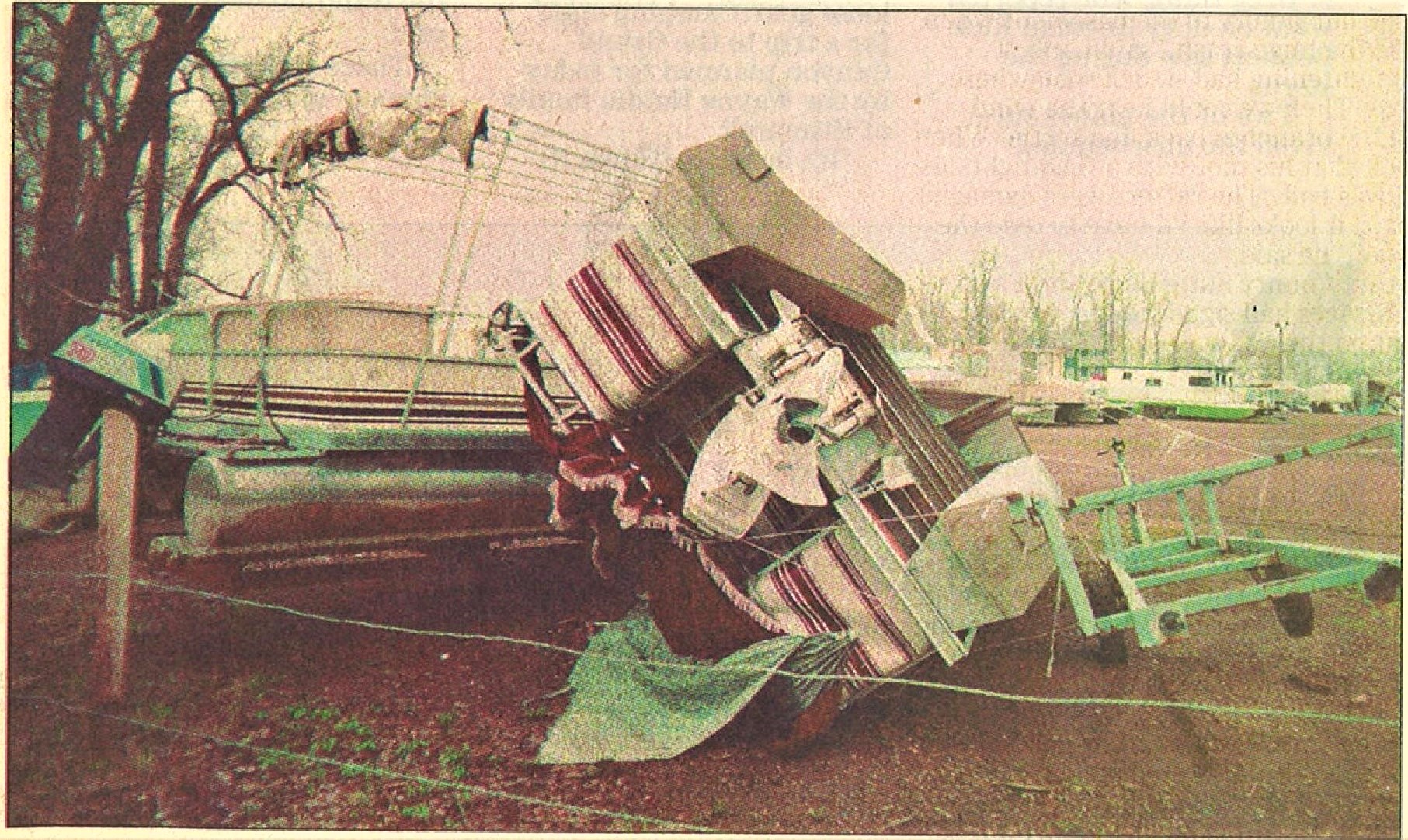
12:15 AM: Winds in Steele were estimated at 81 mph, with 3 homes damaged by uprooted trees being blown over onto them. At least 2 mobile homes were destroyed, and grain bins were blown over.
12:37 AM: A Severe Thunderstorm Warning was issued for Stutsman, Dickey, and La Moure Counties until 1:45 AM. This warning mentioned 60 to 80 mph wind gusts.
12:40 AM: A Severe Thunderstorm Warning was issued for southern Burleigh County, for strong winds caused by a rear inflow jet behind the main line of thunderstorms.
1:20 AM: Winds estimated at 81 mph 2 miles north of Cleveland, with power poles ripped out or snapped off.
In Ellendale, winds were estimated around 60 mph.
1:40 AM: The Jamestown Airport reported a wind gust of 60 mph. A radio tower in the Jamestown area was blown down.
Photos & Video
Header
 |
 |
 |
 |
| Debris being cleared from a trailer in Steele. A vacant trailer next door was destroyed. (Bismarck Tribune) |
A Cessna 172 was ripped from its parking spot and ended upside down from the General Aviation Terminal at the Bismarck Airport. The plane was a total loss. (Bismarck Tribune) |
A toppled pontoon boat on the landing at Mandan's Marina Bay. (Bismarck Tribune) |
The New York Bagel store on Bismarck Expressway was hit by flying debris from a neighboring building. (Bismarck Tribune) |
Header
 |
 |
 |
 |
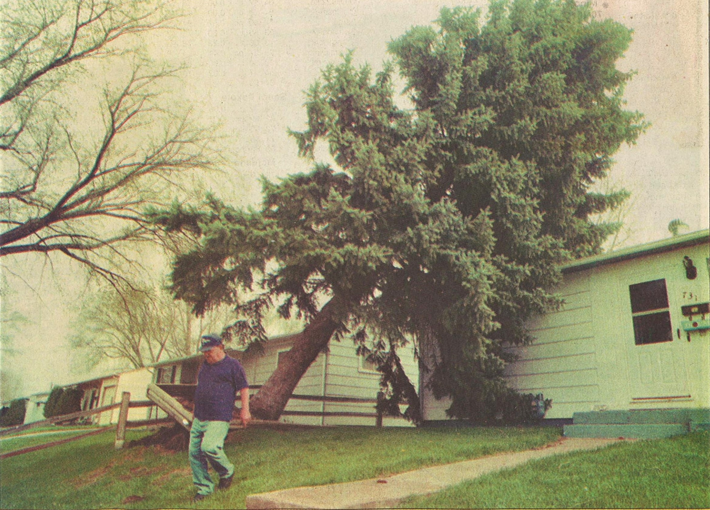
| An evergreen tree fell onto a home in south Bismarck. (Bismarck Tribune) |
The elk in front of the Elks Club in Bismarck was blown over. (Bismarck Tribune) |
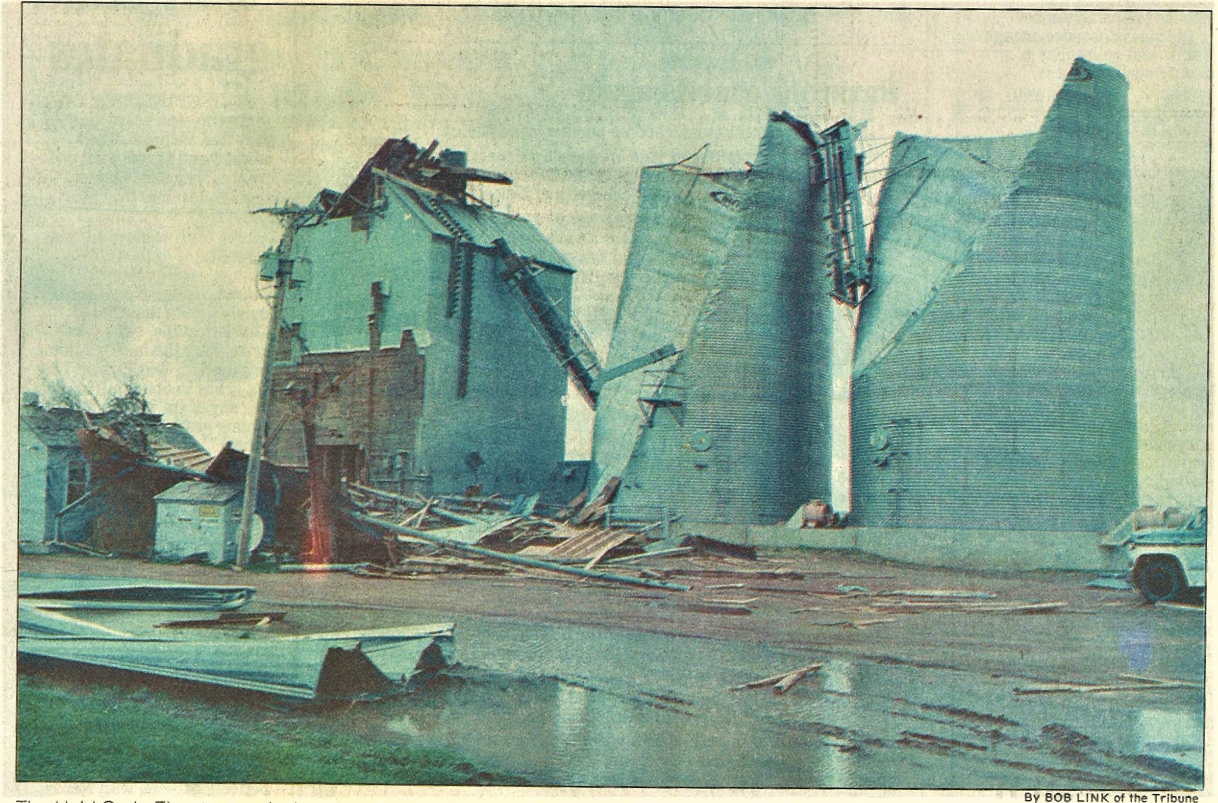
The Heid Grain Elevator in Grant County was heavily damaged. (Bismarck Tribune) |
Damage done to an office building in Bismarck. (Bismarck Tribune) |
Radar
Regional radar loop from the the evening of May 16th into the overnight hours on the 17th.

Environment
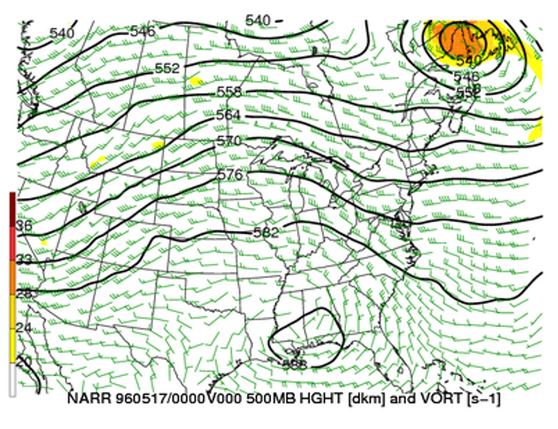
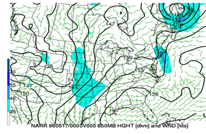
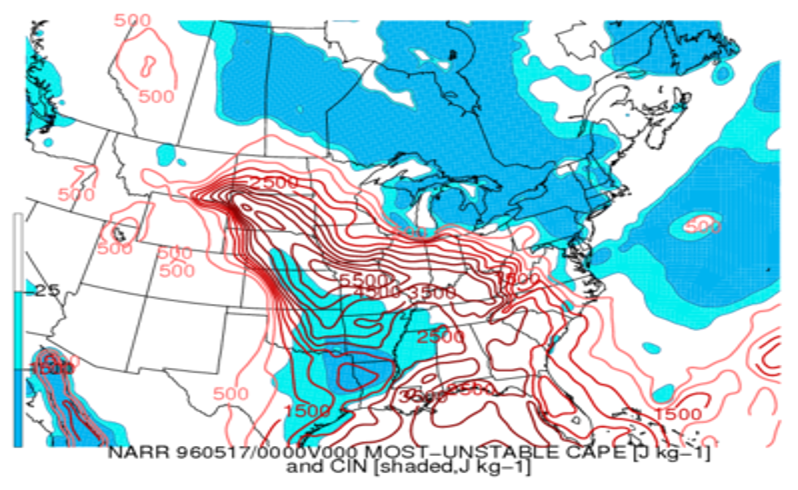
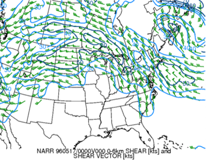
The synoptic pattern was characterized by broad southwest flow aloft, with weak embedded shortwave troughs. Initially-discrete supercells in northwest South Dakota merged, and expanding outflows led to a classic bow echo that moved through south central North Dakota. In the event’s genesis region, there was extreme instability (MUCAPE of ~5000 J/kg), along with deep-layer shear on the order of 50 knots.
 |
 |
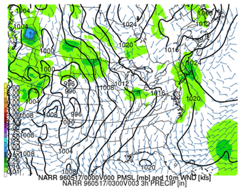 |
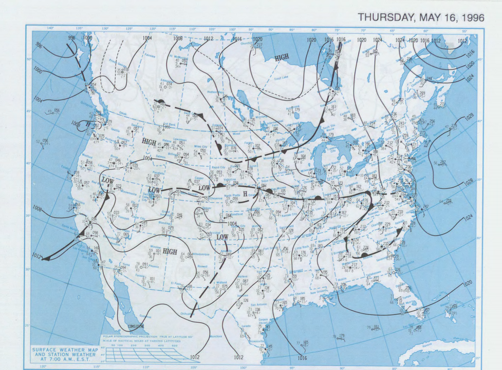
| Figure 1: 500 MB Height, Wind, and Vorticity | Figure 2: 850 MB Height and Wind | Figure 3: MSLP and 10-m Wind |
 |
 |
 |
| Figure 4: MUCAPE | Figure 5: 0-6 KM Bulk Wind Difference | Figure 6: May 16th 6 AM CDT Surface Weather Map |
 |
Media use of NWS Web News Stories is encouraged! Please acknowledge the NWS as the source of any news information accessed from this site. |
|


 Follow us on YouTube