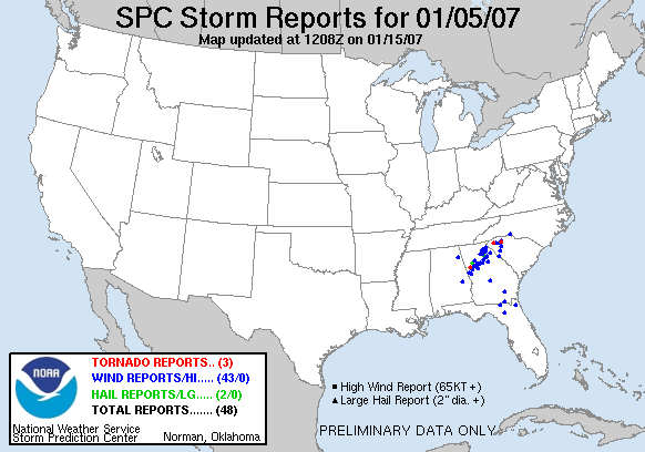
Straight Line Winds - January 5, 2007
An area of low pressure moved out of the Gulf of Mexico and tracked across Mississippi and Tennessee. A cold front eventually moved across Central Alabama during the daylight hours on January 5th.
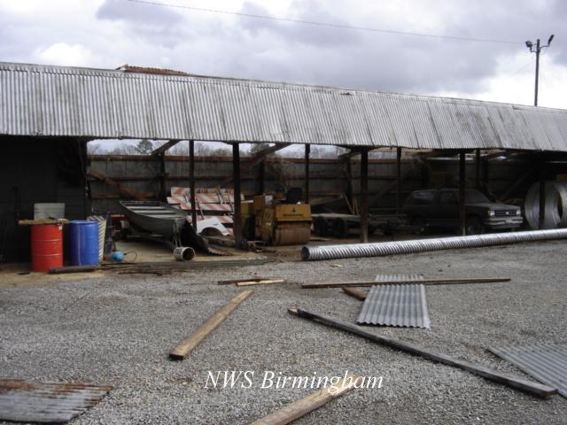
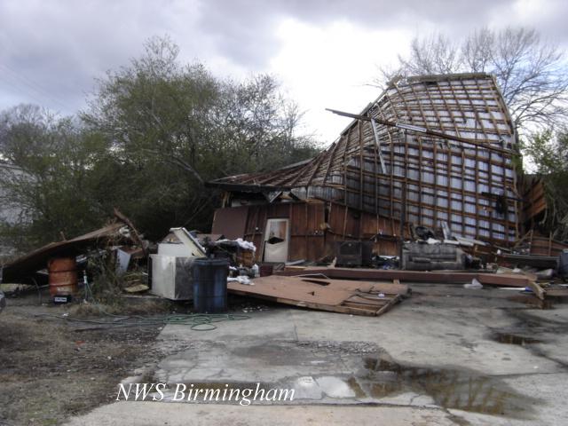
Preceeding the cold front, a line of showers and thunderstorms developed and moved into western Alabama before sunrise. Thunderstorm wind damage occurred in several counties through 7 AM CST. Many trees were blown down as the maximum wind gusts were estimated between 50 and 70 mph. The thunderstorms exhibited some rotational characteristics aloft, but no tornadoes were confirmed with this event. The pictures below are from areas that experienced more concentrated damage. A Tornado Watch was posted for a large part of Central Alabama during this event.
Cherokee County near Leesburg
|
|
||||||||||||||
Lamar County near Vernon
|
|
||||||||||
Marion County near Hamilton
|
|
||||||||||
Weather Data
|
|
||||||||||||||
Preliminary Local Storm Report...Click Here


 Follow us on YouTube