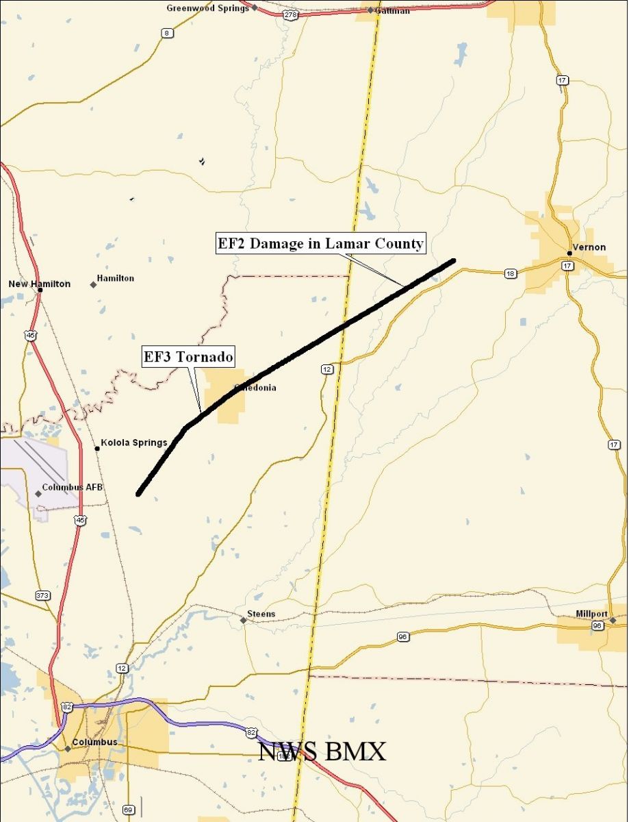
Lamar County Tornado - January 10, 2008
|
Rating:
(Click for EF Scale) |
EF-3 continued from Ms
|
|
Estimated Maximum Wind:
|
130 mph in Lamar Co
|
|
Injuries/Fatalities:
|
None
|
|
Damage Path Length:
|
4.56 miles
|
|
Maximum Path Width:
|
2500 yards
|
|
Approximate Start Point:
|
33.73/-88.25 at 220 PM
|
|
Approximate End Point:
|
33.75/-88.18 at 225 PM
|
National Weather Service meteorologists surveyed storm damage in Lamar County, and determined that the damage was the result of a tornado. This tornado produced EF-2 damage in Lamar County, with estimated maximum winds of 130 mph, and a maxiumum path width of about a half mile. However, this was the same tornado that struck Caledonia, MS, and the entire tornado will be given a rating of EF-3 due to the higher degree of damage in Mississippi.
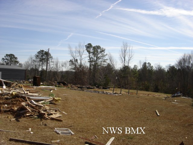
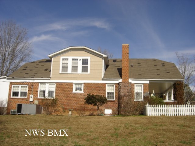
The tornado entered Alabama around 220 PM just north of AL-18. From there, it traveled northeast for about 5 additional miles, remaining just north of AL-18 as it passed close to the town of Molloy. The tornado finally lifted at 225 pm just northeast of Molloy. Along its path in Alabama, the tornado took the roof off of two homes, destroyed 2 wooden barns, moved the foundation of 2 mobile homes, and uprooted several huge trees.
A Tornado Warning was in effect for this area from 2:14 PM until 3:00 PM. A Tornado Watch was in effect from 1134 AM until 519 PM.
Click on the images below for larger picture.
|
|
||||||||||||||||||


 Follow us on YouTube