|
Event Summary
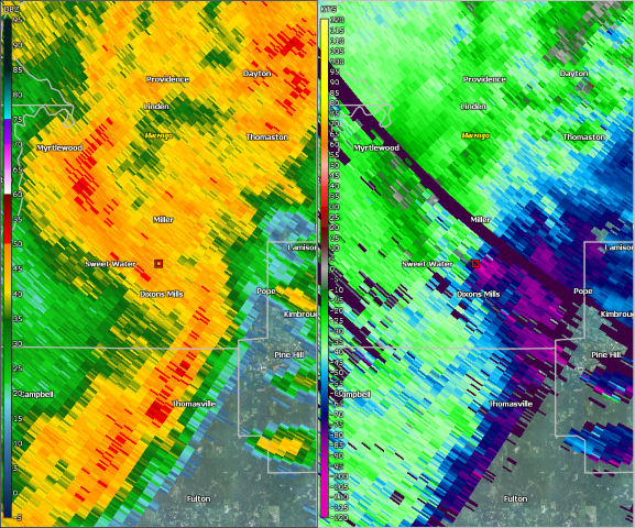
National Weather Service meteorologists surveyed damage in south central Marengo County and determined that the damage was consistent with an EF-1 tornado.
The tornado touched down along U.S. Highway 43 near Sweetwater Creek and Wayne Road. The tornado tracked north northeast and downed several trees along the path. A few outbuildings were damaged. The tornado lifted north of Pillie Road and Diamond Road, east of U.S. Highway 43. The tornado was 4.17 miles long and was 900 yards wide at its widest point. The tornado was rated an EF-1 with maximum winds around 90 mph.
Thanks to Marengo County EMA for their assistance with this survey.
|


 Follow us on YouTube