|
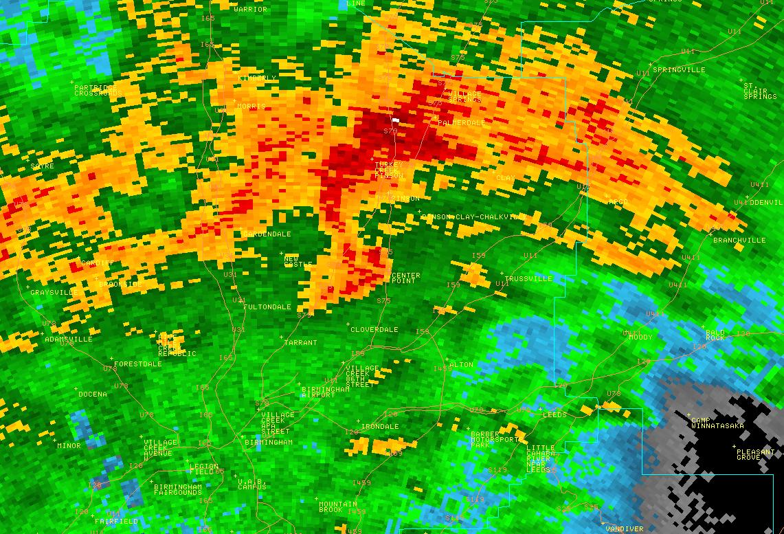
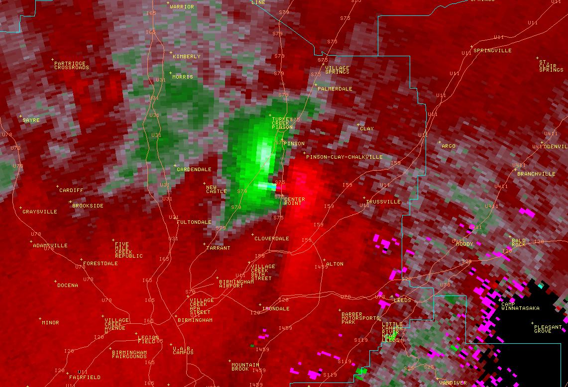
National Weather Service meteorologists have surveyed the damage between Tarrant, Center Point, Clay, and Argo. The damage was the result of an EF-3 tornado. The tornado touched down along Pawnee Village Road about 3.25 miles northeast of Tarrant where several businesses sustained roof and wall damage. The tornado then tracked further northeast across Pinson Valley Parkway where several additional businesses were heavily damaged or destroyed.
In the city of Center Point, the tornado exhibited maximum wind speeds of 120 mph. The most extreme damage was sustained by the Center Point Elementary School, which had the southwestern portion of its roof completely removed. In this same area, the width of the tornado path was approximately 880 yards. Two blocks to the northeast, the tornado crossed Center Point Parkway causing damage to numerous businesses at 24th Street. From there, the tornado continued traveling to the northeast, crossing over Sweeney Valley Road, causing minor roof damage to numerous homes along the way. When the tornado crossed Old Springville Road, the intensity increased to approximately 150 mph. These wind speeds caused damage to dozens of homes in the George Brook Neighborhood.
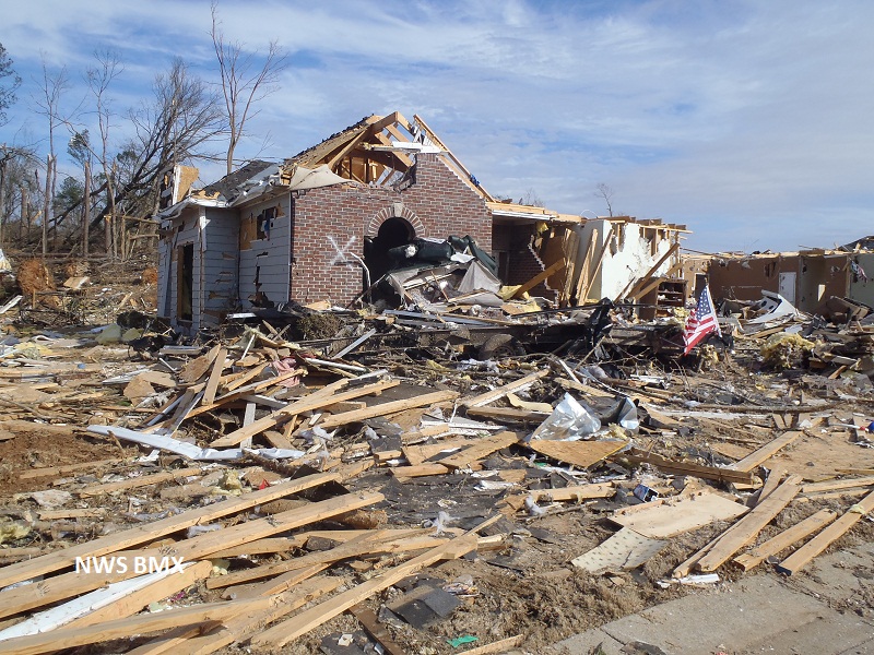
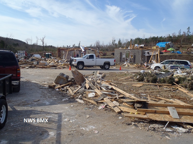
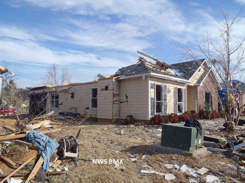
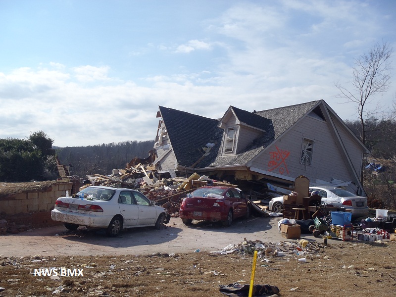
As the tornado moved farther to the northeast, it clipped Harness Circle in the Northwoods neighborhood, where two homes were completely destroyed. It was in one of these two homes where a 16-year-old girl lost her life in the process of trying to take cover. Numerous other homes sustained minor to moderate roof damage. Winds in this area were consistent with an EF-3 tornado of 150 mph and a width of approximately 600 yards. From there, the tornado crossed another ridge and entered the Legacy neighborhood in the city of Clay. Numerous homes throughout the neighborhood sustained minor to moderate roof damage. Homes on Plymouth Rock Drive sustained the heaviest damage as many of the exterior walls had collapsed. Winds in this neighborhood were also consistent with an EF-3 tornado of 150 mph and a width of approximately 600 yards.
The tornado began to weaken as it approached Interstate 59 crossing into St. Clair county just north of Argo where several additional homes sustained damage along with numerous trees uprooted and snapped. The tornado began to lift near Hidden Valley Drive and Country Living Circle.
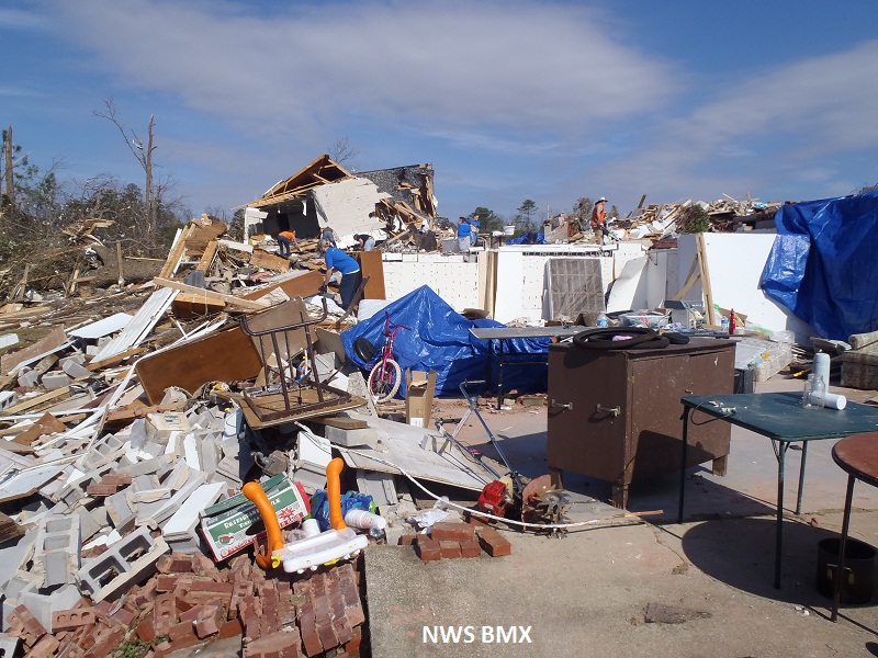
At the time of this report, 231 homes and businesses were damaged or destroyed. The tornado damage path was approximately 15.5 miles long and was 880 yards wide at its widest point. Special thanks to the National Weather Service office in Huntsville for their help with the damage survey.
|


 Follow us on YouTube