Tuscaloosa Tornado - January 24, 1997
Radar images, including reflectivity, storm relative motion, and precipitation.
National Weather Service meteorologists were able to survey the damage caused by the tornado that struck the Tuscaloosa area on the afternoon of January 24, 1997. The following is the information from that survey. Special thanks go to the Tuscaloosa Police Department for their assistance in providing a helicopter for an aerial survey. Note: to view a larger image of some of the pictures contained on this page, just click on the image.
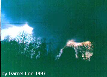 This photograph of the tornado that struck Tuscaloosa on the afternoon of January 27, 1997, was taken by Darrel Lee from his front porch in Cottondale. He is looking west-northwest at the tornado only a short time after it had struck the five points area where the Food World and Big B stores were heavily damaged. The tornado was moving northeast and dissipated only a short time after this photograph was made. Special thanks to Mr. Lee for allowing the National Weather Service to use his photograph for public service purposes.

At approximately 5:00 pm, a tornado began on the east side of the Warrior River, South of Interstate 59 and west of County Road 95. Click here for a graphic showing the tornado track (29kb size). Besides trees, the initial damage was to shingles of an apartment complex in the Crabtree area.
The tornado moved on a northeasterly track crossing U. S. 82 and Interstate 59. Two businesses, Books-A-Million and Gayfer's, sustained roof damage.
The tornado became stronger after crossing Interstate 59 with significantly greater damage from this point to the end of the path. Numerous trees were downed, some roofs were damaged, and several out buildings were destroyed in the Woodland Hills residential area.
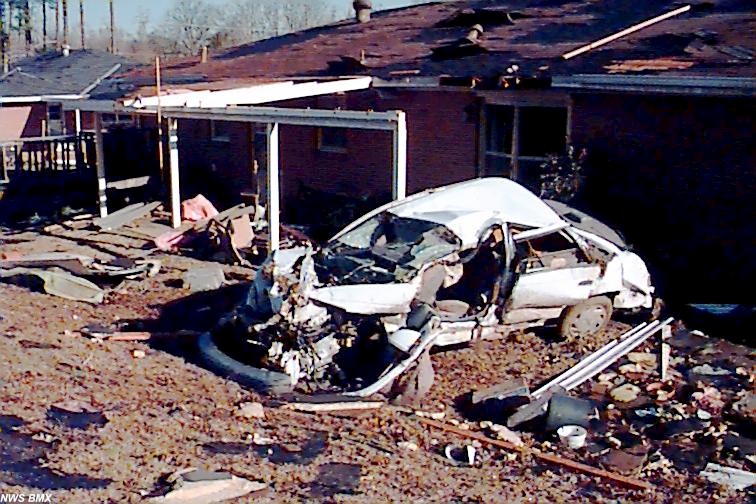
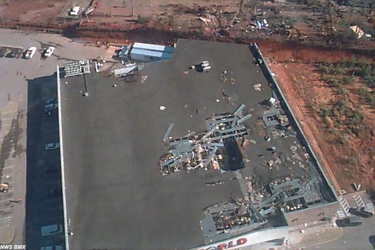
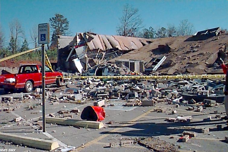
 Several buildings were damaged at Five Points East, the intersection of State Roads 215 and 216, including Food World and Big-B, among others. Cars were tossed about like toys. One vehicle was tossed through the roof of the Food World. Another car was tossed from the parking lot of the Food World into the backyard of a house immediately northeast of Food World, a distance of 300 to 400 feet.
The tornado continued northeast through the Lynn Haven residential area causing significant damage to numerous homes. Ten to twelve homes sustained damage that ranged from partial roof loss to total roof loss.
 The tornado continued across Tuscaloosa Memorial Gardens Cemetery, paralleling and crossing State Road 216. Six to eight houses in the Summerfield subdivision sustained light to moderate damage. A couple of mobile homes and several other buildings including a small corner grocery-type business were destroyed. The tornado dissipated in a wooded area just north of State Road 216 shortly after that around 5:15 pm.
Tuscaloosa County EMA estimates that between 90 and 100 structures sustained some degree of damage.
The total tornado path length was 10 miles with a path width of about 200 yards. On the Fujita scale of tornado intensity, from F0 as the weakest to F5 as the strongest, the tornado was ranked as an F2. This puts the maximum wind speed in an estimated range from 113 to 157 miles per hour.
Tornado watch #29 which included Tuscaloosa County was issued at 3:12 pm valid until 10:00 p.m. A Severe Thunderstorm Warning was issued at 4:23 pm valid until 5:15 pm. The Severe Thunderstorm Warning was upgraded to a Tornado Warning with the initial reports of the tornado at 5:11 pm valid until 6:00 pm.
There was one fatality, a man in a vehicle in the Woodland Hills area, and ten injuries, 8 were treated and released, two were hospitalized.
Times are based on a combination of police reports, EMA reports, and Doppler radar images.
 size about 90kb jpg |
 size about 148kb jpg |
 size about 77kb jpg |
 size about 89kb jpg |
 size about 105kb jpg |
 size about 132kb jpg |
Radar images, including reflectivity, storm relative motion, and precipitation.


 Follow us on YouTube