EF-2 Marble Valley - Lake Tate Tornado - February 6, 2008
|
Rating:
(Click for EF Scale) |
|
|
Maximum Wind:
|
118 mph
|
|
Injuries/Fatalities:
|
None
|
|
Path Length:
|
16.8 miles
|
|
Maximum Path Width:
|
One Half Mile
|
|
Start:
|
33.00/-86.50 at 625 AM
|
|
End:
|
33.12/-86.27 at 645 AM
|
This supercell slowly developed near the Mississippi Louisiana state line and moved northeastward. The storm passed near Laurel, Mississipi and then entered western Alabama. The supercell moved by Butler, Linden, Uniontown, Maplesville, and Thorsby with little to no damage reported. This is preliminary data and some surveys are still ongoing.
A tornado then touched down in the Hidden Valley community along Lay Lake, approximately 2 miles northeast of Lay Dam. The tornado tracked northeastward before producing its most significant damage just east of Marble Valley along County Road 56. Hundreds of hardwood and softwood trees were either snapped off or were uprooted. Four large wooden power poles were snapped off. Two mobile homes were knocked off their foundations and rolled over. The tornado continued northeastward, crossing into Talladega County, and ended just past Lake Tate near Settlement Road. The tornado damage path was 16.8 miles long and was one half mile wide at its widest point.
The supercell quickly started losing its identity as it moved northeastward into Clay and Cleburne Counties where no additional damaage was reported.
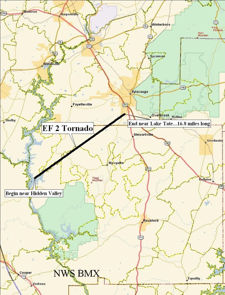 Tornado Damage Path |
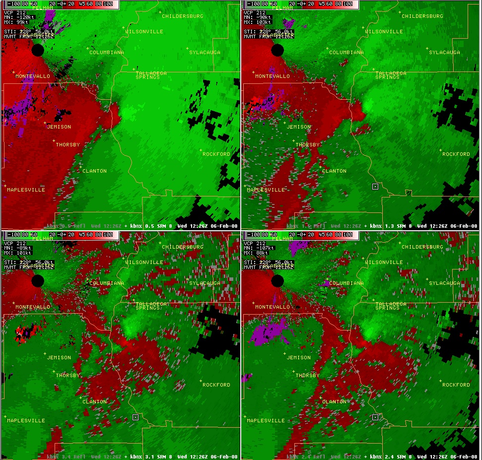 4-PanelStorm Relative Velocity Image Just After Touch down |
|
|


 Follow us on YouTube