|
National Weather Service meteorologists surveyed the damage in central St. Clair County and have determined that the damage was the result of both straight-line wind damage and an EF-0 tornado. Before the tornado touched down, straight-line thunderstorm wind damage was noted on Old Acton Road where a tree was uprooted and there was minor fascia damage to a home. From there, the wind damage continued into the Brookhaven subdivision where scattered shingle damage was noted and trees were uprooted in various locations throughout the subdivision. an A/C unit was also shifted off its platform, and a fence was blown over.
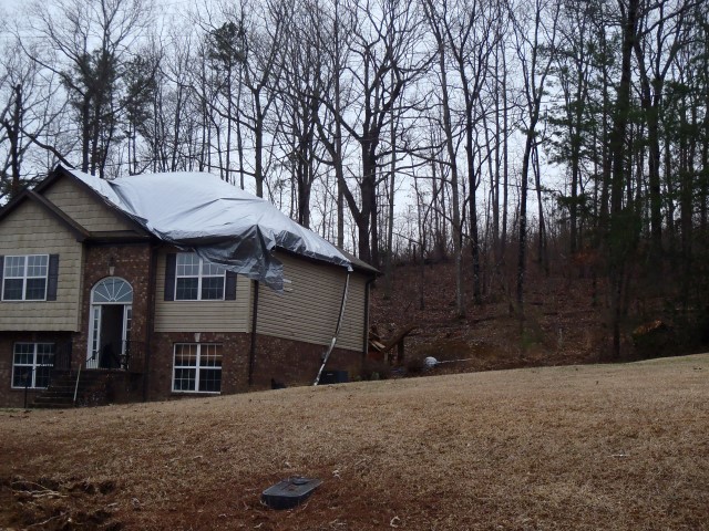
The tornado touched down near Jamaica Lane, where only minor roof damage to a double-wide mobile home was observed with some smaller trees uprooted. The tornado increased in intensity as it neared the intersection of Sanie Road and Nelsie Ann Drive. Minor roof damage to approximately 6-8 two-story homes was observed along with 30-50 uprooted or snapped trees. A couple of the smaller trees on the northern edge of the damage were facing southeast. Similar damage was observed along Hurst Drive, where 25-40 trees either snapped or uprooted with roof damage to a two-story home and a barn. The tornado narrowed as it approached Hwy 411. Another 25-40 trees were either uprooted or snapped along the intersection of Shadow Bend Road and Hwy 411. A majority of the trees were facing northeast, but a couple of small trees along the northern edge of the damage were facing southeast...clearly indicating a convergent damage path. The last point of concentrated damage occurred along Tucker Road, where 10-20 trees were either uprooted or snapped with one down on a home. The tornado lifted just to the east-northeast of this location with sporadic damage beyond this point.
|


 Follow us on YouTube