|
Event Summary for Central Alabama
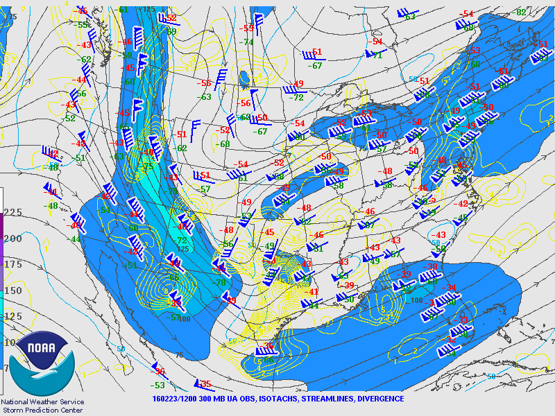
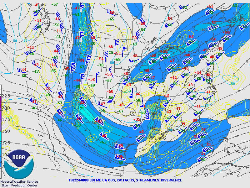
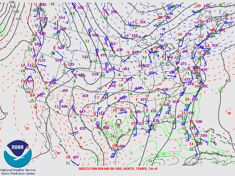
On Tuesday, February 23rd, a deepening trough of low pressure at 500 milibars was analyzed near the New Mexico and Texas border with strengthening winds behind it of 100-105 knots over northern Arizona and Nevada. A weak shortwave trough was also analyzed across northwest Mississippi while weak ridging was present over southeast Georgia and northeast Florida. The longwave trough continued to progress east, and was located across northwest Texas later in the morning, while a shortwave trough was analyzed over the Arklatex region just northwest of Shreveport, LA.
Toward the surface, a stationary front was draped across the deep south early on Tuesday, extending from McComb, MS, eastward to near Tuscaloosa, AL, to near Anniston, AL. Southeast surface winds and high humidity characterized the airmass south of this boundary with temperatures and dew points ranging from the upper 50's across southern Alabama to the lower 60's near the Gulf Coast. North of the front, a northeast surface wind generally prevailed with temperatures in the low to mid 50's with dew points ranging from the upper 40's across north Mississippi and northwest Alabama to dew points in the mid 50's across central Mississippi into north-central Alabama.
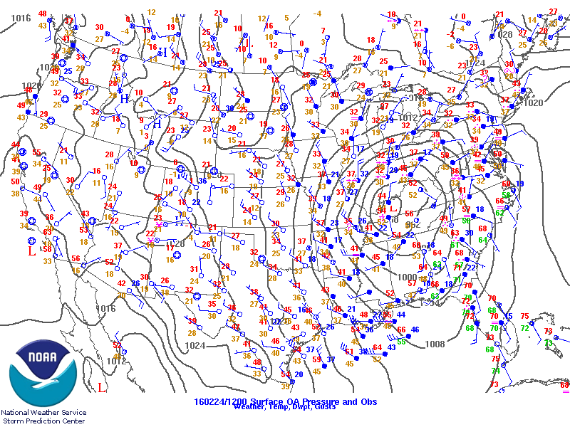
Later in the morning hours the stationary front had moved little resulting in little temperature change. After noon, a surface low pressure area began to develop across far eastern Texas in response to the height falls and increasing winds aloft with the approach of the 500 millibar trough. The strengthening surface low helped strengthen low level convergence and spur warm advection into Louisiana and Mississippi where the warm front began to drift northward. This process continued into the evening hours where a 995 millibar surface low was analyzed west of Natchez, MS, with a warm front extending eastward across north Mississippi from Greenville to near Tupelo and further east from near Haleyville to just south of Gadsden to just south of the Atlanta metro area. To the south of the warm front, with generally south-southeast winds, temperatures had reached into the low to mid 60's with upper 60's to low 70's observed across the southern third of Alabama and across much of the western Florida panhandle. To the north of the front, a generally easterly flow kept conditions cooler and more stable with temperatures in the upper 50's to low 60's and dew points in the upper 50's across north Alabama. A northeast surface flow across the Carolinas and north Georgia kept the front from advancing north and resulted in decreased temperatures and dew points due to weak cold air damming and wedging.
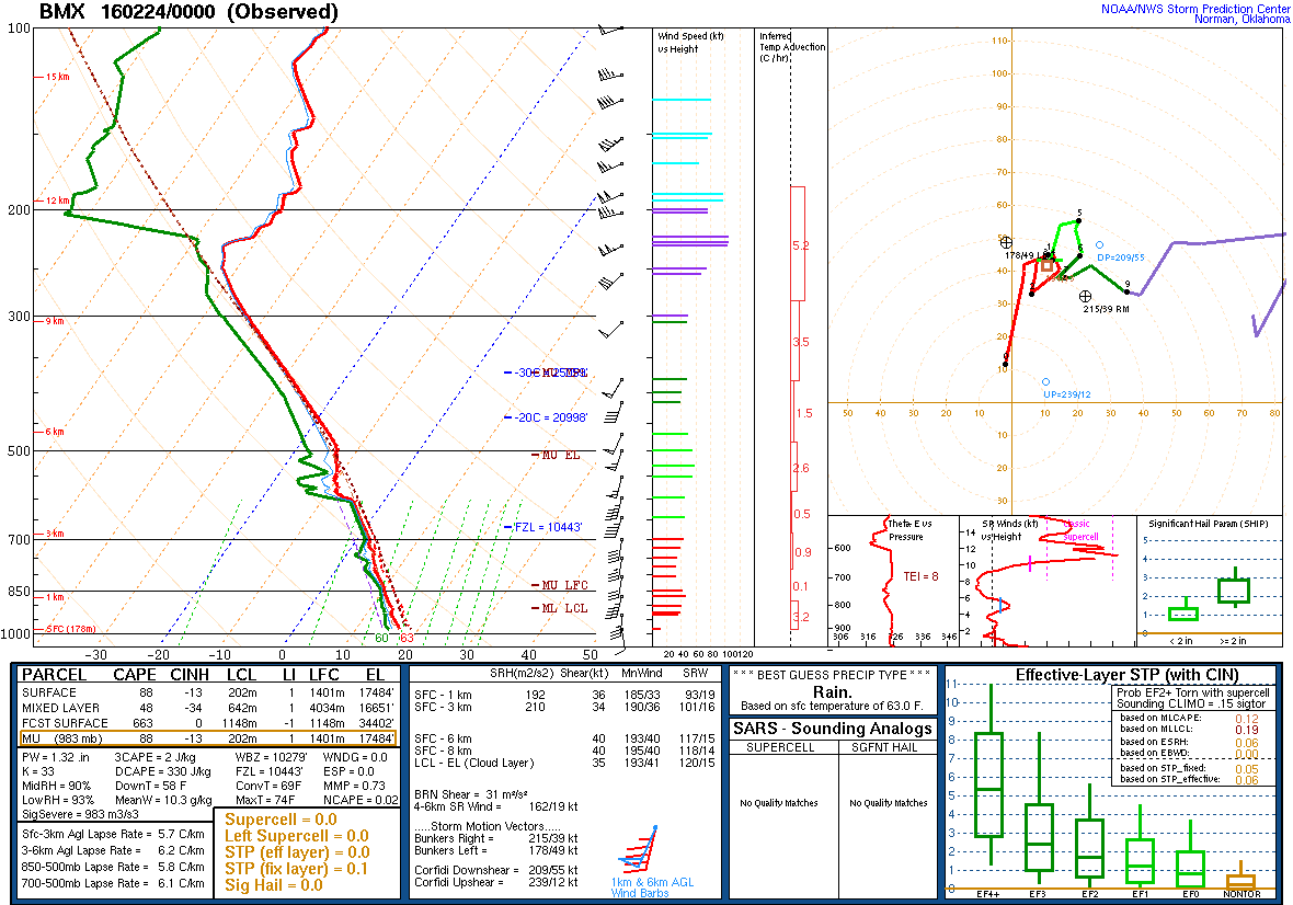
Persistent low clouds across much of the state except for the southeastern counties along with marginal advection kept instability values lower than anticipated. Despite the surface cyclone over northeast Louisiana deepening from 995 millibars at 00z Wednesday to 991 millibars at 06z Wednesday, the lowest levels of the atmosphere remained minimally unstable overall with the higher instability located roughly within 100 miles of the Gulf of Mexico across Louisiana, south Mississippi, south Alabama, southern Georgia and the Florida panhandle.
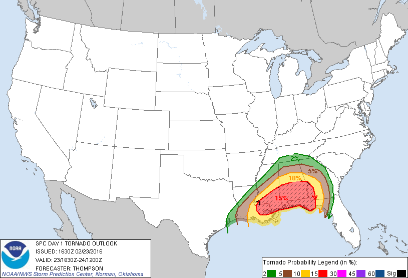
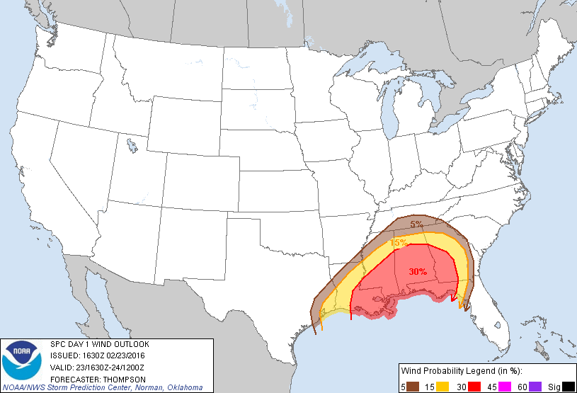
Overall, this event has been characterized as a high shear/low instability case where the lack of instability toward the surface greatly limited what otherwise likely would have been a more widespread severe weather event. Strong forcing and dynamics along with favorable wind shear profiles aloft seemed to all be in place to support severe weather. The persistent cloud cover along with relatively weak warm advection near the surface kept temperature and dew point values lower than expected and reduced the convective available potential energy for severe storm development.
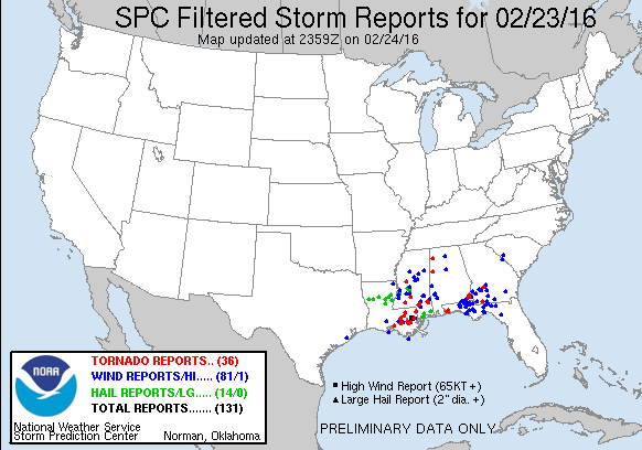
In the end, three weak tornadoes touched down across Central Alabama during the late afternoon hours on Tuesday and into the early morning hours on Wednesday . In addition to the tornadoes, strong gradient winds with gusts of 40 mph caused some sporadic tree damage across the area during the afternoon and into the overnight hours.
The information contained below is the individual tornado events that occurred. The data is PRELIMINARY and may be subject to change.
|


 Follow us on YouTube