|
Event Summary for Central Alabama
On Tuesday, March 1st, a deepening upper-level trough moved closer to the region, with a surface cold front approaching from the northwest. This front was trailing from an intensifying surface low tracking from Illinois to western Pennsylvania.
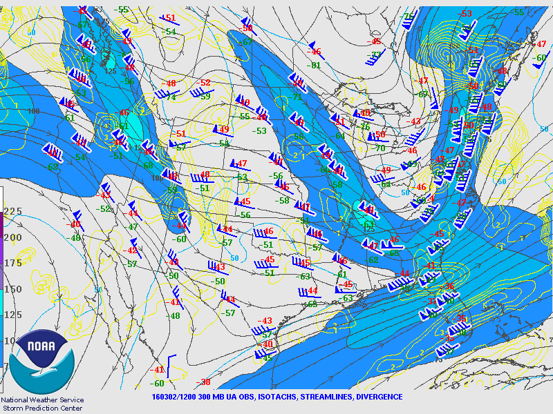
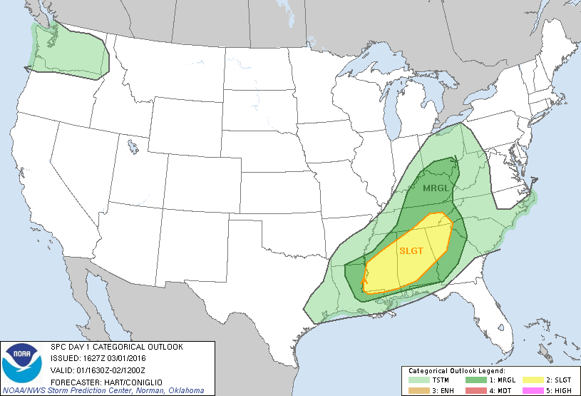
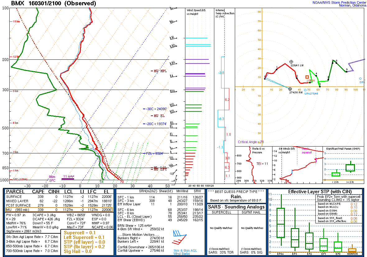
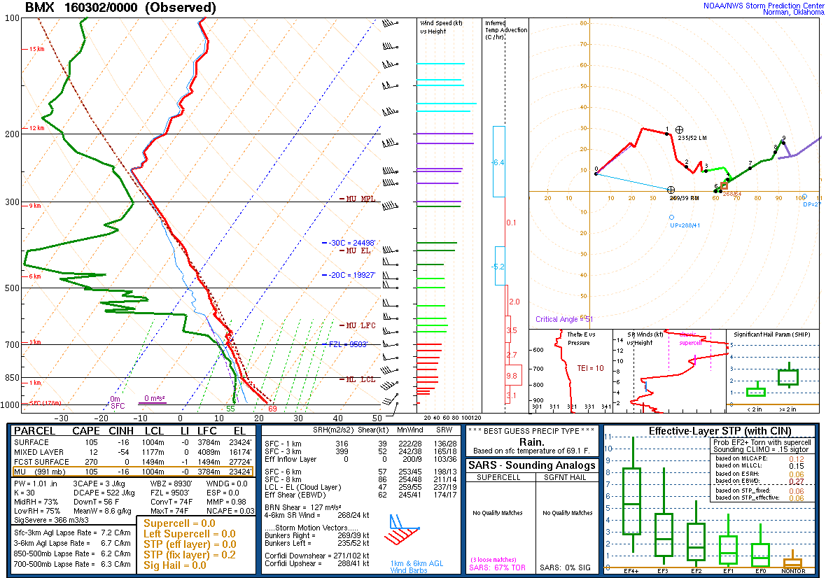
A lead impulse maintained a complex of rain and a few embedded storms that moved through northern Alabama from morning into early afternoon. Meanwhile, broken cloud cover allowed for pockets of sunshine farther toward the south, resulting in temperatures rising into the low-to-mid 70°F range. South-southwesterly surface winds advected mid-to-upper 50F dew points into the area. This resulted in a weakly unstable air mass per the 21Z balloon data from KBMX, with CAPE values ranging from 300-500 J/kg on mesoanalysis. Deep-layer winds were increasing in speed as the low-level and upper-level wind fields began moving in. Bulk shear was analyzed as high as 55-knots, with 0-3km storm-relative helicity in excess of 300 m²/s². Realized destabilization and shear profiles favored a possibility of isolated severe thunderstorms.
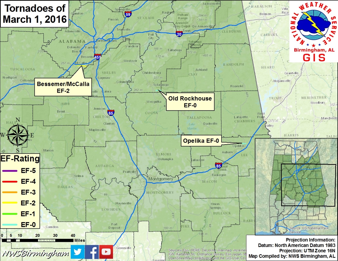
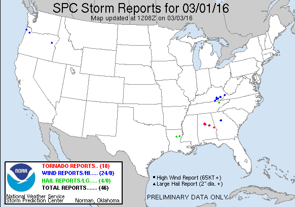
Expectations were for the arrival of frontal forcing to ignite better organized thunderstorms within this environment mid-afternoon into evening, featuring a mixture of bowing segments and possible supercells. This evolution occurred, with a linear storm quickly organizing into a supercell as it moved through the southern reaches of Jefferson County, producing an EF-2 tornado. A broken line of storms continued toward the southeast during the evening, with brief EF-0 tornadoes occurring in Talladega County and Lee County.
The information contained below is the individual tornado events that occurred. The data is PRELIMINARY and may be subject to change.
|


 Follow us on YouTube