Greene County & Tuscaloosa County Tornadoes - March 4th, 2008
Event Summary for Central Alabama
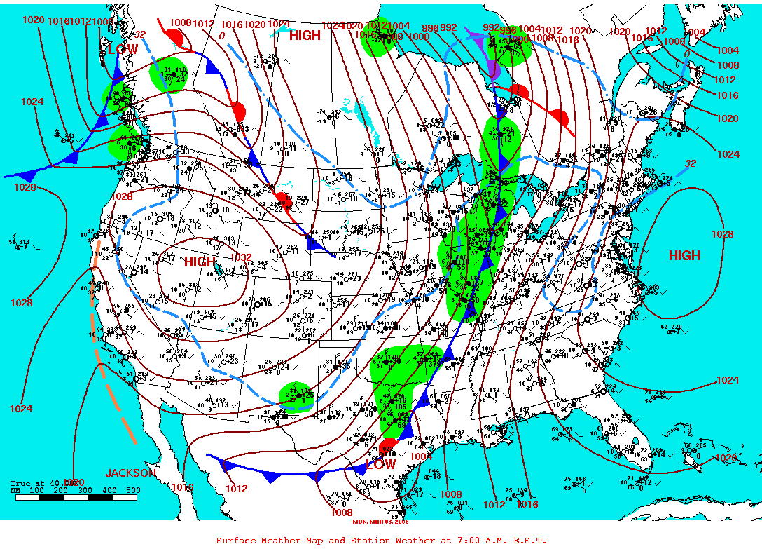
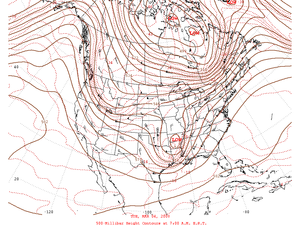
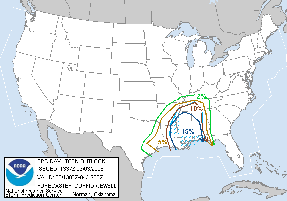
A vigorous upper level low and associated strong cold front approached Central Alabama during the evening hours of March 3rd. Although low level moisture increased rapidly ahead of this system, instability was lacking for robust updrafts. Cloud to ground lightning was limited in most of the storms across Central Alabama. The atmopshere was typical of a winter season severe set up where shear was very high and capes were low. The supercell storms responsible for the tornadoes were embedded in a large rain mass. Two tornadoes were confirmed and a few damaging wind events were reported. Rainfall averaged one to two inches and several locations received an inch of rain in less than 30 minutes. This produced some minor flooding problems.
Tornado Watches were in effect for portions of Central Alabama between 1000 pm and 900 am March 3rd/March 4th.Two tornado damage paths have been identified in Central Alabama:
EF-1 Samantha Tornado - Tuscaloosa County
EF-1 Eutaw Tornado - Greene CountyPreliminary Local Storm Reports
Severe Weather Episode Data
|
|
||||||||||||||||||||


 Follow us on YouTube