|
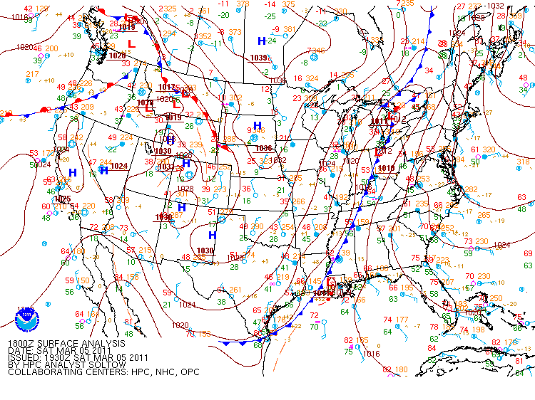
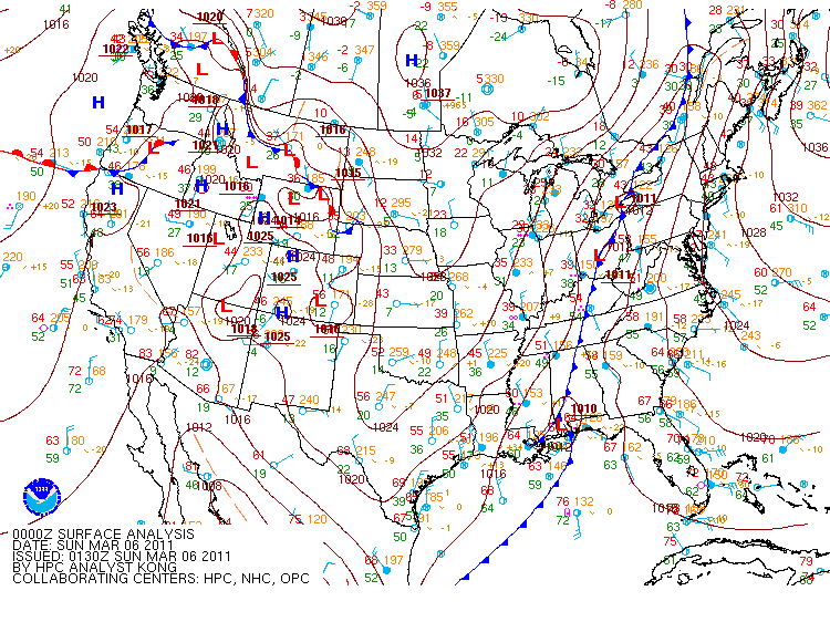
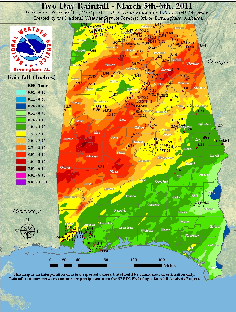
On the evening of March 4th, 2011, a surface low developed over the central U.S. Plains and tracked northeastward into the Great Lakes. Normally, a surface low like this would cause southerly flow to develop over the northern Gulf States, but because of a cold-air damming wedge front in place across the southern side of the Appalachian mountains (seen in the 18z surface analysis below, left), the surface flow remained east to southeast. This limited the ability for enough moisture to move northward and give central Alabama the potential for severe weather. Instead, a secondary surface low developed along the southern end of the cold front from the original surface low, now moving into New England. This low developed near New Orleans and tracked to the east-northeast. Coupled with the front moving through the state and the secondary surface low tracking through the southern third of the state of Alabama, copious amounts of rainfall fell across central Alabama. Looking at the rainfall chart below, the heaviest of the rains were due to the development of an embedded line of convection in the larger rain shield.
|


 Follow us on YouTube