|
Event Summary
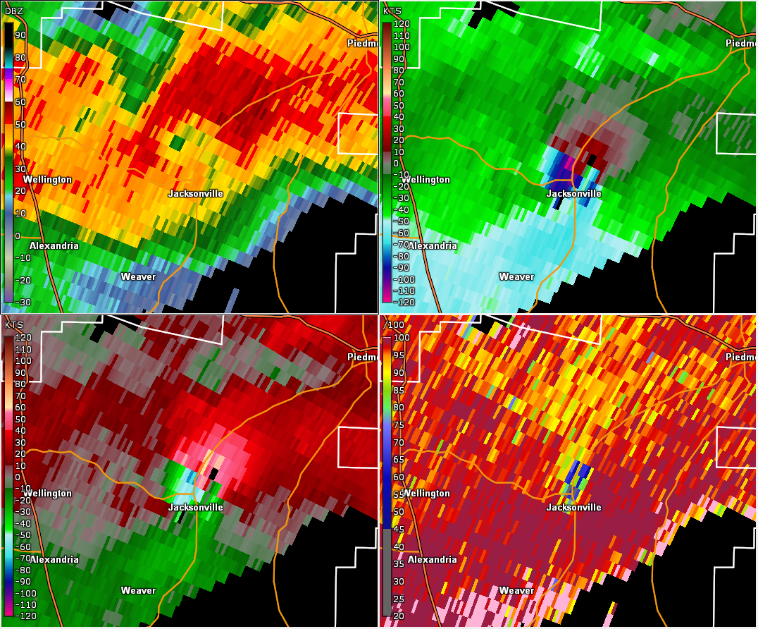
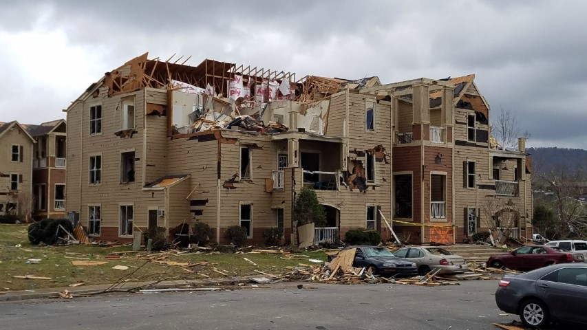
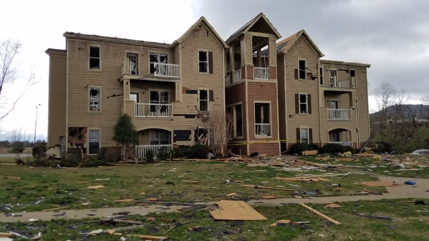
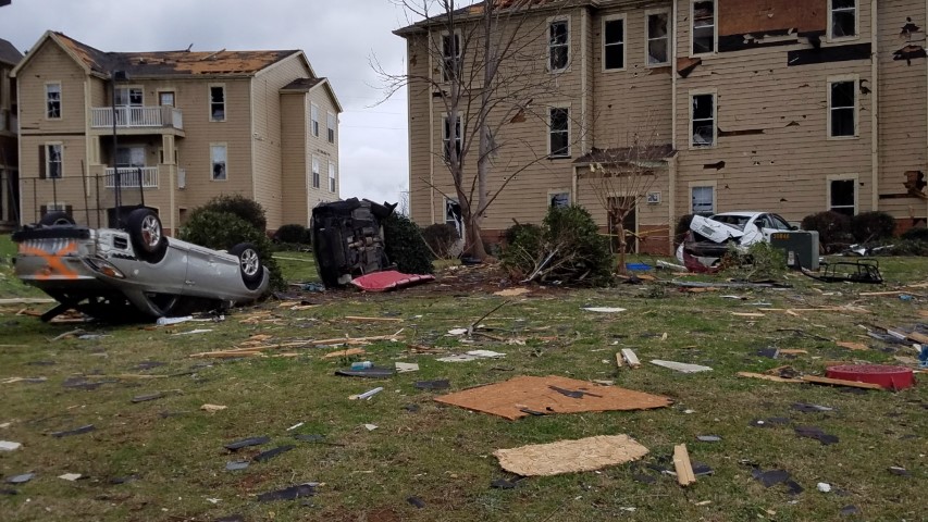
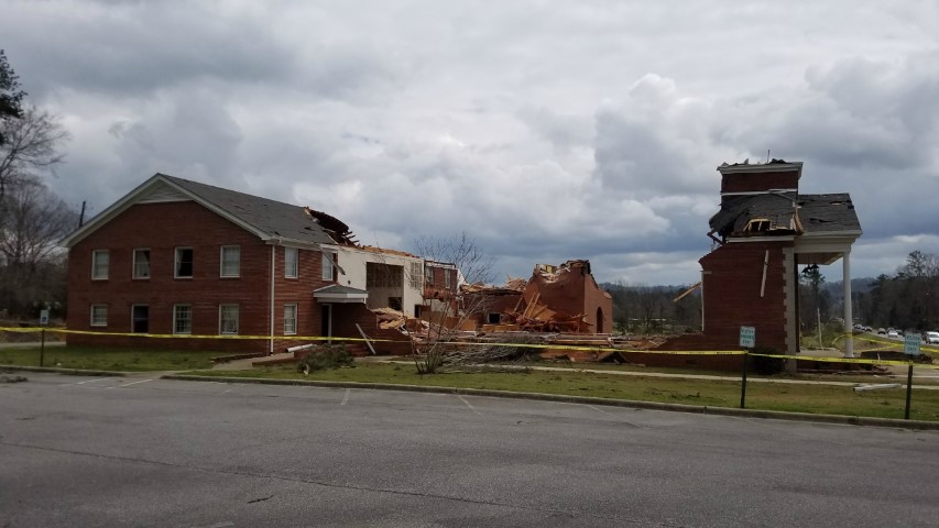
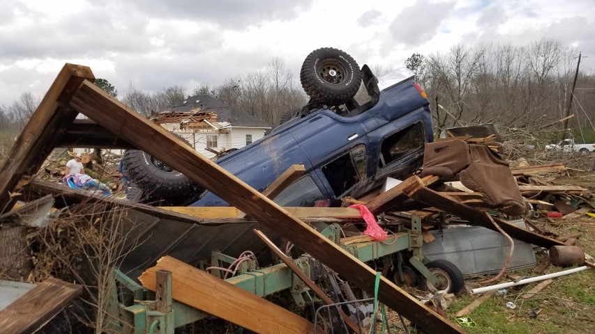
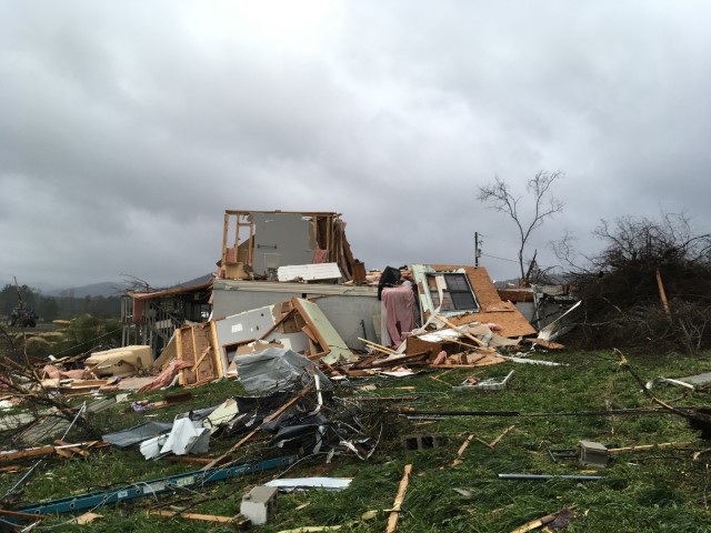
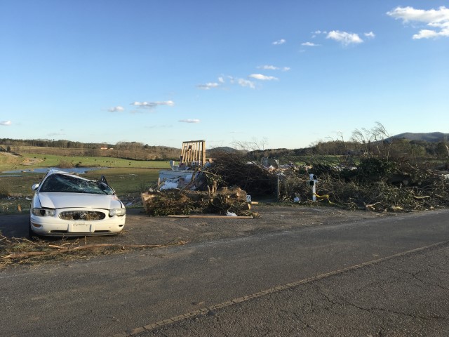
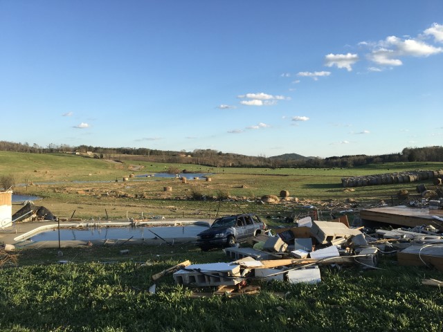
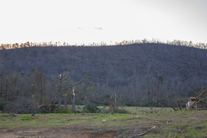
National Weather Service meteorologists surveyed damage in northern Calhoun and Cleburne Counties and determined that the damage was consistent with an EF-3 tornado. The tornado first touched down west of US Highway 431 north of Wellington, where it rapidly intensified and widened. It snapped and uprooted numerous trees along US Highway 431. Several homes were damaged by the falling trees. The tornado proceeded eastward across Websters Road and Broughton Road with scattered tree damage. As the tornado crossed Old Sulphur Springs Road, two homes were damaged with scores of trees snapped or uprooted. At Angel Station Road, the tornado filled the valley from one side to the other and caused extensive tree and home damage. An electrical transmission tower line was toppled at this point, but it was believed that flying debris compromised the structure. The tornado continued eastward and destroyed the sanctuary at West Point Baptist Church. Additional structures were severely damaged at the church. The tornado entered the City of Jacksonville where it gained strength into the EF3 category, with winds around 140 mph. It removed most of the roof and the top floor of two buildings in an apartment complex. The tornado affected the entire campus of Jacksonville State University. Several buildings sustained significant damage. The most intense winds remained north of the campus however, mowing down trees and causing direct damage to homes. As the tornado crossed Highway 21, it caused caused major damage to the Merrill Building. It then moved into a highly populated zone, where scores of homes suffered major damage and rendered many uninhabitable. The tornado maintained its strength as it crossed Choccolocco Mountain, with winds funneled up the valleys mowing down trees. It caused major damage to a number of homes on the mountainside. Damaged continued all the way up to just south of the peak of the mountain. As the tornado moved down the eastern side of Choccolocco Mountain, it narrowed substantially and became stronger once it reached the valley below. Stands of trees were wiped out with trunks snapped relatively close to ground level. Perhaps the most intense damage along the entire track occurred along Hollingsworth Rd, where a site built home was completely destroyed with only a portion of one interior wall left standing. Debris from this home was blown downstream across a field with some evidence of wind rowing. Hay bales adjacent to the home, estimated at 800 pounds each, were thrown up to 300 yards to the east. Maximum winds at this location were estimated at 150 mph. The tornado continued east-southeast and downed many thousands of trees in the Talladega National Forest, areas north of Fruithurst, areas north of Muscadine, and to the Georgia State Line. The tornado damage path to the Georgia State Line is 34.29 miles long.
|


 Follow us on YouTube