|
Event Summary
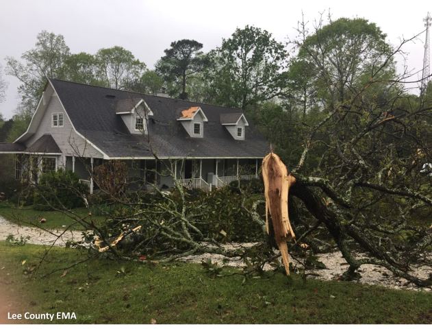
National Weather Service meteorologists surveyed damage in south central Lee County near Beauregard and determined that the damage was consistent with an EF-0 tornado. Maximum winds were estimated to be around 70 mph.
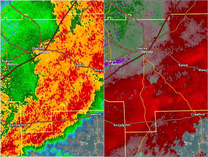
The tornado began near the intersection of State Road 51 and Lee Rd 47, where several pine trees were snapped and uprooted in a convergent pattern. One half mile to the east-northeast, the tornado caused shingle damage to a house along Lee Rd 114. The tornado continued for an additional 1.5 miles and caused minor tree and shingle damage before dissipating near the intersection of Lee Rd 400 and Lee Rd 166. Though the damage was relatively minor, a debris signature was evident in KMXX dual-pol radar data.
|


 Follow us on YouTube