|
Event Summary
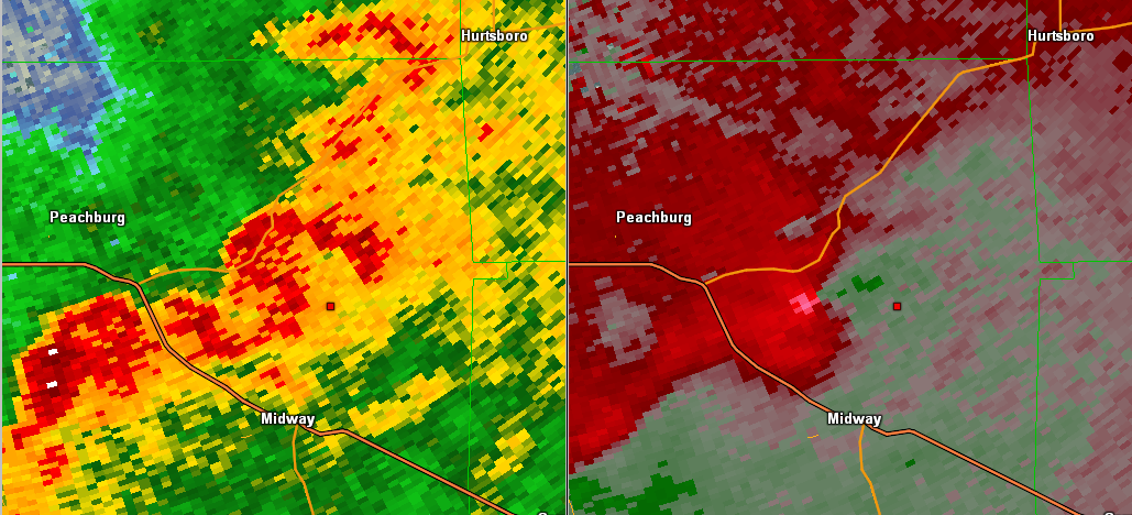
NWS Meteorologists surveyed damage in eastern Bullock County, north of the town of Midway, and determined a tornado with EF-2 intensity occurred.
The tornado began along County Road 35 where a few trees were snapped and uprooted. A debris signature was then seen on KMXX Doppler Radar as the tornado continued eastbound, uprooting additional trees between County Road 35 and County Road 47. The tornado intensified as it crossed County Road 47, where a church was heavily damaged, including wall and roof failures to over half of the building. Here, the tornado was rated a low-end EF-2. Adjacent trees were also snapped and uprooted, and a few nearby homes sustained minor damage.
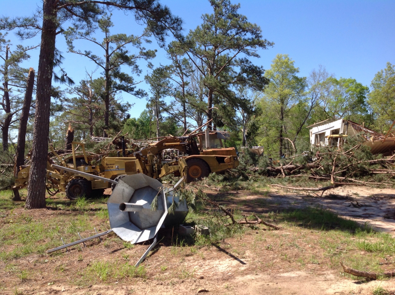
The most chaotic scene was observed on a farmstead just east of County Road 103. At this location, a swath of trees were snapped and uprooted. Large metal farm equipment buildings were heavily damaged or destroyed. This damage was consistent with an EF-2 tornado. The tornado then weakened a bit as it moved east through the property, but continued to down and snap trees. Debris from upstream damage at the farmstead was also seen scattered about the area, approximately one half mile downstream. Additional vegetative damage likely occurred as the tornado continued east, while dissipating, to near the Barbour/Russell County line in an area that was inaccessible.
|


 Follow us on YouTube