April 10, 2004 Severe Weather
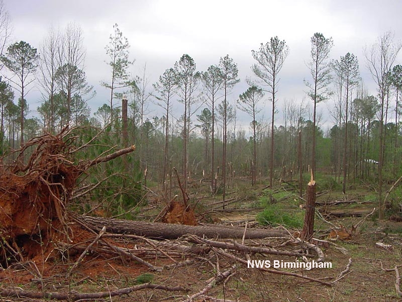
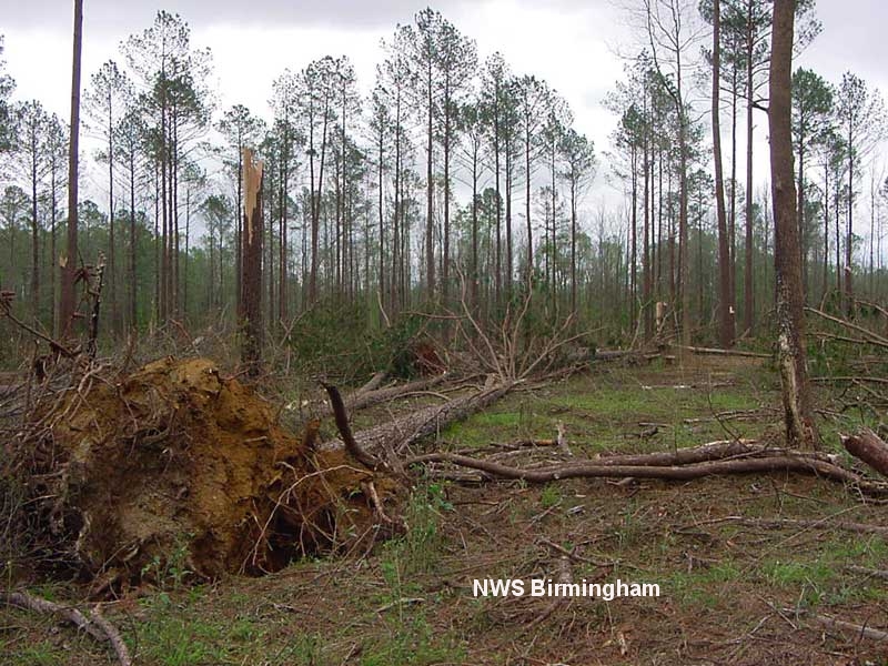
A supercell thunderstorm moved across parts of Greene and Hale Counties early Saturday evening, April 10, 2004. National Weather Service Meteorologists surveyed the damage and preliminary indications are that the damage was produced by straight line winds. The most significant damage started just northeast of Eutaw on U.S. Highway 11 and extended southeast, ending near the Wedgeworth community on State Highway 60. The swath of damage was two miles wide and approximately 6.5 miles long. Thousands of trees were snapped off or uprooted along the path and several power lines were downed.
Large hail up to 2 inches in diameter also accompanied the supercell thunderstorm. In a few locations across Greene and Hale Counties, the hail drifted up to 1. 5 feet deep.
Elsewhere along the storm's path in Greene and Hale counties, several trees were blown down and hail was reported up to the size of quarters.
Severe Thunderstorm Warnings were in effect for Greene County from 4:52 pm until 6:15 pm. A Severe Thunderstorm Warning was in effect for Hale County from 5:27 pm until 6:15 pm.
All images below show the extensive tree damage along US-11 just northeast of Eutaw. Click on the thumbnails to view full sized images.
 |
 |
 |
 |
 |
 |


 Follow us on YouTube