Bullock County Tornado - April 14, 2007
EF-1
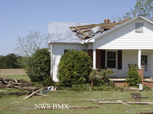
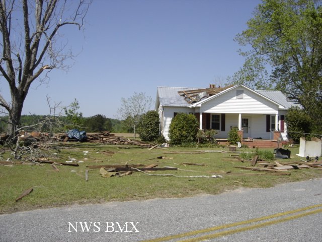
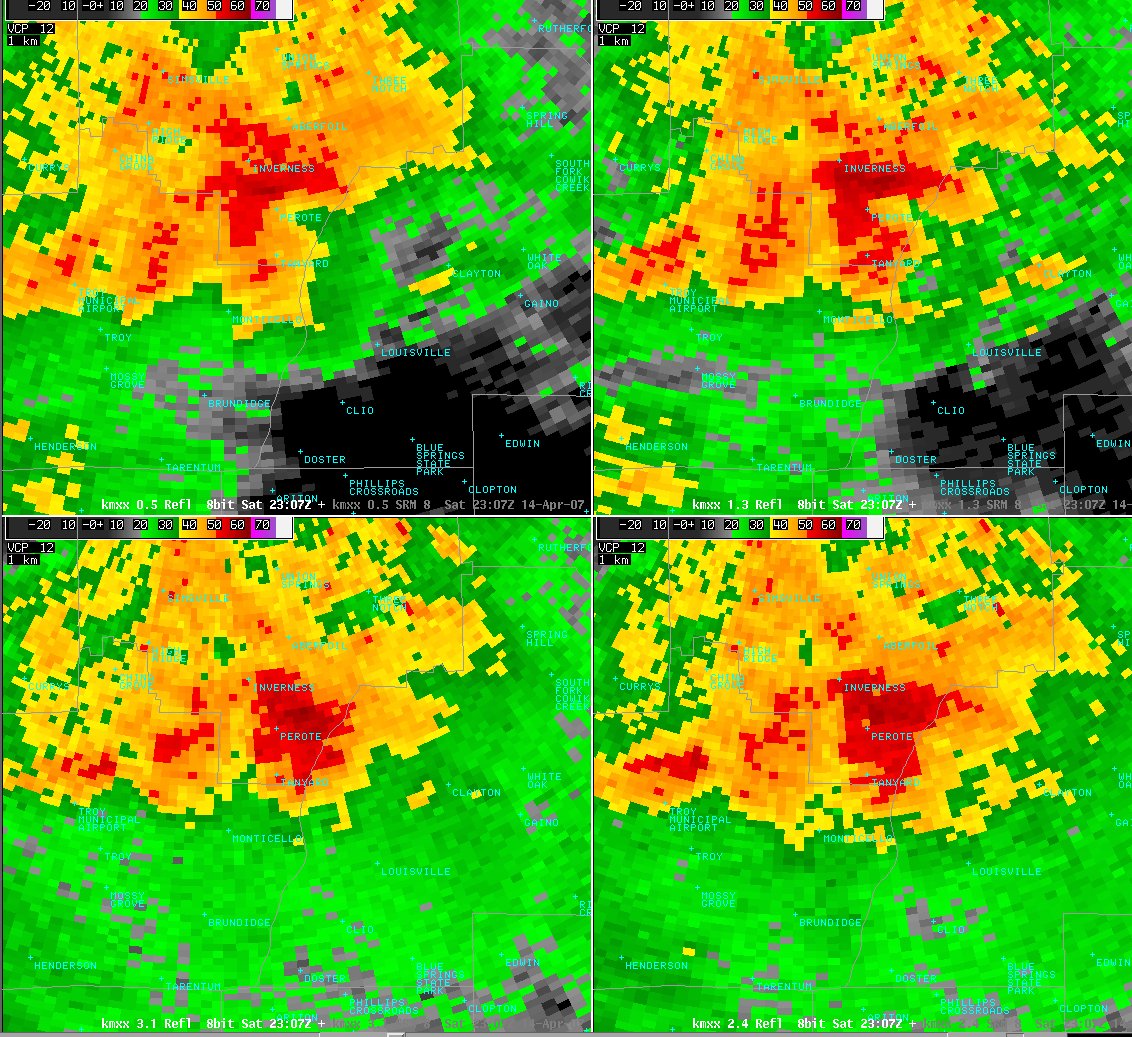
National Weather Service meteorologists surveyed storm damage in far southern Bullock County. It has been determined that the damage was the result of a tornado. The tornado has been rated an EF-1 on the Enhanced Fujita Scale with estimated maximum winds around 100 mph.
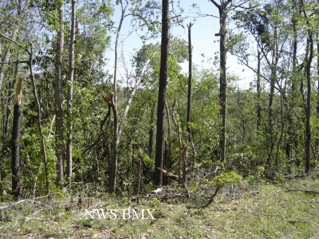
A tornado touched down about one mile southwest of the intersection of US Highway 29 and County Road 53 around 611 PM CDT. The tornado tracked northeast and was on the ground for 3 miles. The tornado damage path was 100 yards wide at its widest point. One barn was completely destroyed near the Jamback Community. Numerous trees were uprooted or snapped off along the path. Several homes sustained minor roof damage. A Tornado Watch was in effect for Bullock County from 1030 AM CDT until 1100 PM CDT. A Tornado Warning was in effect for Bullock County from 602 PM CDT until 630 PM CDT.
Click on the images below for larger picture.
|
|
||||||||||||||||||||||||


 Follow us on YouTube