|
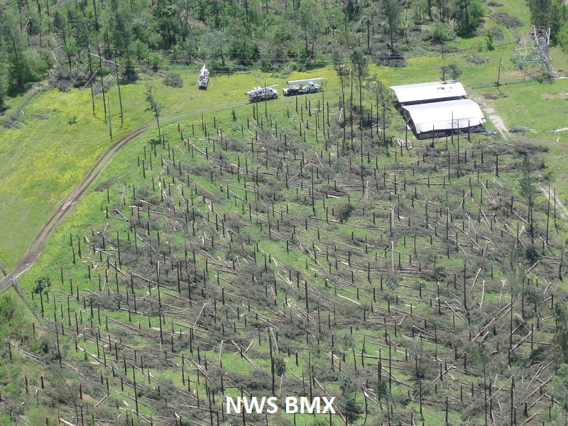
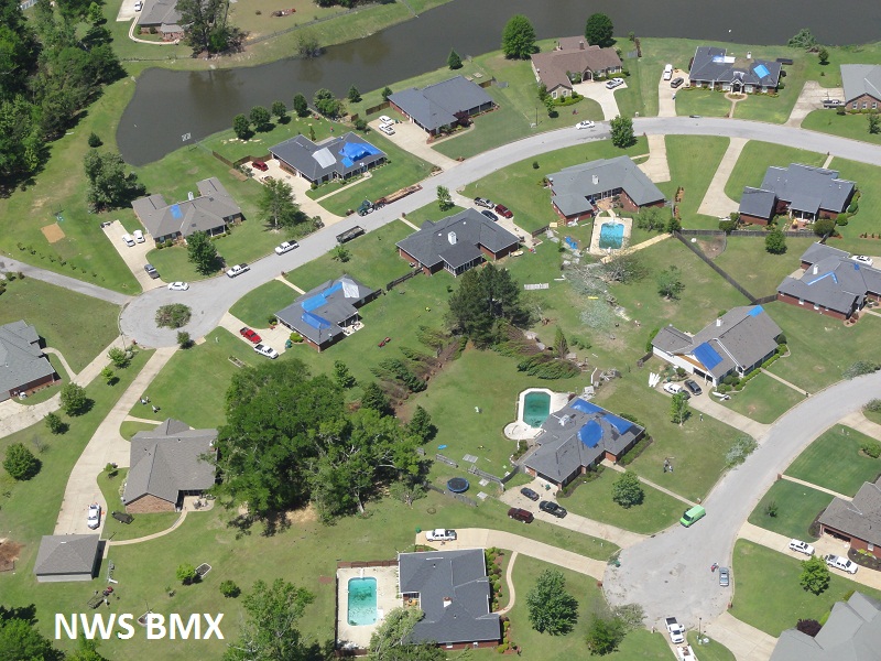
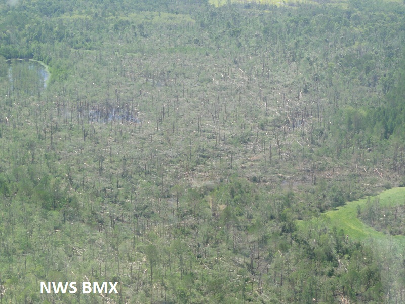
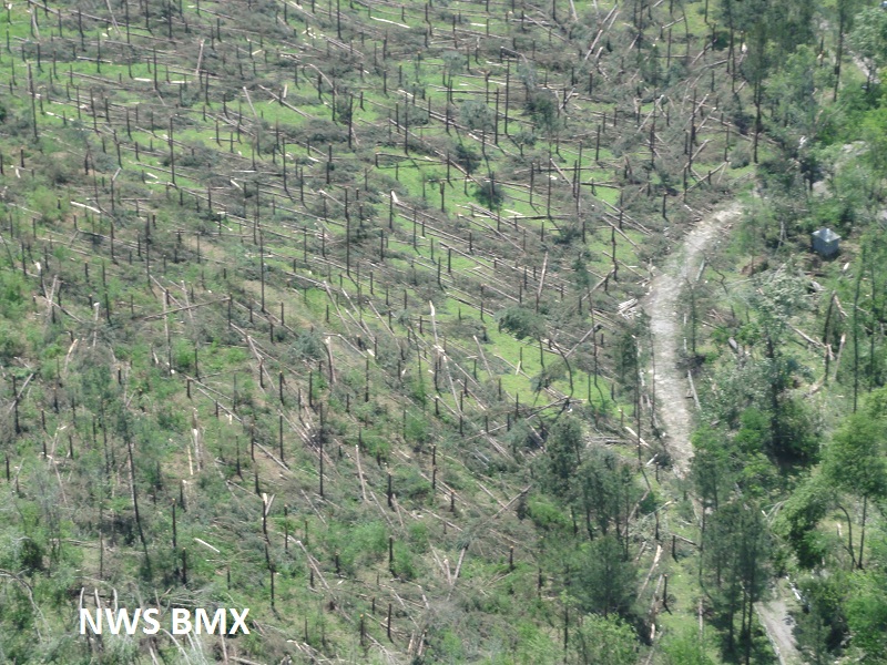
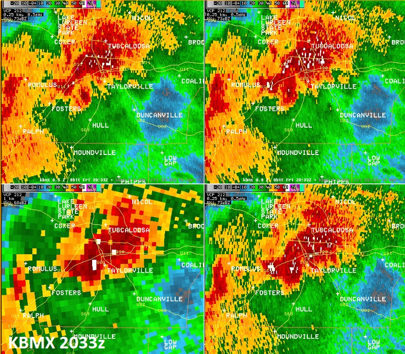
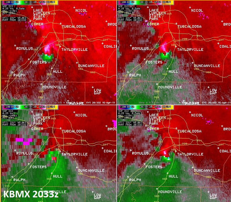
National Weather Service meteorologists surveyed the damage in far northeastern Greene and south central Tuscaloosa Counties. It has been determined that the damage was consistent with a tornado. Winds were estimated at 140 mph. The tornado touched down north of County Road 86 in Greene County, about 3 miles southeast of Ralph, uprooting dozens of hard and softwood trees. From there, the tornado traveled northeast and moved parallel to and less than 2 miles east of the Interstate 20/59 corridor. The tornado snapped and uprooted many trees along the way. The most significant damage occurred as the tornado crossed the Black Warrior River near Maxwell Loop Rd. Hundreds of trees were snapped or uprooted and a power transmission tower was crushed. The tornado continued northeast and moved north of Shelton State Community College and crossed Alabama Highway 69 near Taylorville and the Interstate 20/59 corridor near Alabama Highway 82. Along this path, damage consisted of snapped or uprooted trees and structural damage to homes and businesses. The tornado lifted near Mayfair Drive, south of Veterans Memorial Parkway. The tornado damage path was 18.37 miles long and was 500 yards wide at its widest point.
A Tornado Warning was in effect from 241 pm until 345 pm.
|


 Follow us on YouTube