|
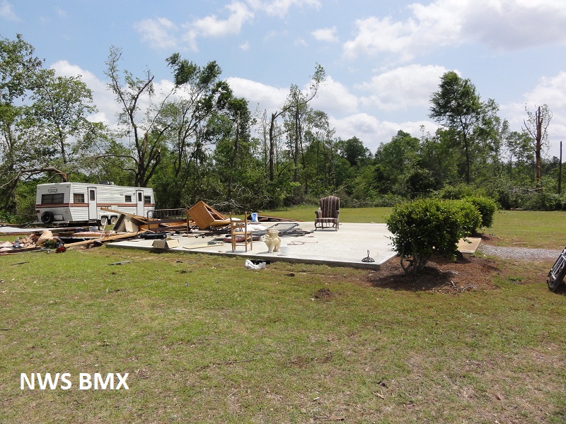
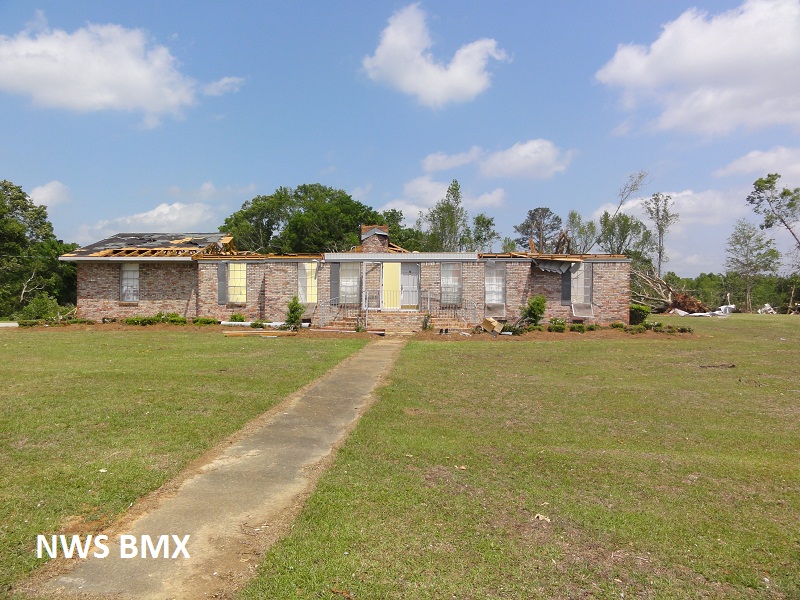
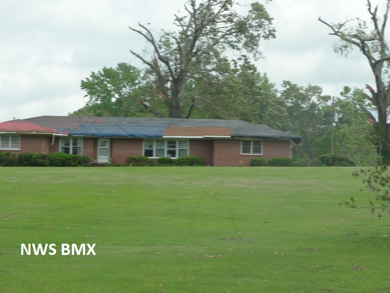
National Weather Service meteorologists surveyed the damage near the Pinhook Community. It has been determined that the damage was consistent with a tornado. Winds were estimated at 130 mph. The majority of damage sustained was hardwood and softwood trees being snapped and uprooted. One brick home had the entire roof and several exterior walls destroyed. Several other homes sustained significant roof damage, as well. The tornado touched down along Old Locke 3 Road and tracked northeastward into the Pinhook Community. The tornado lifted just after it crossed Alabama State Highway 28. The tornado damage path was 5.4 miles long and was 575 yards wide at its widest point.
A Tornado Warning was in effect from 441 pm until 545 pm.
|


 Follow us on YouTube