|
A National Weather Service Damage Assessment Team has surveyed the storm damage in Marion County. It has been determined the damage was the result of a tornado. The tornado has been rated an EF-0 on the Enhanced Fujita Scale. Damage estimates were consistent with winds around 80 mph.
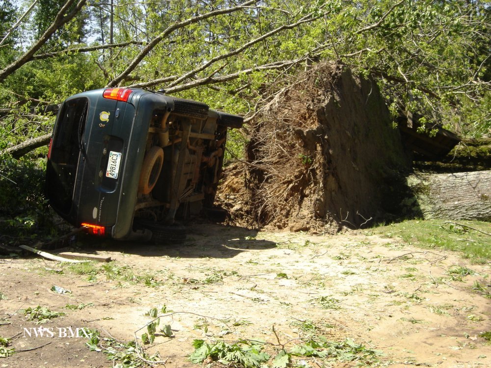
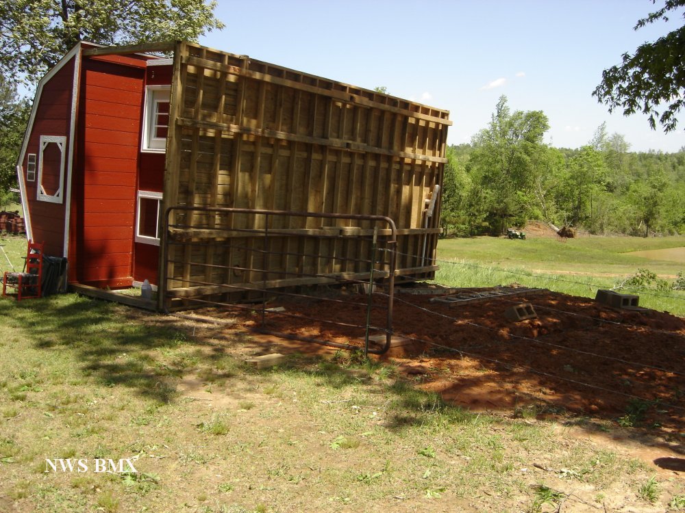
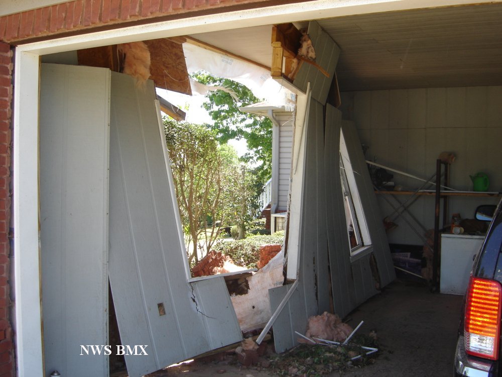
A weak tornado formed just south of the Gu-Win and tracked northeastward. The tornado crosses Highway 78 and lifted on the southwest side of Brilliant. The tornado created a non-continuous damage path for a little more than 7 miles. Three homes took the brunt of the damage. The homes were located southwest of Brilliant along County Road 47. One home had minor damage due to fallen trees. One of these trees uprooted and flipped a minivan upside down. The second home had minor roof damage and two outbuildings on the property were destroyed. The third home incurred major structural damage when the windward side of the garage was blown in. There was also an outbuilding that flipped over at the third home location. In total, there were approximately 40 to 60 hardwood trees were uprooted along the path. The tornado damage path was 7.22 miles long and was 200 yards wide at its widest point.
|


 Follow us on YouTube