|
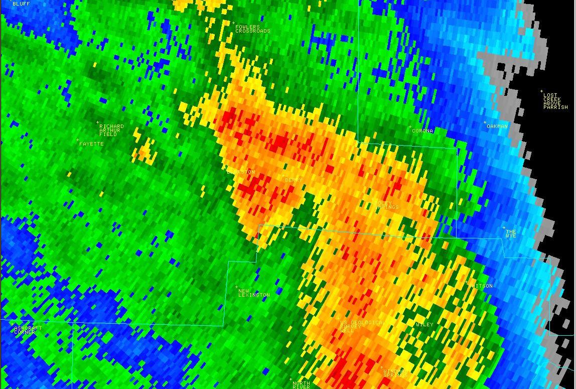
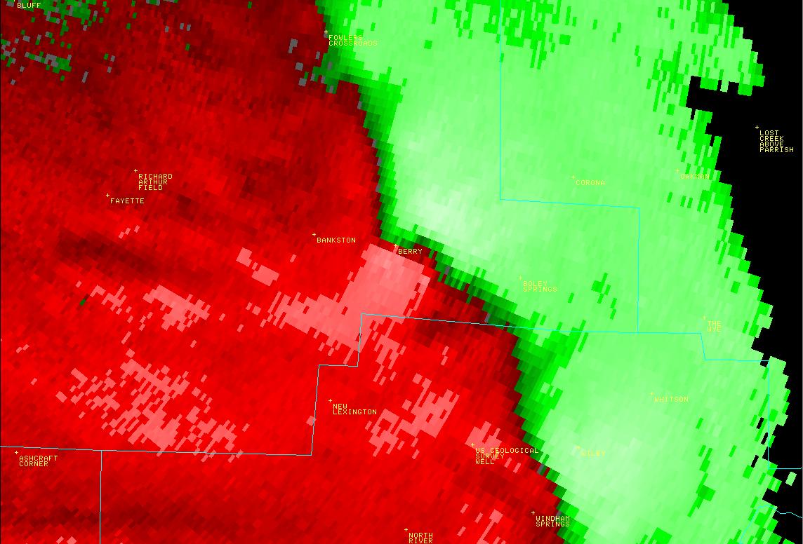
National Weather Service meteorologists surveyed damage across southeastern Fayette County. It has been determined that the damage was consistent with a tornado. Winds were estimated at 100 mph. A tornado developed along a Quasi-Linear Convective System. It touched down in southeast Fayette County southwest of Berry, east of AL Hwy 13, along AL Hwy 18. This tornado maintained a small path width that averaged around 0.10 mile (176 yds). The tornado track paralleled AL Hwy 13 where it damaged several barns and knocked down many trees. The tornado moved through downtown Berry, where numerous businesses and homes sustained roof and wall damage. The damage was consistent with an EF1 rating and winds of 100 mph. As the tornado moved northeast of town, it weakened and dissipated near AL Hwy 18 and Simmons Rd.
|


 Follow us on YouTube