|
National Weather Service meteorologists surveyed the damage path from eastern Jefferson County northeast to Cherokee County. It has been determined that the damage was consistent with a strong tornado, which was a regeneration of the Greene-Tuscaloosa-Jefferson County tornado. As it intially touched down, the tornado caused mostly tree damage with winds of 95 mph, an EF-1 rating, as it moved east. The tornado crossed Interstate 59 near Argo and moved into St. Clair County.
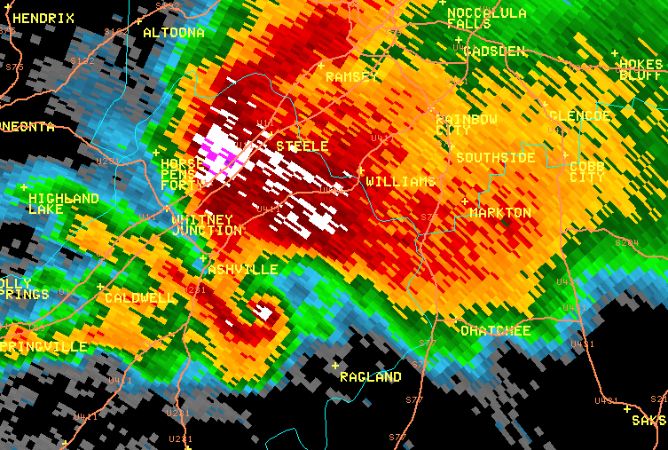
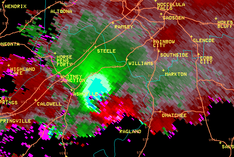
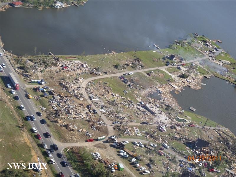
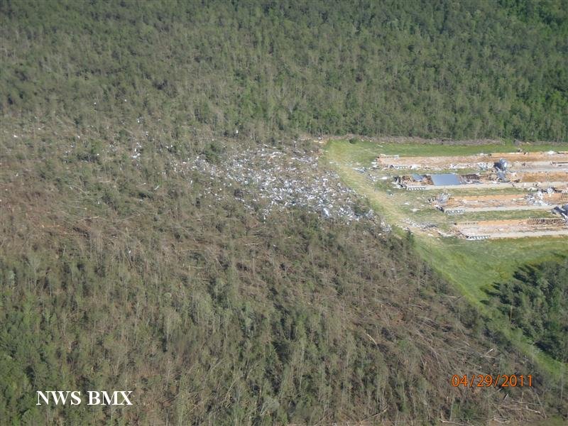
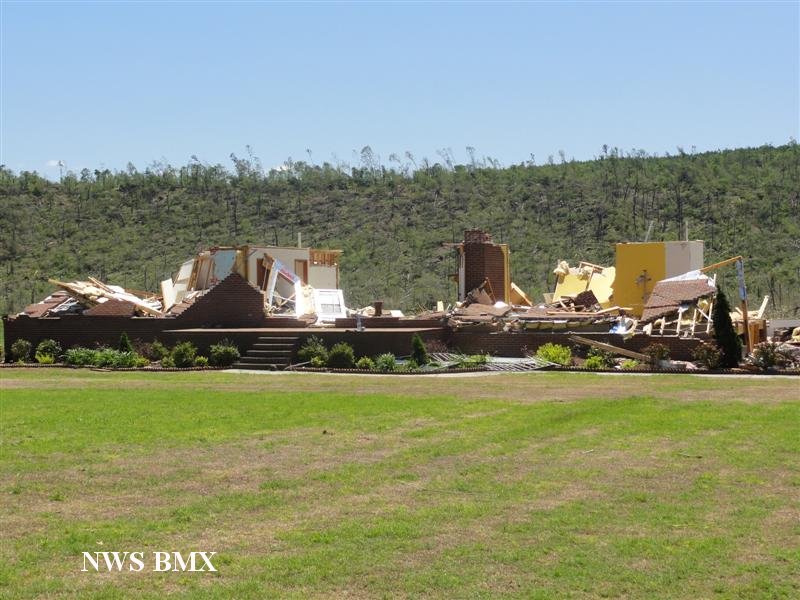
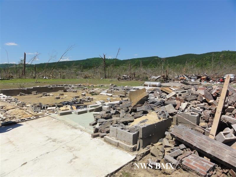
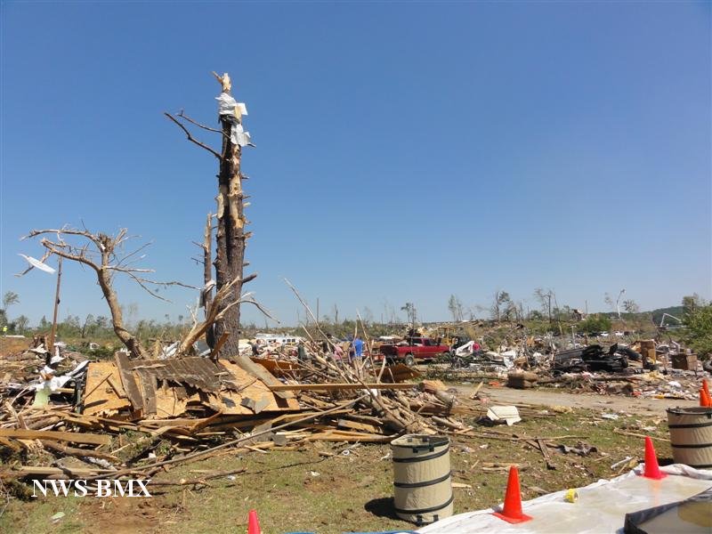
The tornado crossed into St. Clair County near Argo where it caused mostly tree damage consistent with an EF-1 rating as it tracked north of Margaret. The tornado began to strengthen as it neared US Hwy 411 where it caused minor roof damage to one home. The tornado crossed US Hwy 411 north of Odenville, taking a turn to the northeast, and then moved parallel to Shoal Creek. The tornado strengthened rapidly to an EF-4 with winds of 170 mph, and caused extensive damage along Shoal Creek Rd, east of CR 26. At least 6 homes were destroyed, with only small interior rooms remaining. At least one home was swept clean from the foundation. Many mobile homes were also destroyed. In addition, tree damage was extensive in this area, with every tree left mangled. At least 14 fatalities occurred along Shoal Creek Rd. The path width increased to around 1 mile as the tornado approached Neely Henry Lake and the Calhoun County line. The tornado maintained a path along Shoal Creek Rd until it crossed the lake.
The tornado crossed Neely Henry Lake and into Calhoun County at Eagle Cove Rd., northwest of Ohatchee. At this point, the tornado had winds of 180 mph, an EF-4 rating, and a path width of 1 mile. As the tornado crossed AL Hwy 77, numerous homes were leveled and mobile homes were demolished. Trees were left as stumps. Four fatalities occurred in this area. The tornado continued to cause extensive damage as it moved northeast crossing US Hwy 431 at Colwell and CR 23, where several homes and one church were destroyed. Four fatalities occurred in this area. As the tornado approached the Etowah County line, it weakened to an EF-2 with winds of 120 mph, but continued to cause damage. Several homes were damaged and one mobile home destroyed along CR 64. The tornado moved into Etowah County east of Cannonball Rd.
The tornado moved into southeastern Etowah County, east of Cannon Gap Rd, where it caused mainly tree damage consistent with an EF-1 rating and winds of 100 mph. This tornado just clipped the corner of the county. The tornado crossed back into Calhoun County, just south of US Hwy 278. As the tornado crossed US Hwy 278, several homes sustained significant roof damage, consistent with an EF-1 rating and winds of 95 mph. Additional homes were damaged along the Calhoun/Cherokee County line. Significant tree damage was noted along this portion of the path. The tornado crossed into Cherokee County north of the intersection of US Hwy 278 and CR 19. One fatality occurred along this portion of the tornado path.
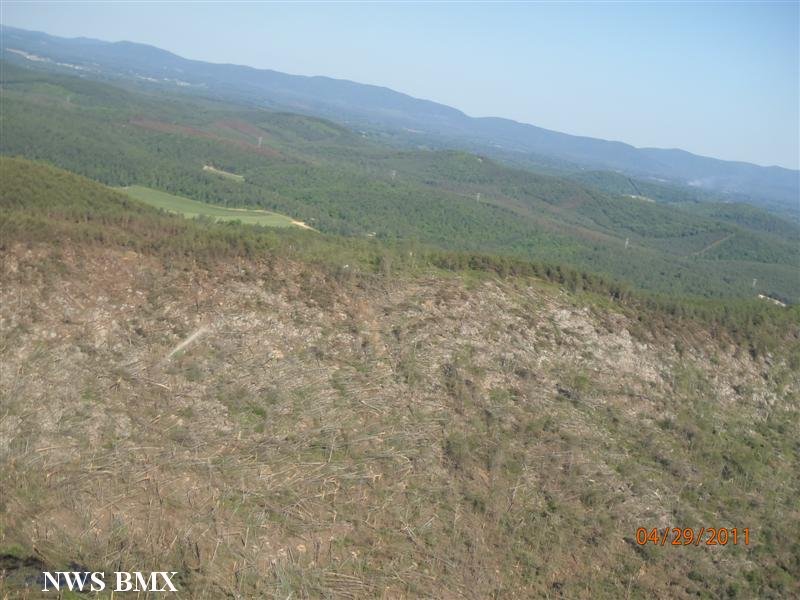
The tornado moved into southwestern Cherokee County south of Estes Crossroads, along CR 19. As the tornado continued northeast, it strengthened as it moved south of Gnatville, to an EF-2 rating with winds of 120 mph. Extensive tree damage was noted along CR 6 and several mobile homes sustained significant damage off of CR 447. The tornado strengthened further to an EF-3 rating with winds of 150 mph as it crossed AL Hwy 9 south of Coloma. A single family home was destroyed on CR 31. The tornado weakened slightly as it crossed Frog Mountain, but continued to knock down trees and damage an outbuilding. The tornado re-strengthened as it crossed CR 45 north of Rock Run. Damage along CR 29 south of Forney was consistent with an EF-3 rating and winds of 160 mph. Several well built homes were completely destroyed. The tornado weakened as it moved toward the Alabama/Georgia stateline, but continued to cause significant tree damage consistent with an EF-1 rating and winds of 105 mph. Along the path, hundreds of structures were damage and destroyed, and many thousands of trees were uprooted, snapped, and reduced to spiked stumps. The tornado then moved into Georgia at County Road 28.
After moving out of Alabama, this storm was not done. It passed through 3 counties in Georgia, injuring 4 more people as it strengthened back into an EF-2 in Polk and Floyd Counties before weakening to an EF-1 in Bartow County. In all, the total path length was 97.33 miles.
Tornado Warnings were in effect for Jefferson, St. Clair, Calhoun, Etowah and Cherokee Counties from 618 pm until 800 pm.
|


 Follow us on YouTube