|
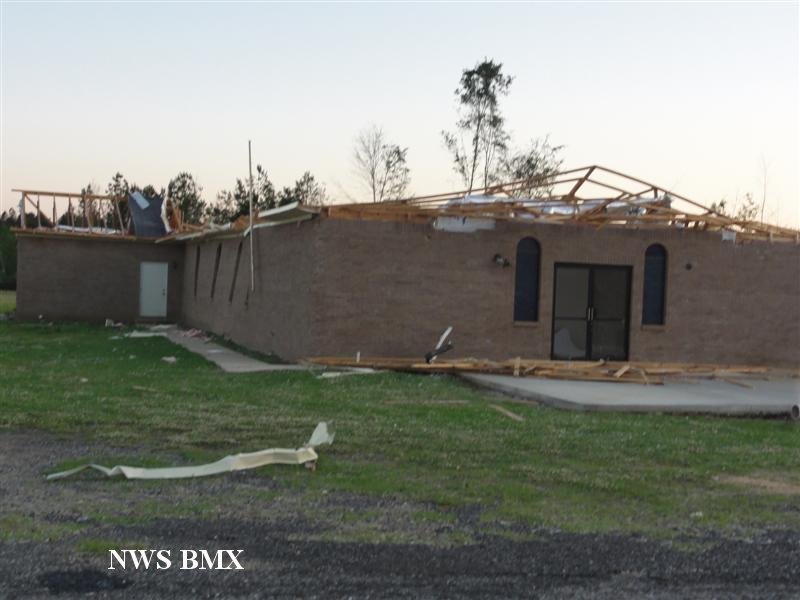
National Weather Service meteorologists surveyed multiple tracks across Greene, Hale and Bibb Counties. It has been determined that the damage was consistent with a strong tornado. The tornado touched down in far southwest Greene County near the Tombigbee River just West of Tishabee on County Road 69 near Head Drive, and headed northeast across rural Greene County north of Forkland. At least 4 mobile homes, 3 outbuildings, and 2 churches were damaged or destroyed along with numerous trees. Two minor injuries were noted in Greene County. The track started as an EF-1 but increased to an EF-2 rating while in Greene County.
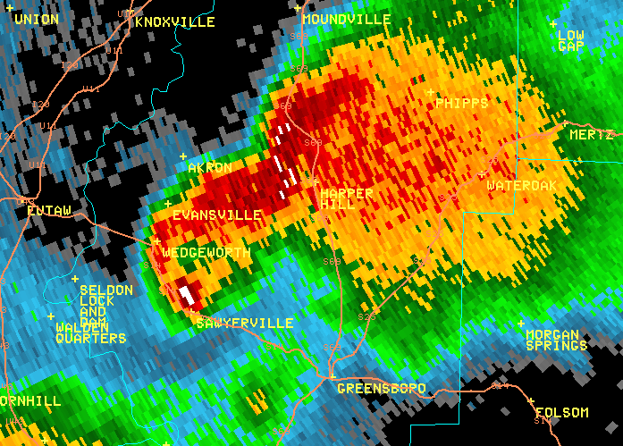
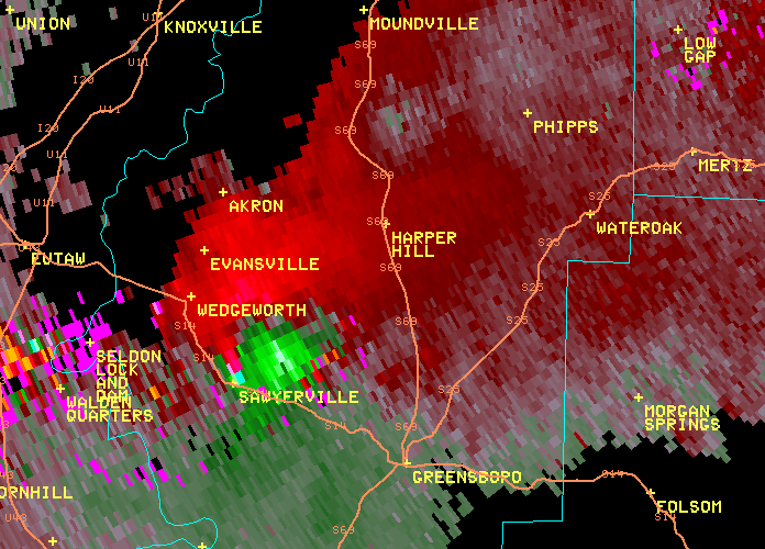
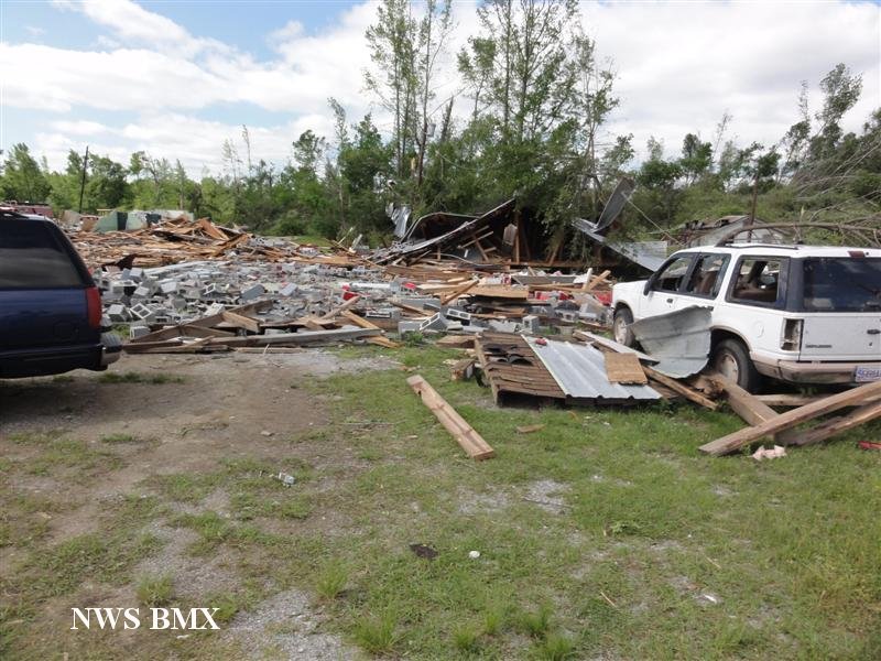
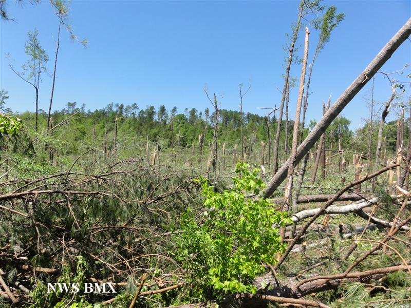
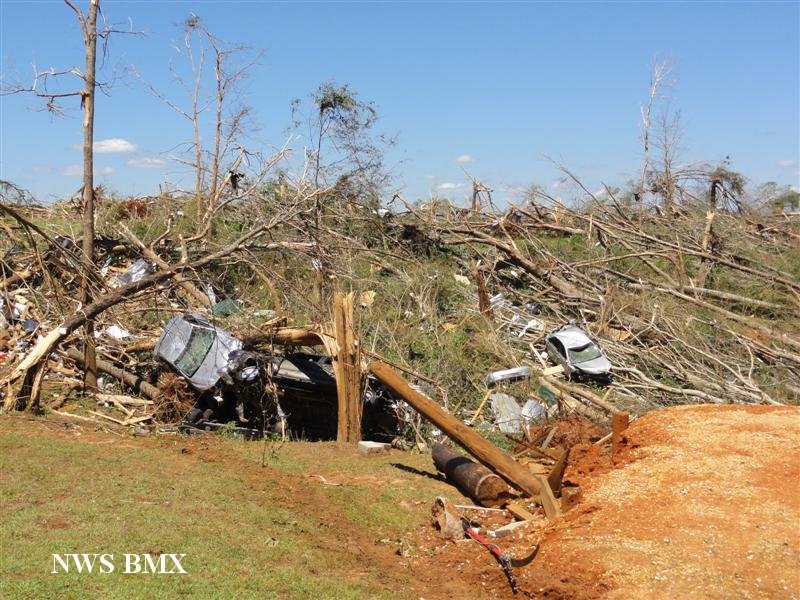
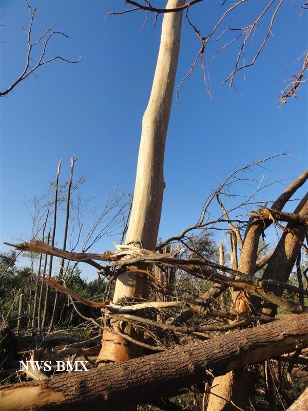
The tornado crossed the Black Warrior River and into Hale County west of Sawyerville. The tornado crossed AL Route 14, just north of Sawyerville, where it intensifyed to an EF-3 rating with winds of 145 mph. As the tornado continued northeast, it crossed CR 18, CR 21, AL Hwy 69 south of Harper Hill, and CR 29 east of Ingram. Extensive structural damage was noted in the these locations, which resulted in at least 40 injuries and 6 fatalities. Numerous mobile homes and single family homes and one church were damaged or destroyed. Thousands of trees were knocked down. The tornado moved into the Talladega National Forest near Ingram, where it caused significant tree damage to the Bibb County line.
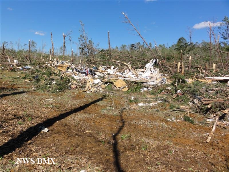
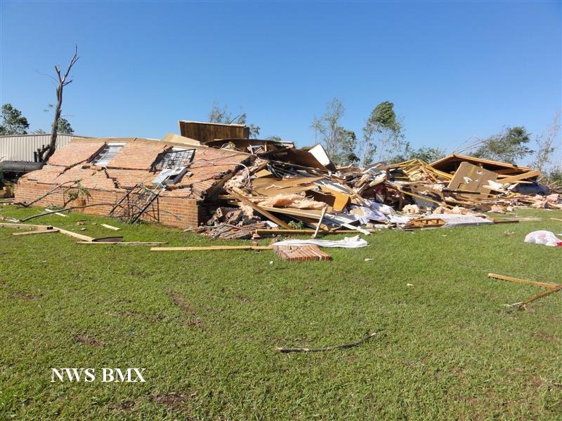
The tornado tracked northeastward where it caused significant tree damage in the national forest. The tornado moved through Eoline and caused significant structural damage consistent with an EF-3 rating and winds of 145 mph. Numerous mobile homes and single family homes sustained minor to major damage. A dozen mobile homes and single family homes were destroyed. In addition, the Eoline Fire Dept and another business were destroyed. One fatality occurred in a vehicle near the fire dept. At least 10 other injuries were noted. The tornado continued northeast and crossed AL Hwy 5, south of West Blocton where it weakened slightly to an EF-2 with winds of 125 mph. Several mobile homes and single family homes sustained major damage or were destroyed near CR 26. Along the path, thousands of trees were downed. The tornado continued to weaken and lifted just northeast of Marvel.
Tornado Warnings were in effect for Greene, Hale and Bibb Counties from 450 pm until 745 pm.
|


 Follow us on YouTube