|
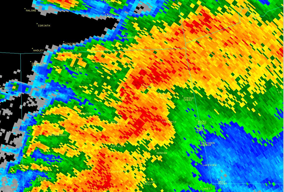
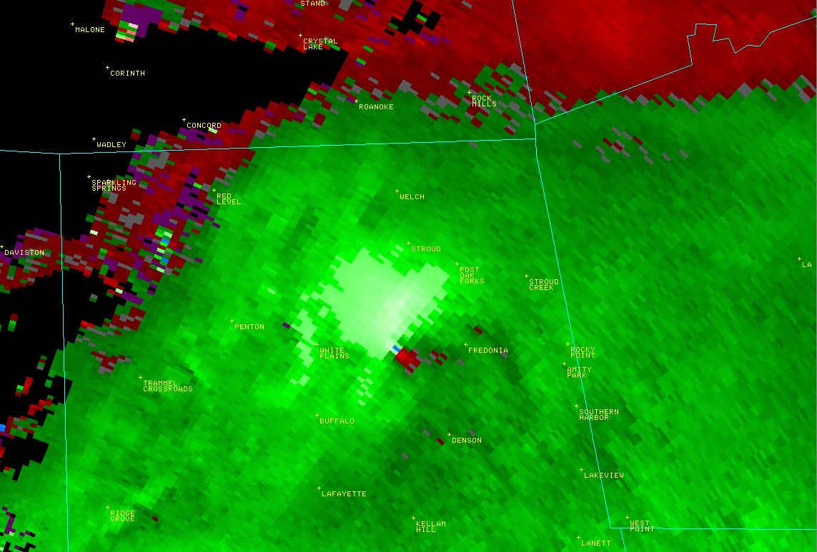
National Weather Service meteorologists surveyed damage across Chambers County which impacted the White Plains area. It has been determined that the damage was consistent with a tornado. This tornado touched down 2 miles southeast of White Plains, along CR 225, where it downed several trees and caused major damage to a single family home. The tornado moved east northeast and crossed CR 178 and 176 where numerous trees were knocked down. The tornado crossed CR 222 and lifted near CR 267 where additional trees were knocked down. Damage along the path was consistent with an EF-1 rating with winds up to 110 mph.
A Tornado Warning was in effect for Chambers County from 9 pm until 10 pm
|


 Follow us on YouTube