Mother's Day Severe Weather Outbreak
May 10th & 11th, 2008
Event Summary for Central Alabama
Severe weather developed late Saturday evening, May 10th, across Central Alabama and continued into the early morning hours on Mother's Day, May 11th. Damaging winds, large hail, tornadoes, continuous lightning and minor flooding were all produced by these thunderstorms.
A warm front moved very slowly northward through Central Alabama on May 10th. The atmosphere in the vicinity of the front and southward was extremely unstable. Additionally, moisture was pooling along and south of the front. On Saturday, warm air just above the surface, referred to as a cap, limited the strength and overall development of thunderstorms for much of the day. An upper level disturbance moved from west to east over Central Alabama late Saturday evening into early Sunday morning. This disturbance had several effects which aided the development of much stronger and more widespread thunderstorms. This disturbance eroded the cap, produced much stronger winds just above the surface, and pushed a cold front through the region. Therefore, the overall environment was characterized by high wind shear and moderate cape. This severe weather episode was highlighted in the Birmingham Hazardous Weather Outlook several days before its subsequent occurrence.
Tornado Watches were in effect for portions of Central Alabama between 700 pm and 800 am May 10th into May 11th.
Identified Damage Areas;
EF-1 Heflin Tornado - Cleburne County
EF-1 Sunlight Tornado - Walker County
EF-0 Northeast Walker County Tornado
(EF-2 in Cullman County)
(Click for EF Scale)
Severe Weather Episode Data
Surface Analysis
May 10th 6 am
500 mb Chart
May 10th 6 am
Surface Analysis
May 11th 6 am
500 mb Chart
May 11th 6 am
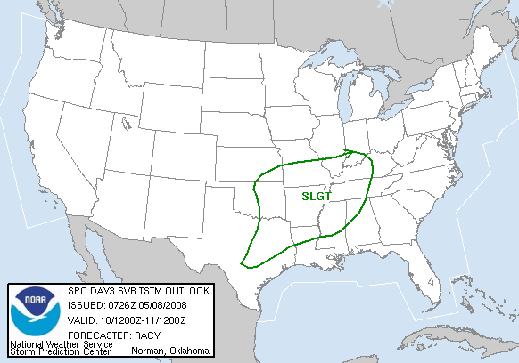
Day 3 Severe Weather Outlook
Issued May 8th
Day 3 Probabilistic Outlook
Issued May 8th
Day 2 Severe Weather Outlook
Issued May 9th
Day 2 Probabilistic Outlook
Issued May 9th
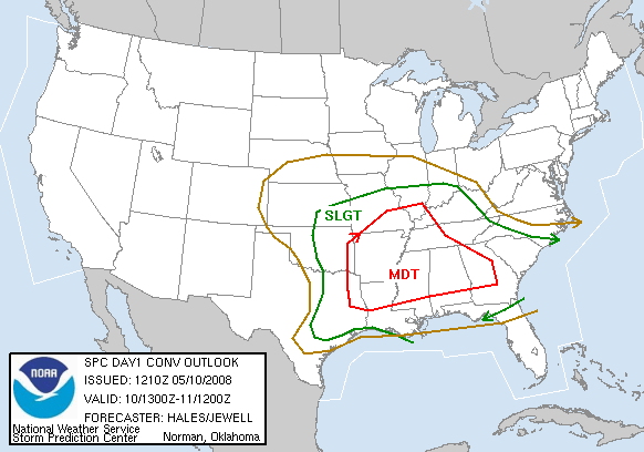
Day 1 Severe Weather Outlook
Issued May 10th
Day 1 Probabilistic Outlook
Issued May 10th
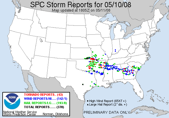
Preliminary Severe Weather Reports
May 10th/11th
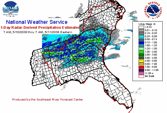
24 Hour Rainfall Estimate
Ending 6 AM May 11th


 Follow us on YouTube