Hale County Severe Thunderstorm - July 26, 1998
A severe thunderstorm caused damage across parts of Hale County on the evening of Sunday, July 26 th, 1998. The storm did damage to structures and trees just west of the Havana area. The swath of damage was in a fan pattern consistent with straight line winds as determined by a National Weather Service survey team.
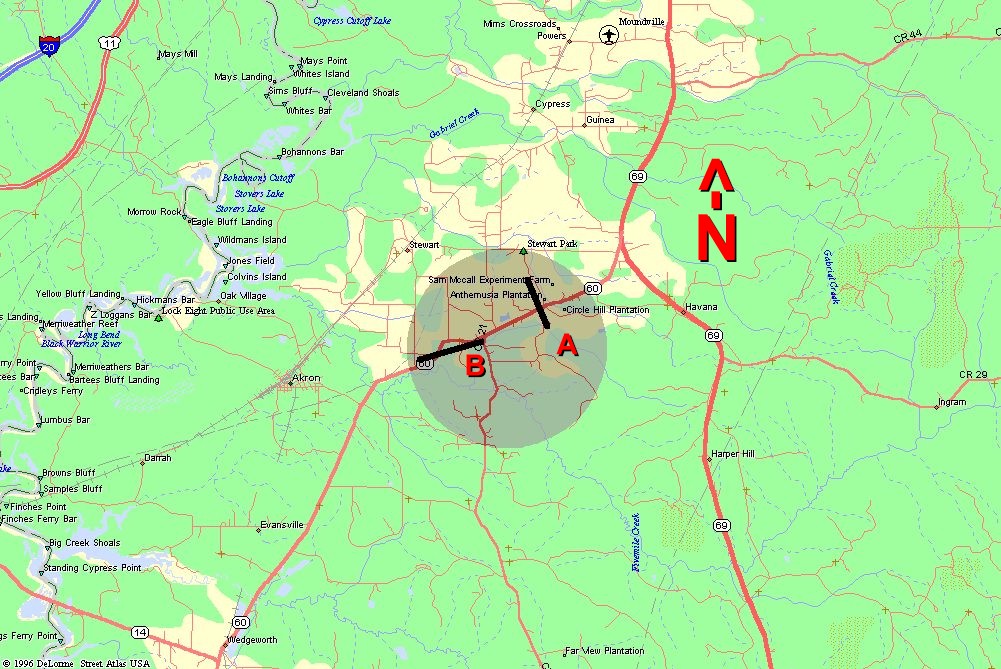
This map shows the damage path caused by the high winds. Path A's damage swath indicated that the destructive winds were blowing toward the northwest. The winds occurring along Path B were blowing westward.
Radar images showed that the storm over this area was enhanced by an eastward moving outflow boundary that emanated from a cluster of storms just to the west.
Click on an image to get a larger view.
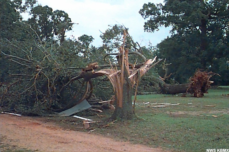 |
Trees blown down. |
 |
This shows the front of a building that was damaged. This building used to have a roof that hung over the front of the structure. Wind blowing towards the front of the building lifted the overhang causing damage to structure. Tin from the roof was blown into the tree behind the building, visible in the upper right corner. |
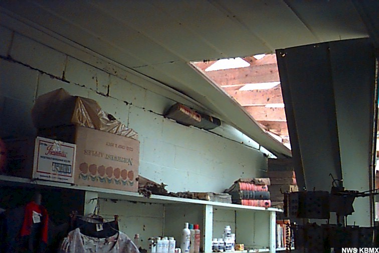 |
Same building as shown above. Interior shot. Notice the ledgers in the middle of the image in the wall. As roof lifted, ledgers were blown into the gap. The roof then dropped back on top of the ledgers. |
 |
Mobile home rolled off its foundation. |


 Follow us on YouTube