National Weather Service United States Department of Commerce


Isolated Tornado Damage on October 13, 2014


An upper level weather system and surface cold front approached Central Alabama from the west on October 13th and kicked off several rounds of thunderstorms that afternoon and evening across Central Alabama. Isolated supercells and clusters of severe thunderstorms developed in the warm sector during the afternoon hours, well out ahead of an organized squall line in the lower Mississippi Valley. The squall line weakened as it approached Central Alabama and continued to weaken as it moved eastward. There were numerous reports of tree damage and structures damaged by trees. Most of the damage appeared to be caused by straight-line winds, but there were at least two tornadoes.

 
Shottsville (Marion Co) EF-0 Henson Springs Rd (Lamar Co) EF-0
 

Shottsville (Marion) EF-0 Tornado

 
EF-0
Estimated Maximum Wind:
75-85 mph
Injuries/Fatalities:
None
Damage Path Length:
6.0 miles
Maximum Path Width:
50 yards
Approximate Start Point/Time:
34.2080/-88.1077 at 443 pm 
Approximate End Point/Time:
34.2878/-88.0658 at 452 pm
 

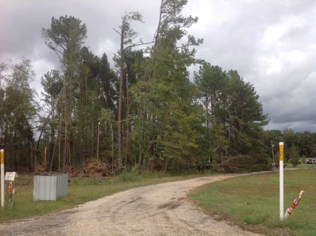
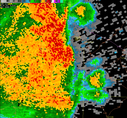
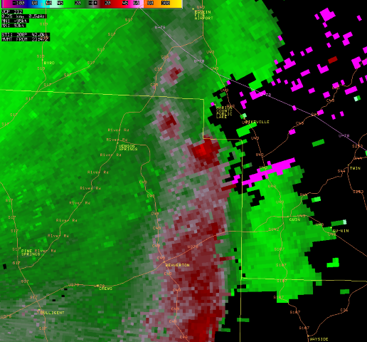
National Weather Service meteorologists surveyed the damage in western Marion County and have determined that the damage was the result of an EF-0 tornado. A weak tornado touched down north of Interstate 22/US Highway 78 northeast of the intersection of Taylor Road and County Road 11. Along County Road 11, ten to twenty pine trees were uprooted in a convergent pattern, with damage caused to a church by falling trees. The tornado paralleled County Road 11 briefly, causing mainly sporadic tree damage, and then continued northeast over open fields and forest. As it crossed County Road 157 north of County Road 56, several trees were uprooted and tin was pealed back on a farm building. It continued northeastward with very minor damage, crossing County Road 309 and Reid Road. The last damage along the path occurred on County Road 13 just west of Alabama Highway 19, where several pine trees were uprooted. The tornado dissipated rapidly beyond this point.


View larger map

Damage Point legend
  Download in KML         Shapefile Information
 
 
Radar Data 

Radar Reflectivity Image
This is an image of the 0.5 degree reflectivity data from KGWX at 449 pm as the weak tornado crossed CR 157 just west of AL Hwy 19.
Click to enlarge.

Radar Storm Relative Velocity Image
This is an image of the 0.5 degree velocity data from KGWX at 449 pm as the weak tornado crossed CR 157 just west of AL Hwy 19.
Click to enlarge.


Storm Damage Images - Click to Enlarge

Storm Damage Image
  Roof damage

Storm Damage Image
Tree damage


Henson Springs Rd (Lamar) EF-0 Tornado
 
EF-0
Estimated Maximum Wind:
75-85 mph
Injuries/Fatalities:
None
Damage Path Length:
1.1 miles
Maximum Path Width:
150 yards
Approximate Start Point/Time:
34.0087/-88.0010 at 648 pm 
Approximate End Point/Time:
34.0209/-87.9893 at 650 pm
 

National Weather Service meteorologists surveyed the damage in extreme northeast Lamar County and have determined that the damage was the result of a brief EF-0 tornado. The weak tornado touched down in extreme northeastern Lamar County north of Beaverton. The tornado touched down just to the southwest of Henson Springs Road and continued to the northeast. The only damage observed was along Henson Springs Road where 20-30 trees were either uprooted or snapped. Most of the trees were facing northeast but there were indications of convergent damage. No structural damage was observed in the area. The tornado continued to the northeast over mostly forest and open farm land. The tornado lifted just to the southeast of the Pikeville Country Club before entering Marion County. The start and end points are approximate due to limited road access in the area.


View larger map

Damage Point legend
  Download in KML         Shapefile Information
 
 
Radar Data 

Radar Reflectivity Image
This is an image of the 0.5 degree reflectivity data from KGWX at 649 pm as the weak tornado crossed Henson Springs Rd.
Click to enlarge.

Radar Storm Relative Velocity Image
This is an image of the 0.5 degree velocity data from KGWX at 649 pm as the weak tornado crossed Henson Springs Rd.
Click to enlarge.


Storm Damage Images - Click to Enlarge

Storm Damage Image
  Tree damage