Tropical Storm Fay
August 24th & 25th, 2008
Event Summary for Central Alabama
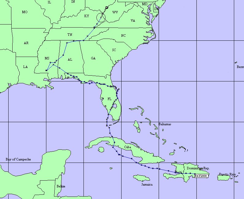
Tropical Storm Fay formed Friday afternoon, August 15th, over the Dominican Republic. The storm moved rather slowly west-northwest and dumped very heavy rain on the Dominican Republic and Haiti. Numerous fatalities occurred as a result of flash flooding. Fay then turned northward and crossed the western part of Cuba early on Monday, August 18th.
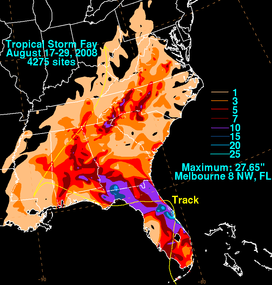
Fay then made four distinct landfalls along the Florida Peninsula from August 19th through August 23rd. As Fay meandered slowly northward, rainfall amounts added up quickly. Measurements of 10 to 20 inches were common with isolated totals as high as 25 to 30 inches. Damaging wind gusts and tornadoes also affected the peninsula during this time.
Fay became a Tropical Depression as it entered Far Southwestern Alabama early Sunday morning, August 24th. A few damaging wind gusts and very heavy rain fell across parts of Alabama and Georgia from Friday, August 22nd through Tuesday, August 26th. Rain amounts of 5 to 10 inches were common with isolated locations just over 10 inches.
Fay finally exited northeastward and into the Appalachians early Wednesday, August 27th. Fay then dissipated Thursday, August 28th over Eastern Kentucky.
The five day rainfall amounts reported from Friday, August 22, 2008 at 7 AM through Wednesday, August 27, 2008 at 7 AM can be found at the link below. The rain fell in association with the remnants of Fay. A majority of the heavy rain fell over two days, Saturday, August 23rd and Monday, August 25th. These reports are sorted by county, and they are to be considered unofficial as they have not been quality controlled. The rainfall table can be found...HERE.
Central Alabama had been experiencing a drought over the past few years. Area river and stream levels were running at 10 to 20 percent of normal before the tropical rainfall occurred. Although rain amounts were quite significant for Central Alabama, flash flooding was very limited and mainstem river flooding was not a large problem. Catoma Creek in Montgomery did go above flood stage and produced minor flooding. Several other locations went above caution stages, but no flooding was observed. Localized heavy rainfall, with rain rates as high as 5 inches per hour, was observed in several spots. The heavy rain produced quite a bit of nuisance flooding areawide. Some flash flooding occurred near Troy (Pike County), Eufaula (Barbour County), Alabaster (Shelby County), Talladega (Talladega County), Springville (St. Clair), and Bessemer and Pinson (Jefferson County).
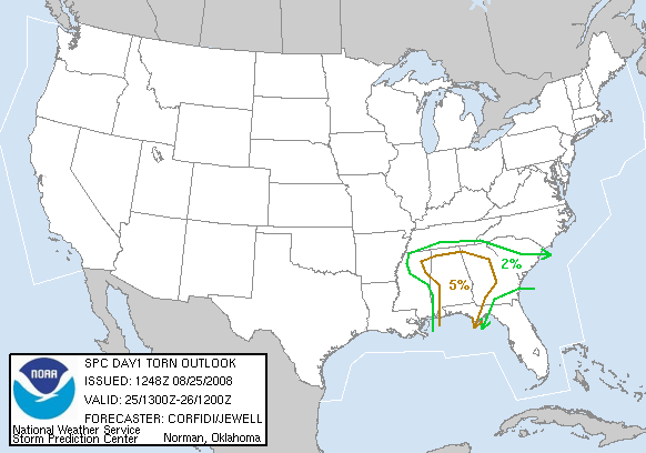
Preliminary data suggested that 11 tornadoes occurred in association with Fay`s remnants across Central Alabama. The vast majority of the tornadoes were produced in banding features on Monday, August 25th. The tornado producing storms exhibited little if any lighting at all. Many of the tornado occurrences were observed by several witnesses and captured with video and pictures. The times listed are approximated.
|
Identified Damage Areas: EF-0 Emerald Mountain Tornado - Elmore County EF-0 Elmore-Coosa County Line Tornado EF-0 Arley Tornado - Winston County EF-0 I-65 Tornado - Autauga County EF-0 Needmore Tornado - Pike County EF-1 St. Clair Springs Tornado - St. Clair County EF-1 Inland Lake Tornado - Blount County EF-2 Five Points Tornado - Cleburne County EF-1 Sugar Valley Subdivision Tornado - Calhoun County EF-1 Choccolocco Tornado - Calhoun County |
|
Weather Episode Data
|
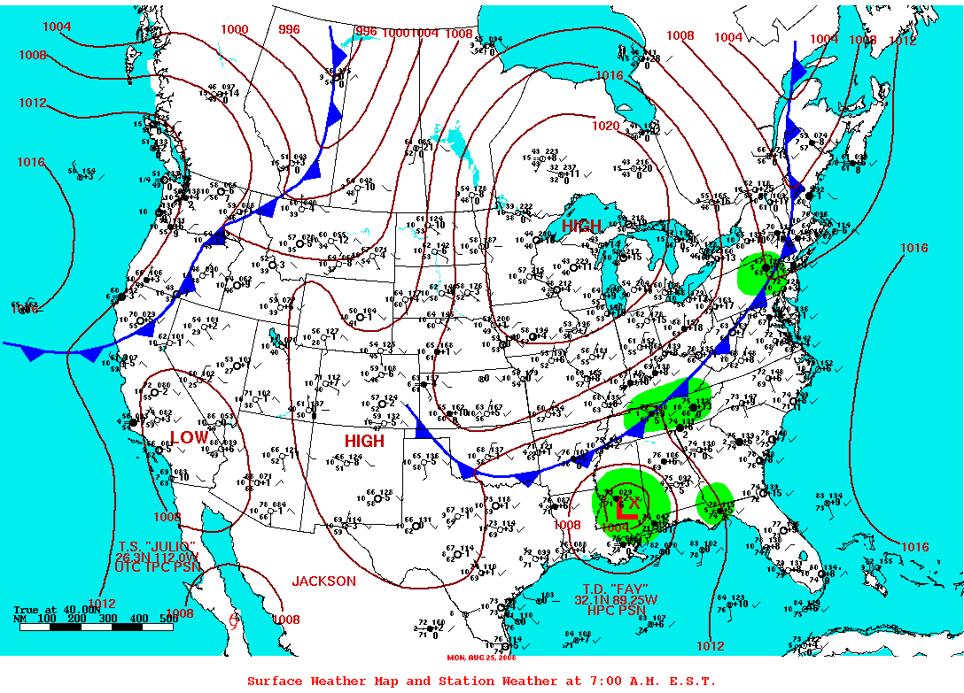
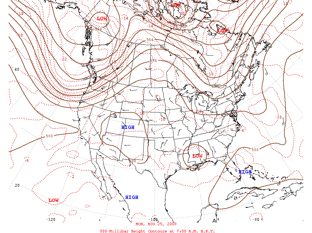
Surface Analysis for August 25th 6 AM CDT 500 mb Chart for August 25th 6 AM CDT
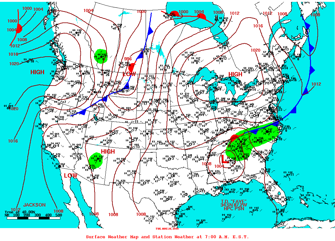
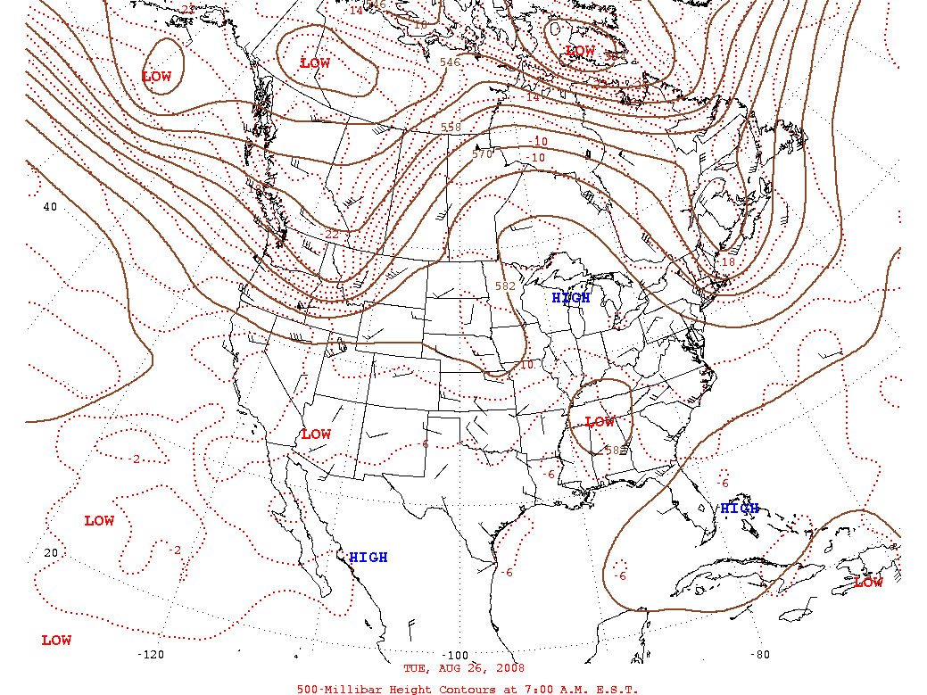
Surface Analysis for August 26th 6 AM CDT 500 mb Chart for August 26th 6 AM CDT
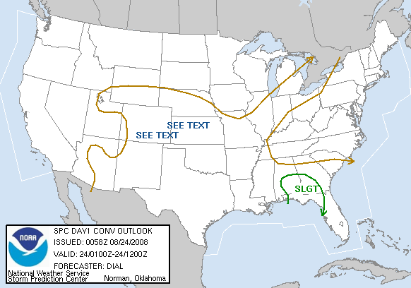
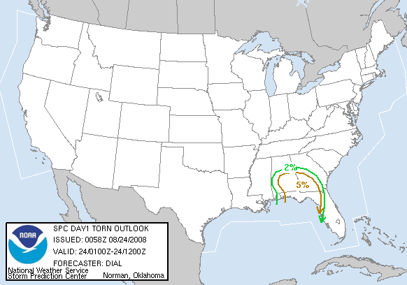
Day 1 Severe Weather Outlook Issued August 24th Day 1 Probabilistic Outlook Issued August 24th
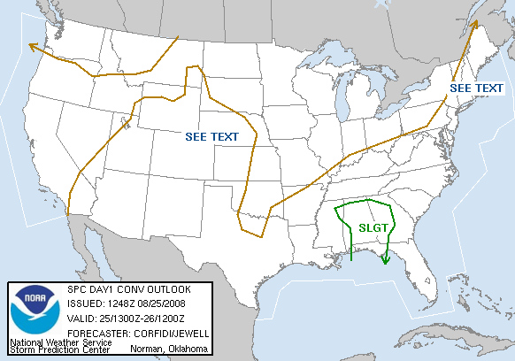
Day 1 Severe Weather Outlook Issued August 25th Day1 Probabilistic Outlook Issued August 25th
Track of Tropical Storm Fay Storm Total Rainfall Estimates for Fay
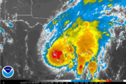
Satellite Imagery of Fay over Florida Satellite Loop of Fay over Florida |


 Follow us on YouTube