Analysis and Comments on a March 1998 Wedge Event
PC-GRIDDS is a great tool for looking at sub-synoptic fields below 850mb. The higher resolution Eta model provides a better representation of mesoscale features in mountainous regions, including precipitation resulting from orographic processes. The analysis and forecast gridded data fields below show how the Eta model did a much better job at depicting the low level wedge. The Eta 1000 mb wind field shows a mostly parallel flow along the eastern slopes of the Appalachians, while the NGM model shows winds flowing more normal to the mountains.
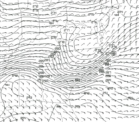 Analysis of 1000 mb Eta potential temperature/wind field valid at 00 UTC, March 17th. |
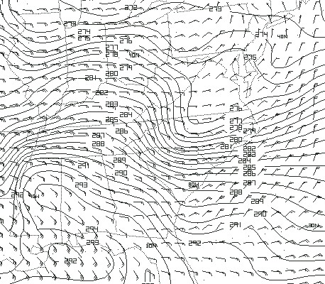 Analysis of 1000 mb NGM potential temperature/wind field valid at 00 UTC, March 17th. |
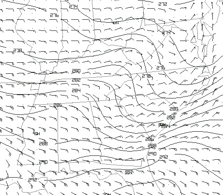 48hr forecast of 1000 mb Eta potential temperature/wind field valid at 00 UTC, March 17th. |
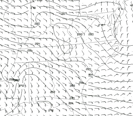 48hr forecast of 1000 mb NGM potential temperature/wind field valid at 00 UTC, March 17th. |
| Page 1 | Page 2 | Page 3 | Page 4 | Page 5 | Page 6 |


 Follow us on YouTube