Alabama Tornado Database
|
| 1995 Tornado Occurrences (37) |
| Tornado # of Year |
Year |
Month |
Day |
Time (CST) |
County |
Damage Scale |
Path Length (Miles) |
Maximum Path Width (Yards) |
Fatalities |
Injuries |
Location |
| 37 |
1995 |
12 |
6 |
2230 |
Coffee |
F0 |
0.4 |
50 |
0 |
1 |
Jack
A tornado flipped a mobile home and scattered debris 350 yards into nearby trees. A woman inside received a cut, while her two children escaped unharmed.
Start: 31.5500/-86.0200
End: 31.5500/-86.0200
|
| 36 |
1995 |
11 |
11 |
0900 |
Houston |
F0 |
0.1 |
10 |
0 |
0 |
5 W Dothan
A small tornado downed trees and power lines and overturned a travel trailer.
Start: 31.2300/-85.4700
End: 31.2300/-85.4700
|
| 35 |
1995 |
11 |
7 |
1205 |
Henry |
F0 |
0.1 |
40 |
0 |
0 |
Haleburg
A tornado downed about 30 trees blocking County Roads 65 and 97.
Start: 31.4000/-85.1300
End: 31.4000/-85.1300
|
| 34 |
1995 |
10 |
27 |
1420 |
Houston |
F1 |
0.2 |
50 |
0 |
2 |
Dothan
A tornado downed trees and damaged two businesses. A person was injured at each business.
Start: 31.2300/-85.3700
End: 31.2300/-85.3700
|
| 33 |
1995 |
10 |
4 |
2000 |
Crenshaw
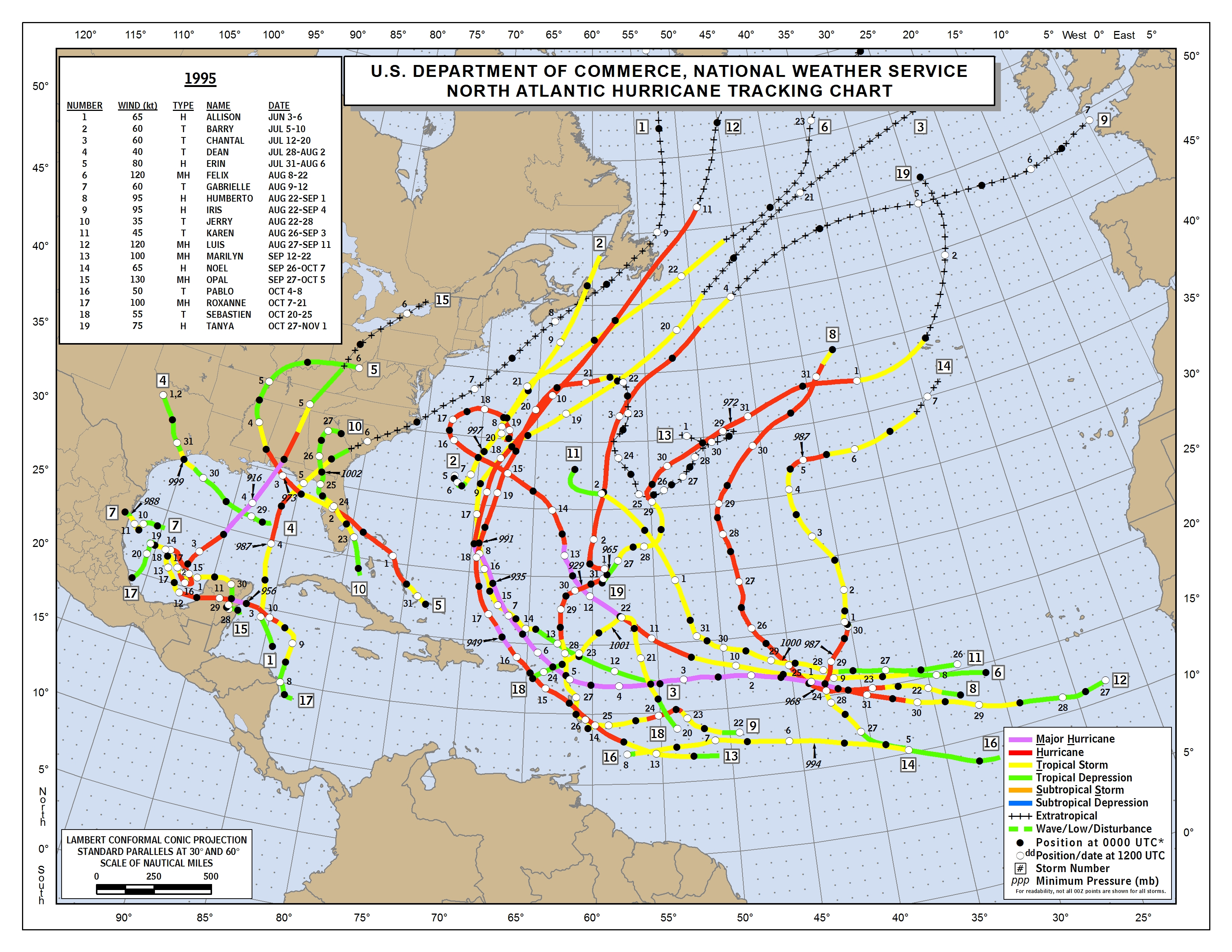
Hurricane Opal
Information
Hurricane Opal
Information
More Opal
Information
1995 Tropical Map |
F0 |
0.1 |
23 |
0 |
0 |
Saville
A tornado briefly touched down along US Highway 331 just east of Saville. Several trees and power lines were blown down.
Start: 31.9800/-86.3300
End: 31.9800/-86.3300
|
| 32 |
1995 |
10 |
4 |
1930 |
Crenshaw
Hurricane Opal
Information
Hurricane Opal
Information
More Opal
Information
1995 Tropical Map |
F0 |
0.1 |
23 |
0 |
0 |
Brantley
A tornado briefly touched down along US Highway 29 near Brantley. Several trees and power lines were blown down.
Start: 31.5800/-86.2500
End: 31.5800/-86.2500
|
| 31 |
1995 |
10 |
4 |
1910 |
Covington
Hurricane Opal
Information
Hurricane Opal
Information
More Opal
Information
1995 Tropical Map |
F0 |
0.1 |
23 |
0 |
0 |
Gantt Lake
A tornado briefly touched down along US Highway 20 around Gantt Lake. Several trees and power lines were blown down.
Start: 31.4000/-86.4800
End: 31.4000/-86.4800
|
| 30 |
1995 |
10 |
4 |
1850 |
Butler
Hurricane Opal
Information
Hurricane Opal
Information
More Opal
Information
1995 Tropical Map |
F0 |
0.1 |
23 |
0 |
0 |
Georgiana
A tornado briefly touched down near Georgiana. Trees and power lines were blown down.
Start: 31.6300/-86.7500
End: 31.6300/-86.7500
|
| 29 |
1995 |
10 |
4 |
1830 |
Conecuh
Hurricane Opal
Information
Hurricane Opal
Information
More Opal
Information
1995 Tropical Map |
F0 |
0.1 |
23 |
0 |
0 |
Evergreen
A tornado briefly touched down near Evergreen. Trees and power lines were blown down.
Start: 31.4300-86.9700
End: 31.4300/-86.9700
|
| 28 |
1995 |
10 |
4 |
1800 |
Escambia
Hurricane Opal
Information
Hurricane Opal
Information
More Opal
Information
1995 Tropical Map |
F0 |
0.1 |
23 |
0 |
0 |
4.5 N Brewton
Trees and power lines were blown down along US Highway 31 north of Brewton.
Start: 31.1700/-87.0700
End: 31.1700/-87.0700
|
| 27 |
1995 |
10 |
4 |
1745 |
Escambia
Hurricane Opal
Information
Hurricane Opal
Information
More Opal
Information
1995 Tropical Map |
F0 |
0.1 |
23 |
0 |
0 |
Near Bradley
Trees and power lines were blown down near Bradley.
Start: 31.0300/-86.7300
End: 31.0300/-86.7300
|
| 26 |
1995 |
10 |
4 |
1730 |
Escambia
Hurricane Opal
Hurricane Opal
Information
Information
More Opal
Information
1995 Tropical Map |
F0 |
0.1 |
23 |
0 |
0 |
Near Brewton
Several short lived tornadoes were reported in the east part of the county. Tornadoes briefly touched down in the Damascus area, in the Bradley area, and along US Highway 31 north of Brewton. Trees and power lines wer blown down in all of these areas.
Start: 31.1200/-87.0700
End: 31.1200/-87.0700
|
| 25 |
1995 |
10 |
4 |
1730 |
Covington
Hurricane Opal
Information
Hurricane Opal
Information
More Opal
Information
1995 Tropical Map |
F0 |
0.1 |
23 |
0 |
0 |
5 SW Andalusia
A tornado briefly touched down along US Highway 29 betwen Pleasant Home and Andalusia. Several trees and power lines were blown down.
Start: 31.2300/-86.5500
End: 31.2300/-86.5500
|
| 24 |
1995 |
10 |
4 |
1245 |
Covington
Hurricane Opal
Information
Hurricane Opal
Information
More Opal
Information
1995 Tropical Map |
F0 |
0.1 |
23 |
0 |
0 |
Andalusia
A tornado briefly touched down on US Highway 12 between Andalusia and River Falls. Several trees and power lines were blown down.
Start: 31.3000/-86.4800
End: 31.3000/-86.4800
|
| 23 |
1995 |
7 |
17 |
1305 |
Butler |
F0 |
0.1 |
20 |
0 |
0 |
Foster Flats
The public reported a tornado briefly touching down and damaging a building in the Foster Flats area.
Start: 31.8300/-86.4800
End: 31.8300/-86.4800
|
| 22 |
1995 |
7 |
4 |
2012 |
Lamar |
F0 |
0.5 |
80 |
0 |
0 |
6.0 E Detroit
A brief tornado occurred near Henson Springs with little or no damage.
Start: 34.0300/-88.1700
End: 34.0300/-88.1700
|
| 21 |
1995 |
7 |
4 |
1555 |
Tuscaloosa |
F0 |
0.5 |
50 |
0 |
0 |
Elrod-Echola
Tuscaloosa Fire Deptment witnessed a tornado with little to no damage.
Start: 33.2000/-87.5700
End: 33.2000/-87.5700
|
| 20 |
1995 |
5 |
18 |
1803 |
Lauderdale |
F1 |
1.5 |
120 |
0 |
0 |
14 NE Florence
Just south of Green Hill, a small tornado damaged about 10 homes near CR 47 and US 43. Several barns were destroyed and numerous trees and power lines were downed.
Start: 34.9700/-87.0470
End: 34.9700/-87.4700
|
| 19 |
1995 |
5 |
18 |
1633 |
Limestone-Madison-Jackson |
F4 |
39.0 |
1300 |
1 |
55 |
3 NW Athens-15 NW Scottsboro
A supercell thunderstorm produced a violent tornado across the Tennessee Valley. A mobile home park was destroyed in Limestone County near Athens. Numerous homes were severely damaged.
Start: 34.8300/-87.0300
End: 34.8000/-86.2500
|
| 18 |
1995 |
5 |
18 |
1545 |
Colbert |
F1 |
6.5 |
150 |
0 |
0 |
Near Muscle Shoals
A supercell thunderstorm moved out of Mississippi and into Colbert County. The storm produced multiple reports of large hail. A small tornado touched down about 2 miles east of the Muscle Shoals Airport and moved on a path just over 6 miles long. Several buildings sustained damage along the path with power lines and trees down. Emergency Medical Association reported that 5 homes and 3 mobile homes were damaged.
Start: 34.7500/-87.5800
End: 34.8500/-87.5000
|
| 17 |
1995 |
5 |
10 |
0040 |
Mobile |
F0 |
0.1 |
50 |
0 |
0 |
2 N Grand Bay
A tornado was reported near the eleven mile marker north of Grand Bay. No damage was reported.
Start: 30.500/-88.3500
End: 30.500/-88.3500
|
| 16 |
1995 |
5 |
9 |
1840 |
Talladega |
F0 |
1.0 |
200 |
0 |
1 |
2.0 NE Lincoln
Numerous trees downed and several structures had minor damage.
Start: 33.6300/-86.0800
End: 33.6300/-86.0800
|
| 15 |
1995 |
5 |
9 |
1330 |
Covington |
F0 |
2.0 |
100 |
0 |
0 |
4 WNW Opp
A small tornado touched down blowing the siding off a mobile home, overturning a pump house, and downing several trees and power lines.
Start: 31.3200/-86.3200
End: 31.3200/-86.3200
|
| 14 |
1995 |
5 |
9 |
1005 |
Mobile |
F0 |
0.1 |
50 |
0 |
0 |
7 NW Mobile
A tornado was observed in the Semmes Community. 3 mobile homes were damaged and a few trees were blown down.
Start: 30.7800/-88.1800
End: 30.7800/-88.1800
|
| 13 |
1995 |
4 |
23 |
1930 |
Escambia |
F0 |
0.1 |
30 |
0 |
0 |
Atmore
A tornado touched down along Interstate 65 near Exit 57. No damage was found.
Start: 31.0300/-87.5000
End: 31.0300/-87.5000
|
| 12 |
1995 |
4 |
22 |
1705 |
Baldwin |
F0 |
0.1 |
30 |
0 |
0 |
Loxley
A brief tornado touched down between Loxley and Stapleton. No damage was found.
Start: 30.6200/-87.7500
End: 30.6200/-87.7500
|
| 11 |
1995 |
4 |
22 |
0645 |
Walker |
F1 |
1.5 |
60 |
0 |
0 |
Sumiton
Several trees and power lines downed.
Start: 33.7500/-87.0500
End: 33.7500/-87.0500
|
| 10 |
1995 |
4 |
20 |
1956 |
Marion-Winston |
F1 |
6.0 |
120 |
0 |
17 |
5.0 SW Haleyville-Haleyville
3 mobile homes and 3 business were destroyed. Most injuries occurred in mobile homes.
Start: 34.1700/-87.6800
End: 34.2500/-87.6000
|
| 9 |
1995 |
4 |
20 |
1903 |
Lamar |
F1 |
4.0 |
80 |
0 |
6 |
6.0 SW Vernon
Several trees downed.
Start: 33.6800/-88.2000
End: 33.7300/-88.1500
|
| 8 |
1995 |
4 |
11 |
1200 |
Chambers |
F0 |
1.5 |
200 |
0 |
0 |
Lanett
Numerous trees and power lines downed in Lakeview. 4 homes were damaged.
Start: 32.8800/-85.1800
End: 32.8800/-85.1800
|
| 7 |
1995 |
4 |
11 |
1015 |
Elmore |
F1 |
4.0 |
100 |
0 |
0 |
3.0 WSW Elmore
Numerous trees and power lines downed and 20 mobile homes had minor damage.
Start: 32.5200/-86.3700
End: 32.5300/-86.3000
|
| 6 |
1995 |
3 |
7 |
1710 |
Morgan |
F0 |
1.0 |
80 |
0 |
0 |
Lacey's Spring
A small tornado touched down on Highway 36 just west of Lacey's Spring damaging one home, one barn, and a shed. Numerous trees and power lines were blown down.
Start: 34.5300/-86.6000
End: 34.5300/-86.6000
|
| 5 |
1995 |
3 |
7 |
1645 |
Cullman |
F0 |
1.5 |
80 |
0 |
0 |
Enon
A small tornado damaged several homes along with downing trees and power lines. A barn and chicken house were also destroyed.
Start: 34.3000/-86.7800
End: 34.3000/-86.7800
|
| 4 |
1995 |
3 |
7 |
1503 |
Tuscaloosa |
F0 |
2.0 |
80 |
0 |
0 |
Samantha
Numerous trees and power lines downed. 1 mobile home destroyed and 6 had minor damage, and 2 barns destroyed.
Start: 33.4200/-87.6200
End: 33.4200/-87.6200
|
| 3 |
1995 |
2 |
16 |
0528 |
Marshall-DeKalb |
F2 |
12.0 |
700 |
0 |
3 |
2 SSW Martling-1 SW Lakeview
10 homes were destroyed, 40 homes damaged, and 30 chicken houses were damaged.
Start: 34.3300/-86.2200
End: 34.4000/-86.0000
|
| 2 |
1995 |
2 |
16 |
0459 |
Cullman-Marshall
Storm Information
Storm Information
Storm Information |
F3 |
14.0 |
703 |
6 |
130 |
3 WSW Joppa-5 SW Guntersville
One death occurred in a house and the others occurred in mobile homes. 157 homes were destroyed and 12 businesses were destroyed.
Start: 34.2871/-86.6269
End: 34.3258/-86.3814
|
| 1 |
1995 |
2 |
16 |
0332 |
Marion |
F1 |
6.0 |
80 |
0 |
0 |
6.0 E Hamilton
5 homes damaged and 6 chicken houses destroyed.
Start: 34.1300/-87.8700
End: 34.2200/-87.7700
|


 Follow us on YouTube