December 14, 1997 Snow

Above is an image some people across parts of Central Alabama saw on December 14th as a snow producing storm system moved across the state. Below is a visible satellite image from GOES 8. For further discussion of satellite imagery that day go to: 14 December 1997 -- Heavy Snow Over Mississippi/Alabama at the CIMSS GOES Gallery. The visible satellite image below was taken at 10:32 AM CST (or 1632 UTC). The satellite image below was saved from the Real-Time Weather Data Home Page and then annotated.
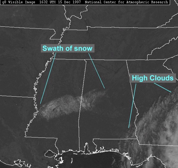
You can see the snow covering the ground from parts of Southwest Mississippi into Central Alabama after an upper level low pressure system moved across these areas December 14th, 1997. Some areas in central Alabama may not show up well do to some melting that occurred when the snow switched over the rain. This image shows how reflective snow covering the ground can be. The white areas to the right are the high clouds associated with the upper level low pressure system that brought snow to the deep south. After a snow producing storm system passes over an area and skies have cleared, be sure to check out the latest visible satellite image to see if you can see the snow cover.


 Follow us on YouTube