|
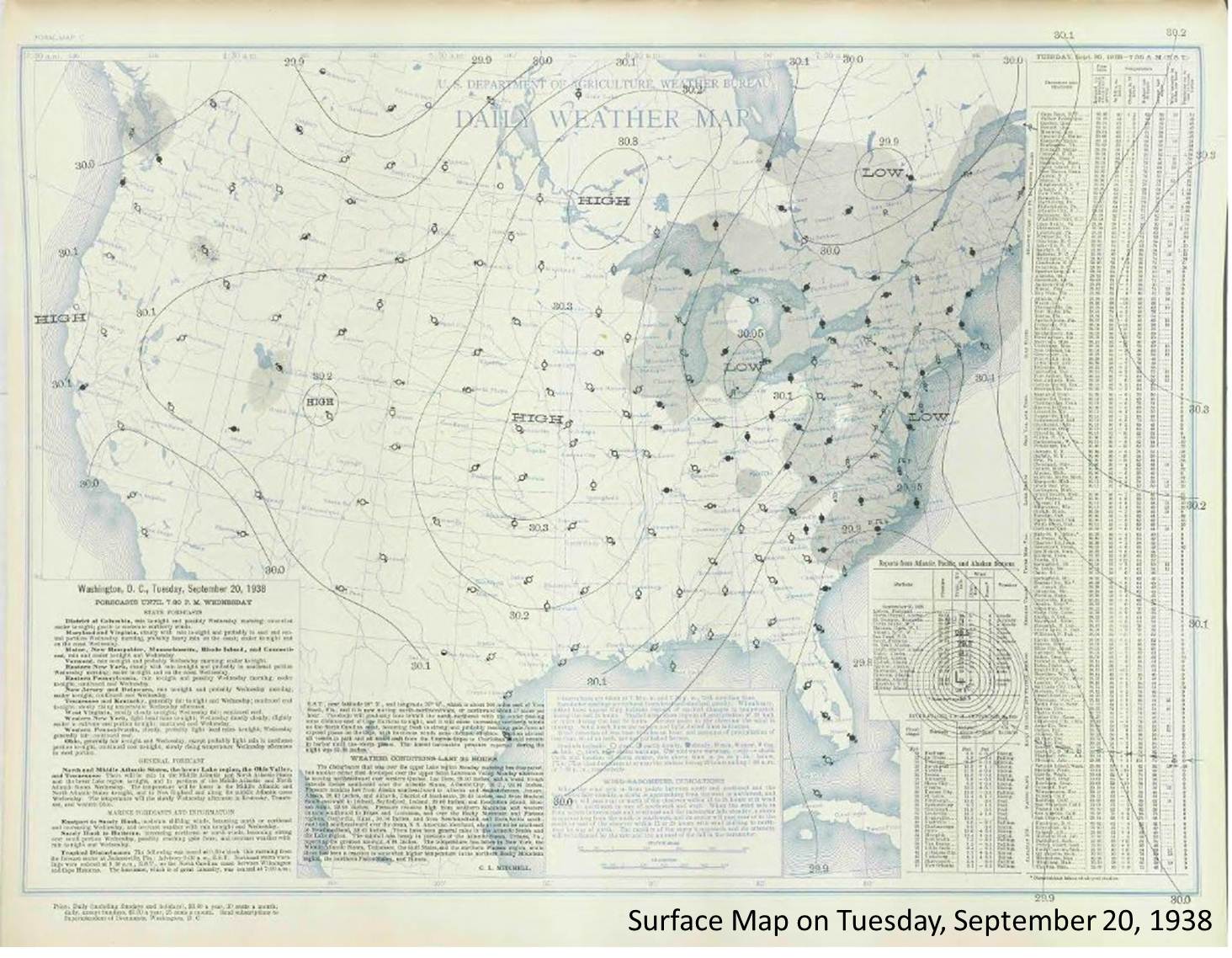
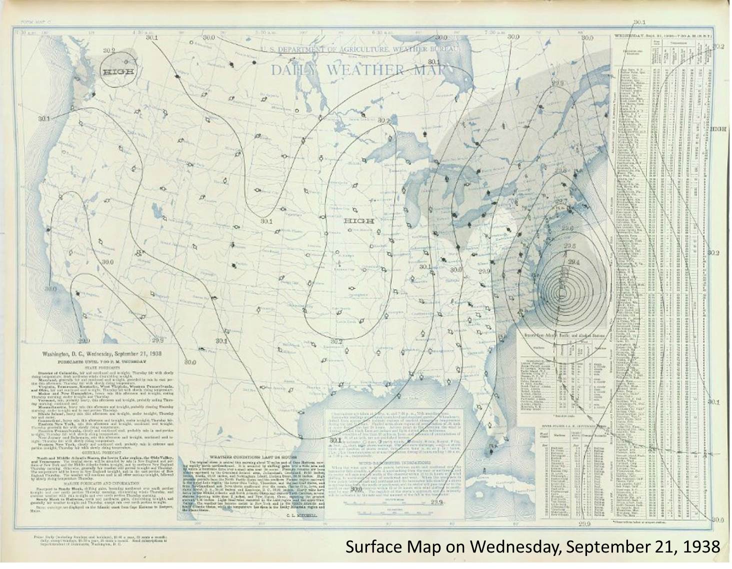
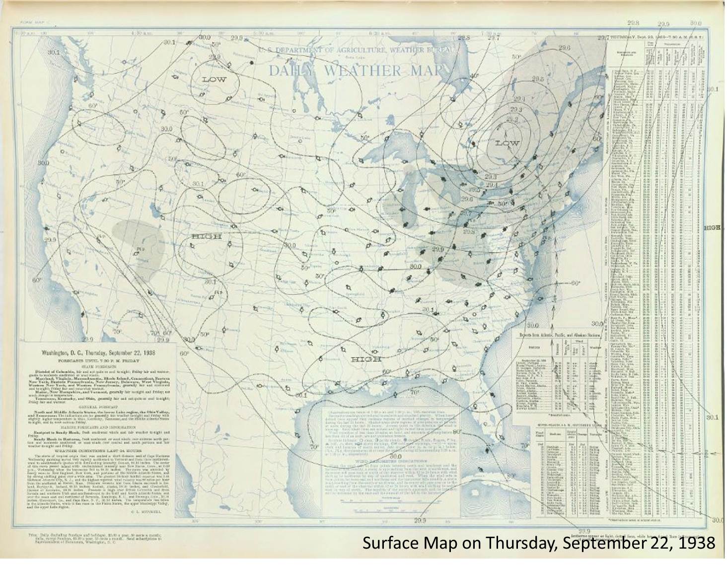
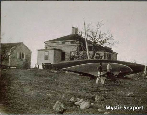
The Great New England Hurricane of 1938 was one of the most destructive and powerful storms ever to strike Southern New England. This system developed in the far eastern
Atlantic, near the Cape Verde Islands on September 4. It made a twelve day journey across the Atlantic and up the Eastern Seaboard before crashing ashore on September 21 at
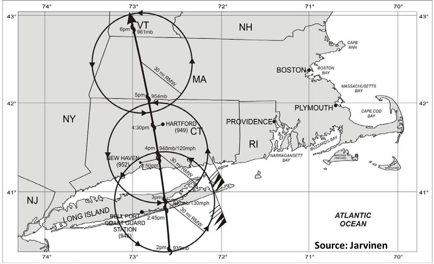
Suffolk County, Long Island, then into Milford, Connecticut. The eye of the hurricane was observed in New Haven, Connecticut, 10 miles east of Milford. The center made landfall
at the time of astronomical high tide, moving north at 50 mph. Unlike most storms, this hurricane did not weaken on its way toward Southern New England, due to its rapid forward
speed and its track. This kept the center of the storm over the warm waters of the Gulf Stream.
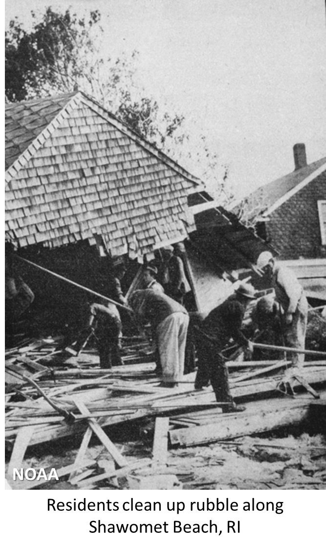
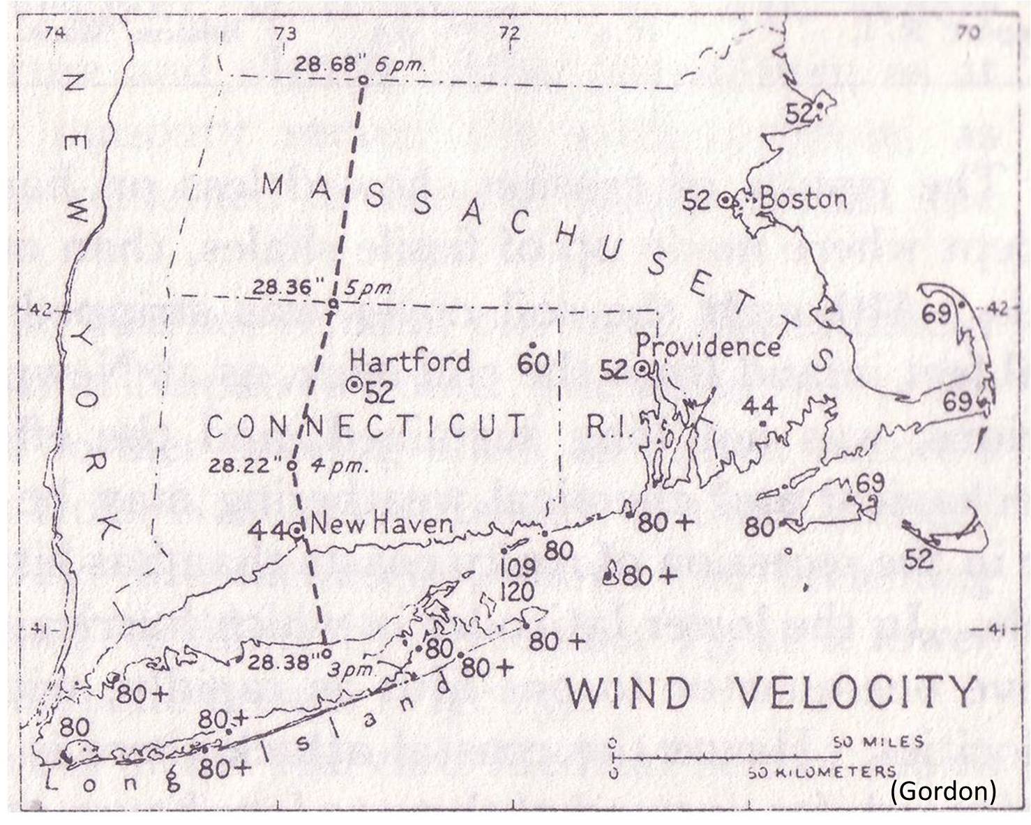
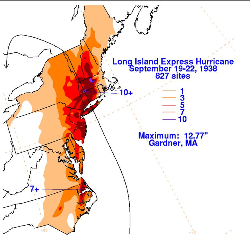
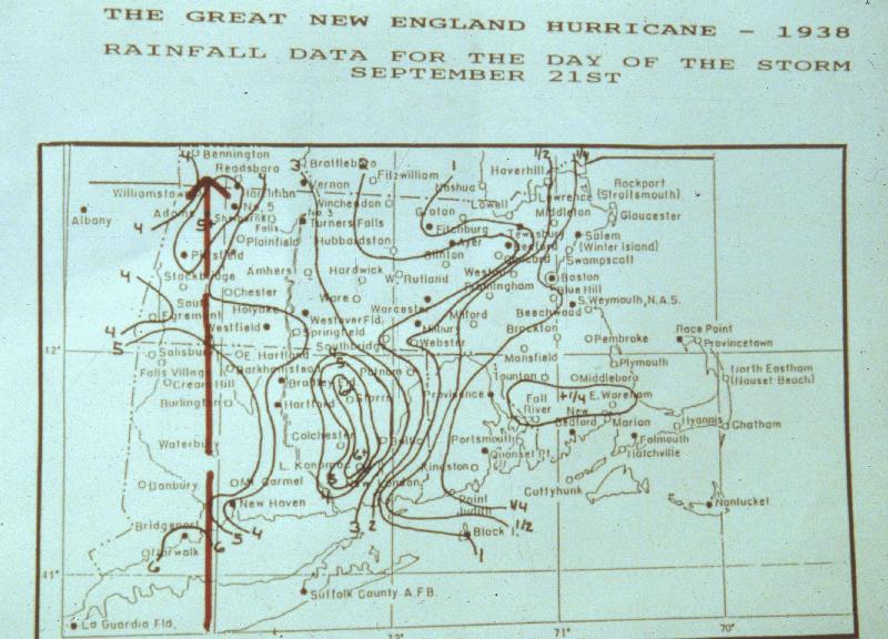
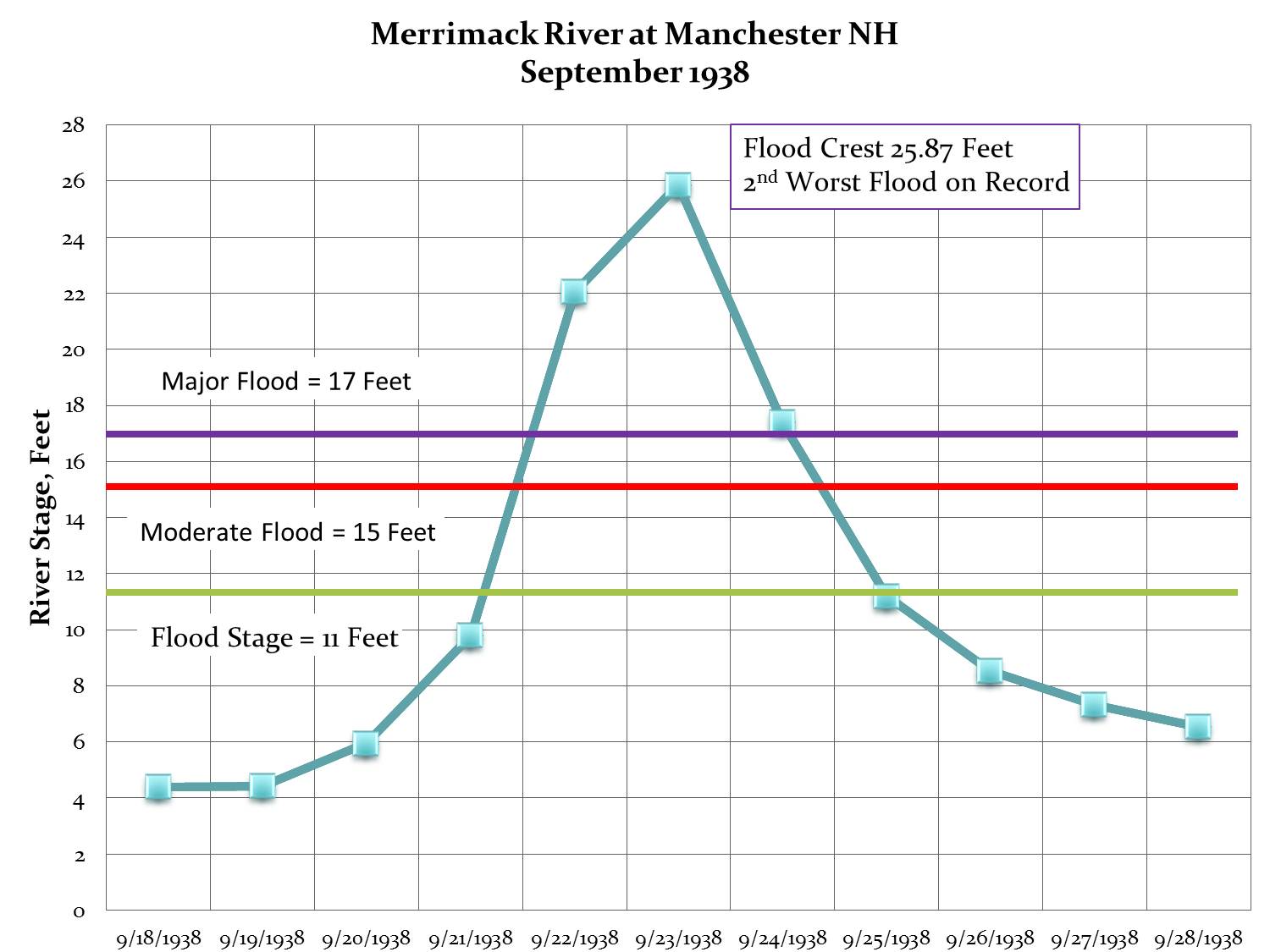
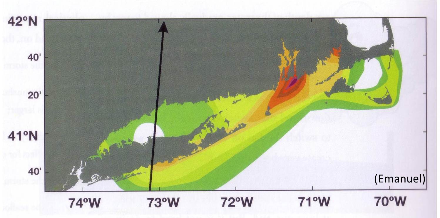
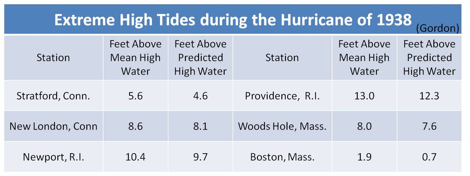
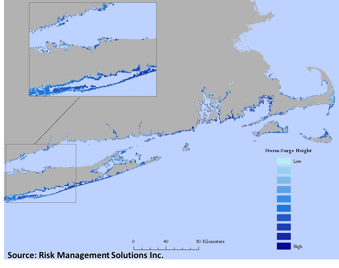
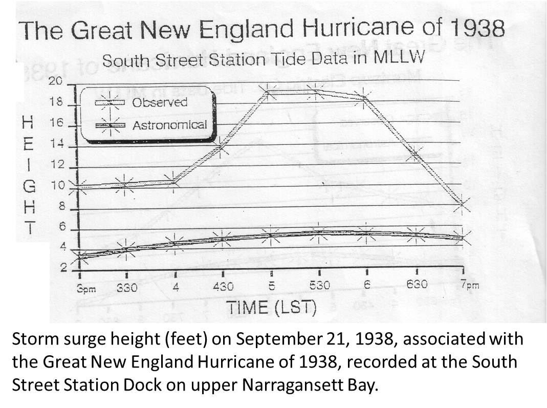
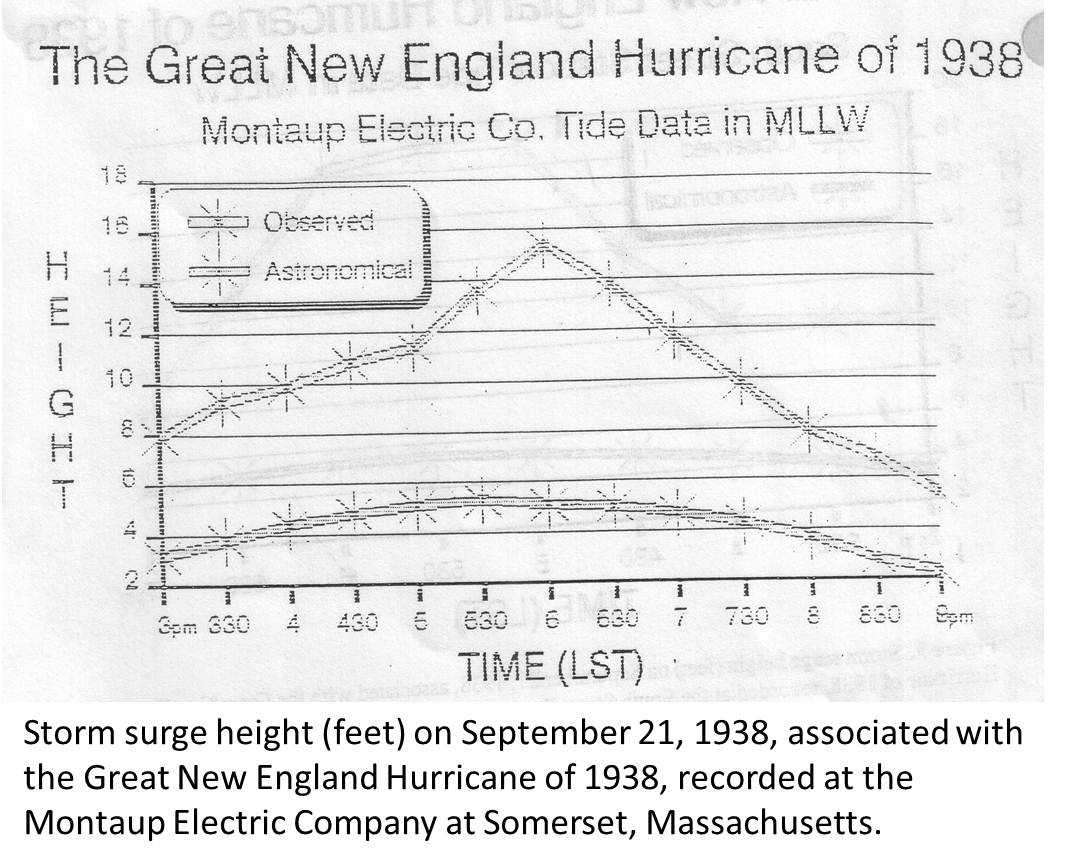
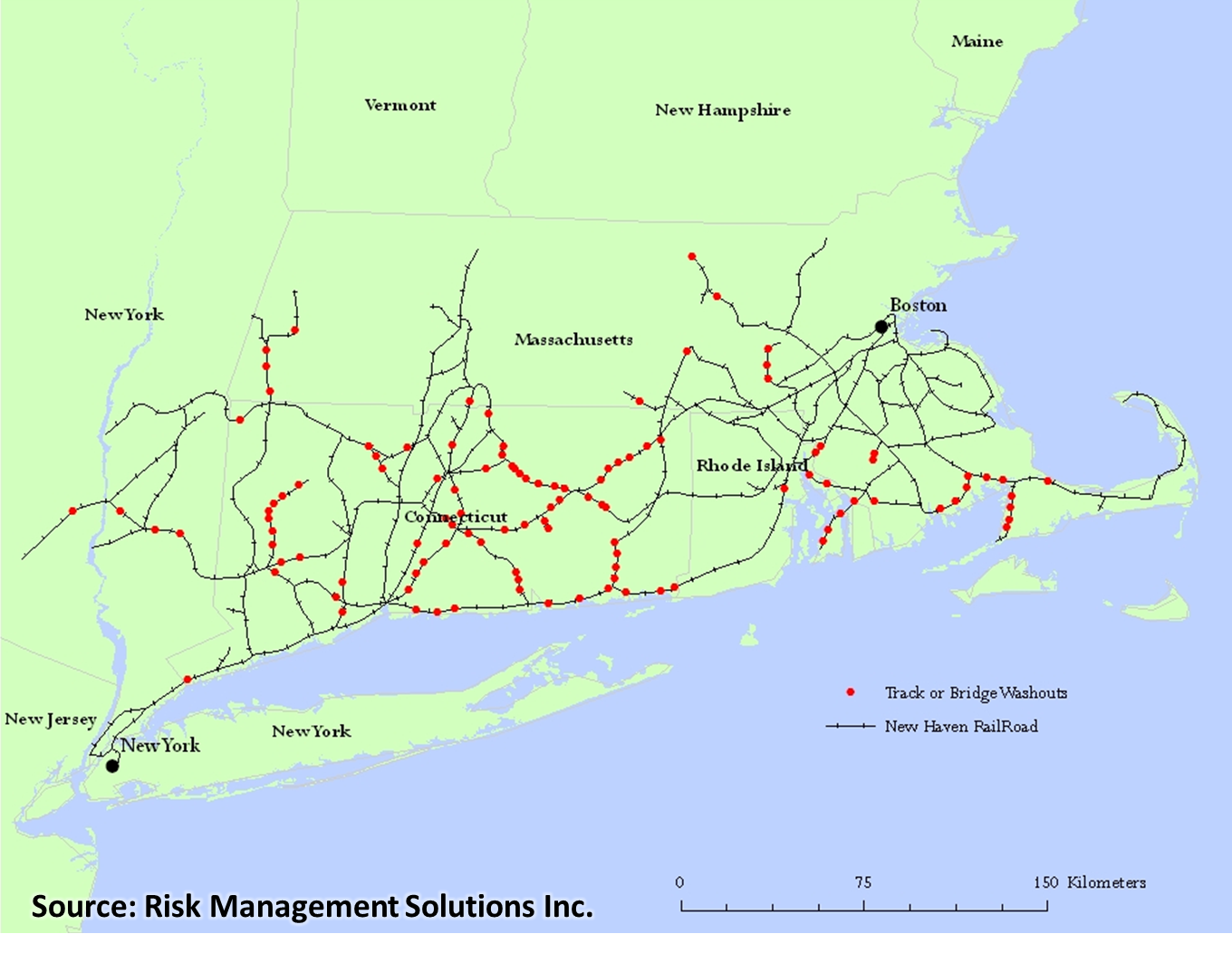
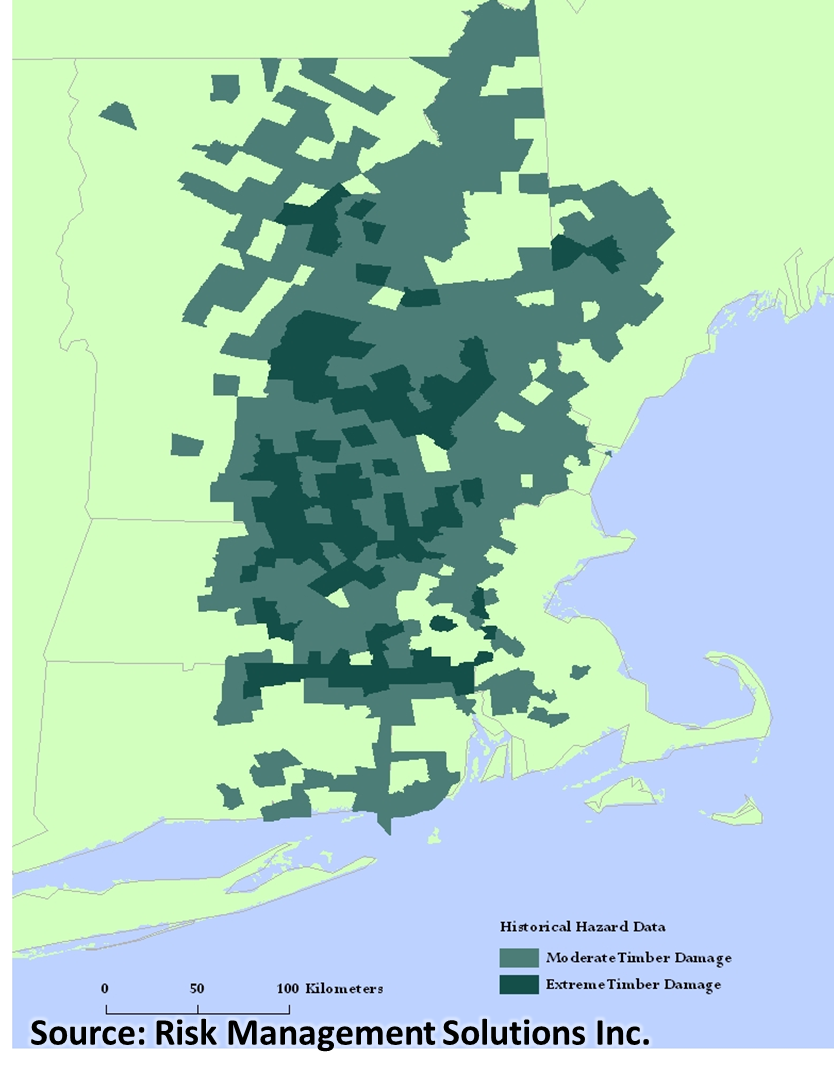
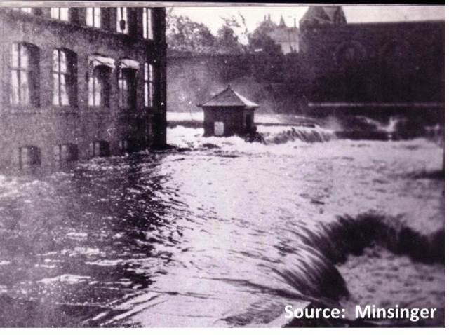
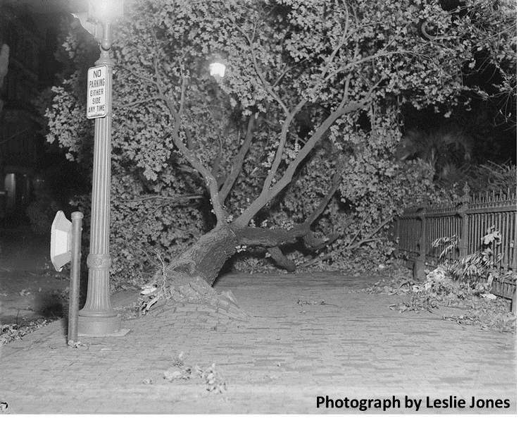
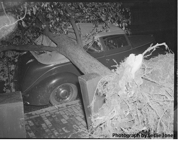
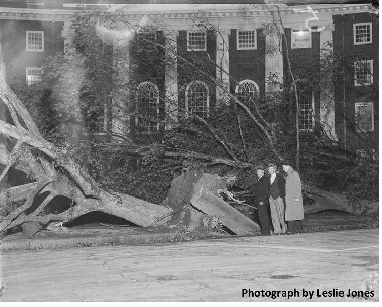
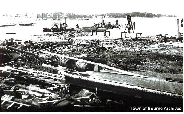
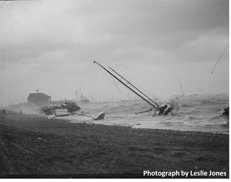
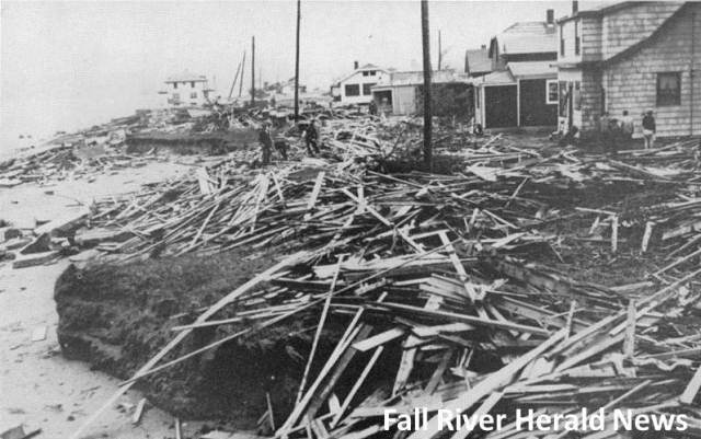
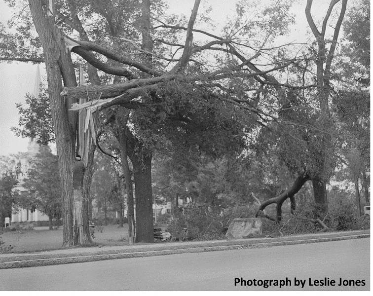
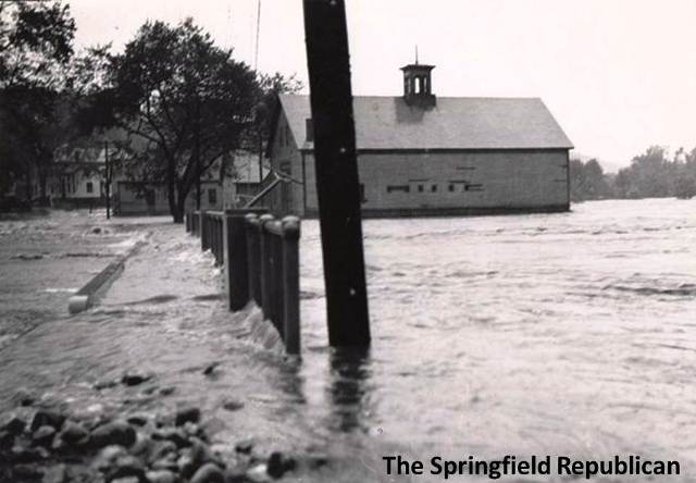
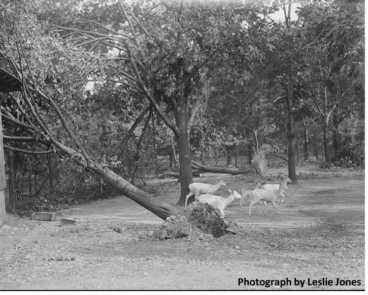
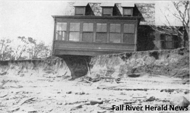
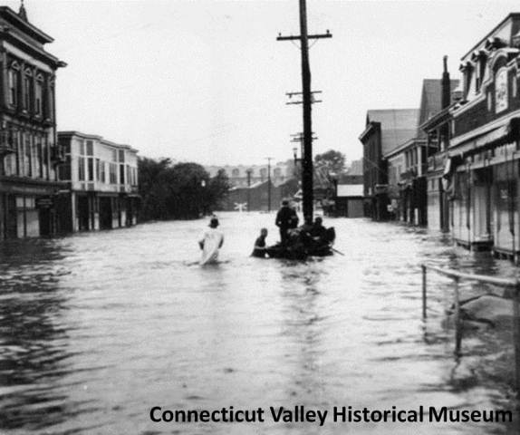
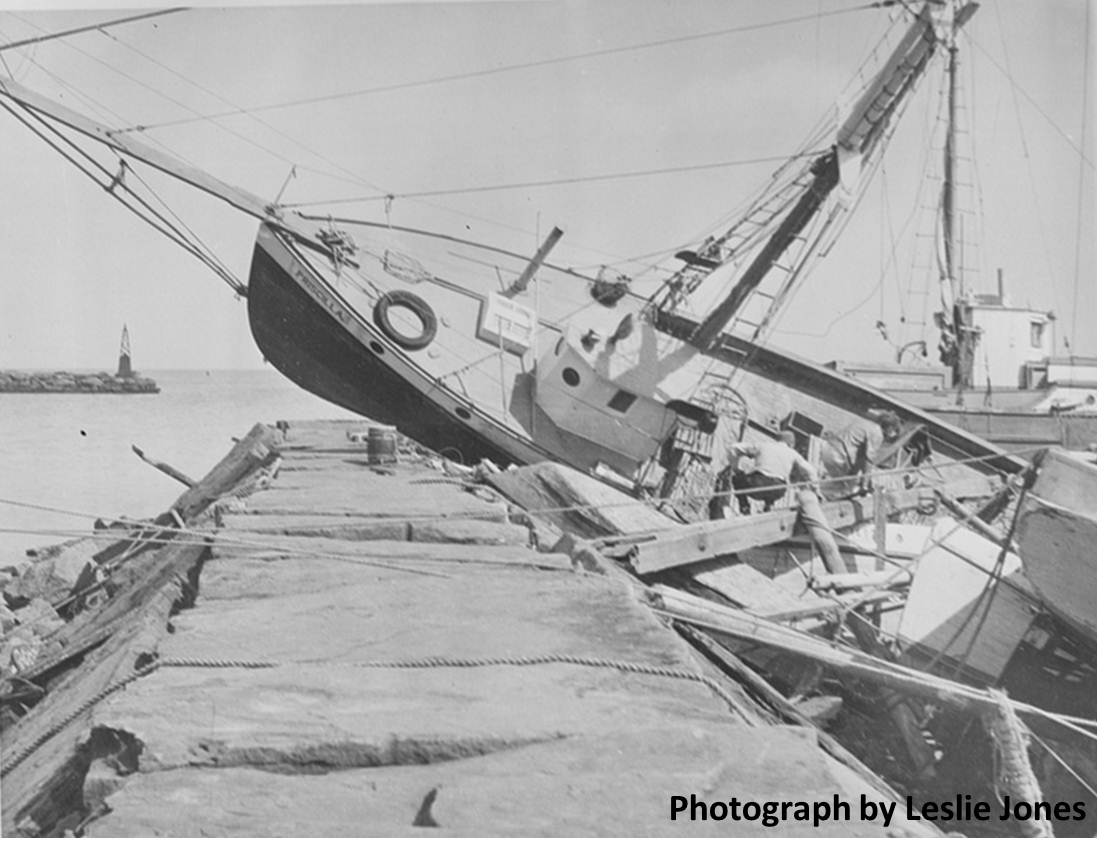
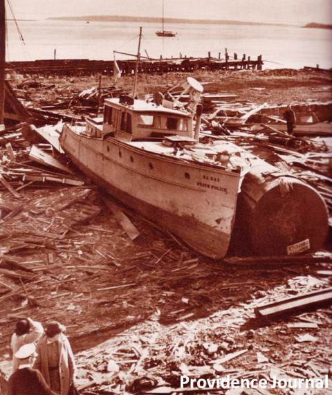
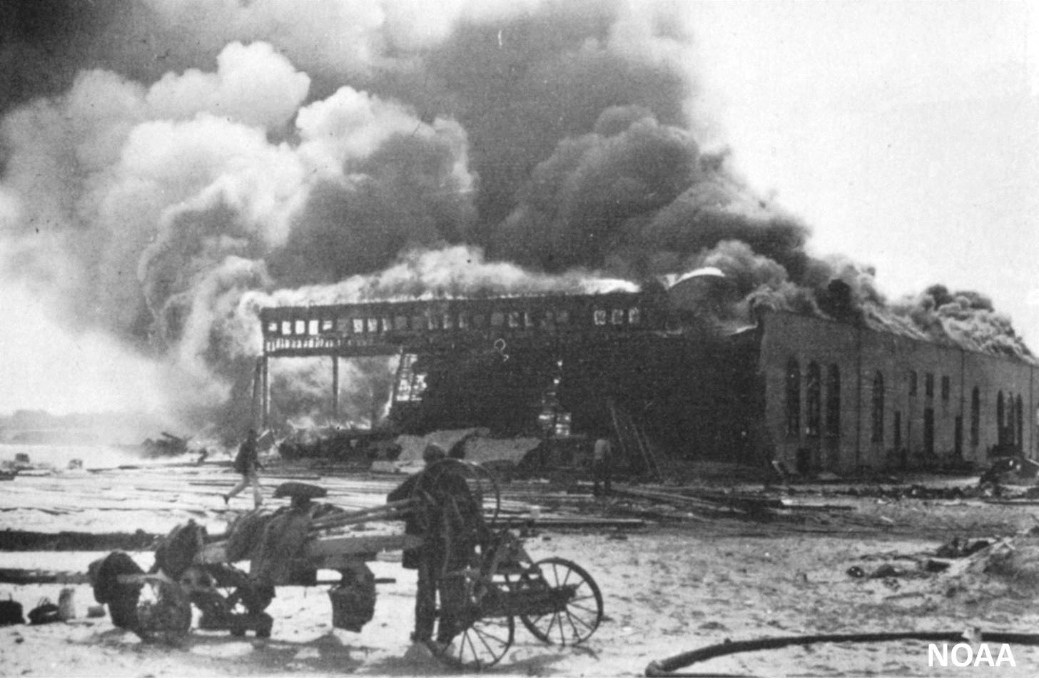
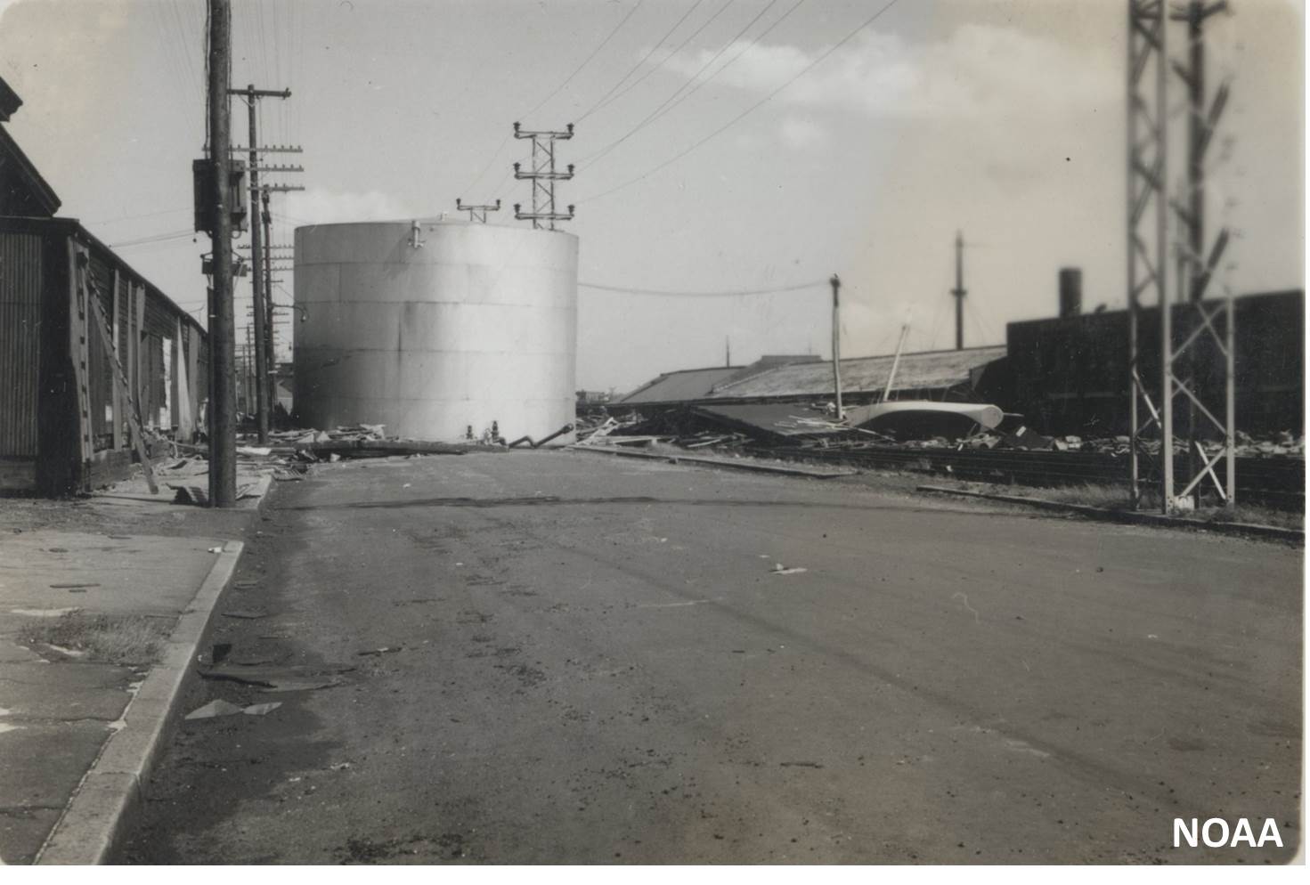
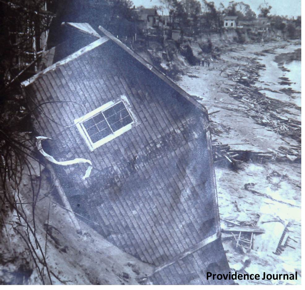
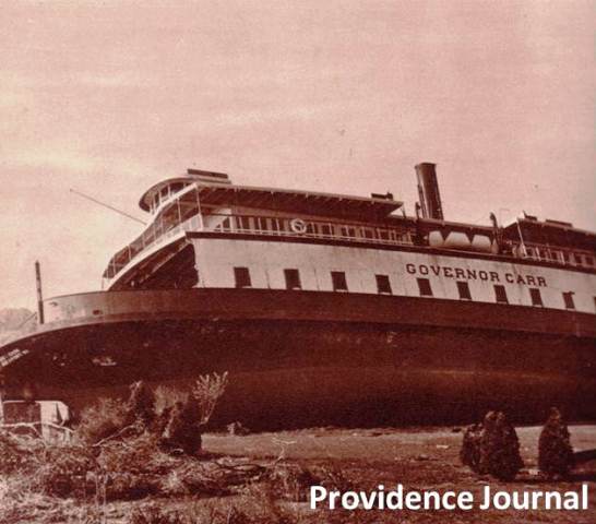
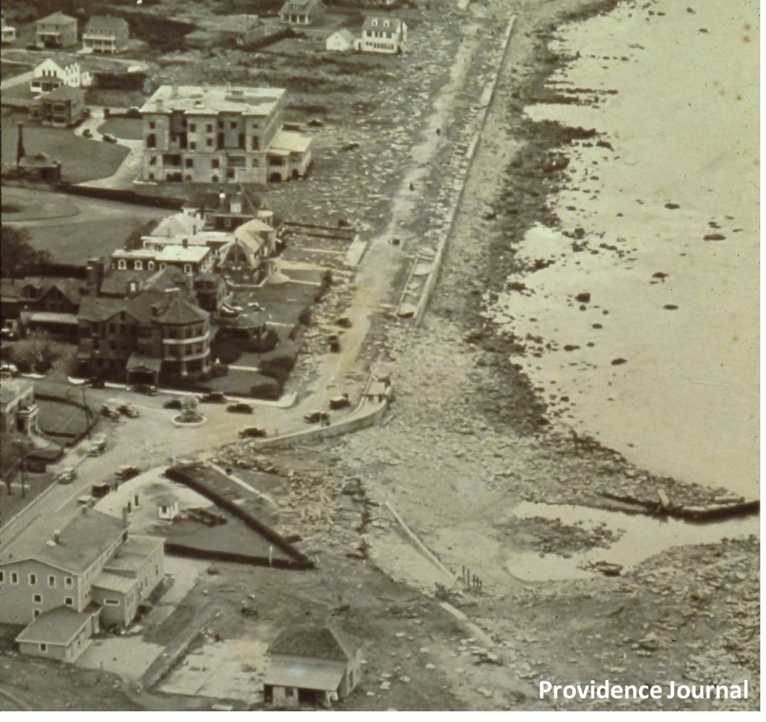
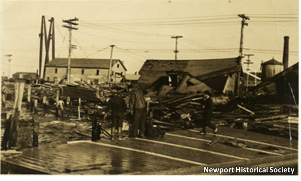
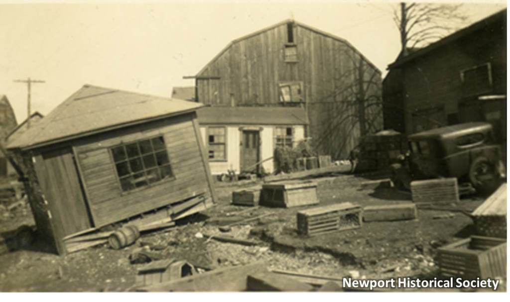
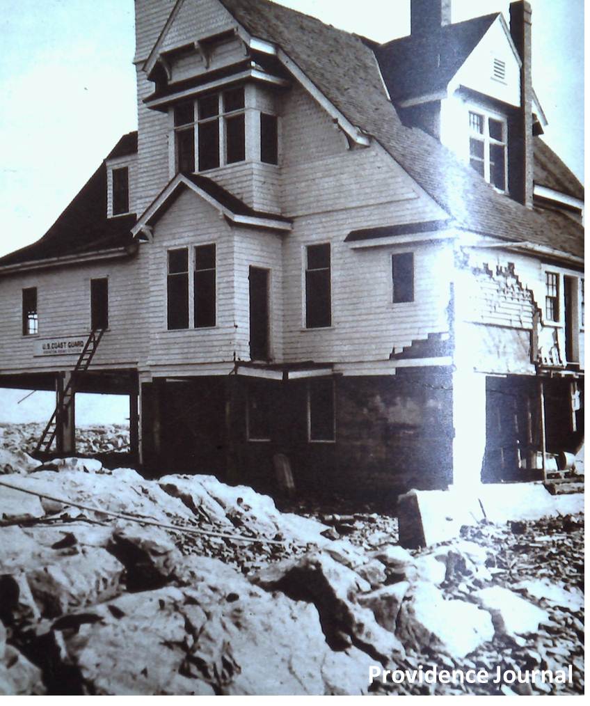
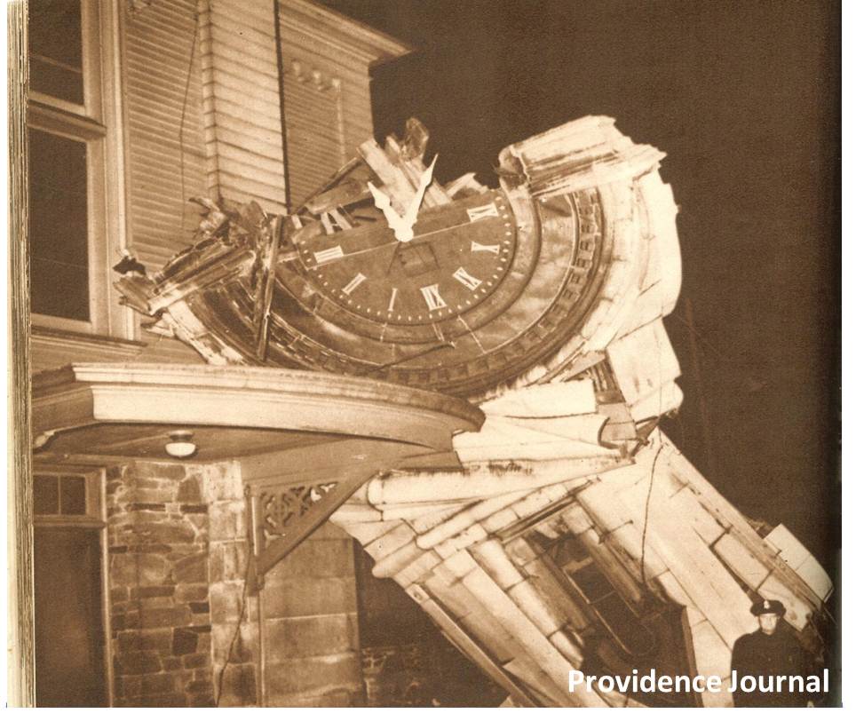
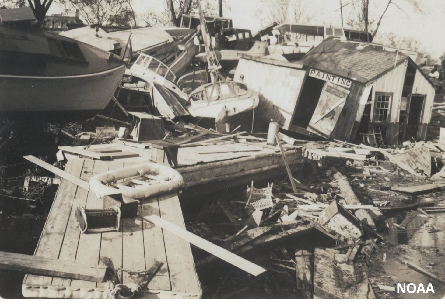
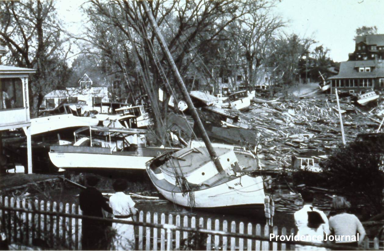
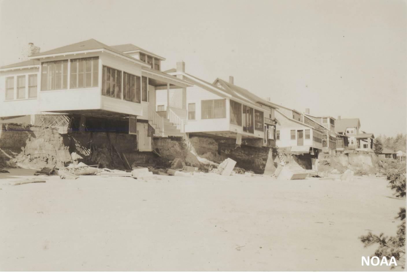
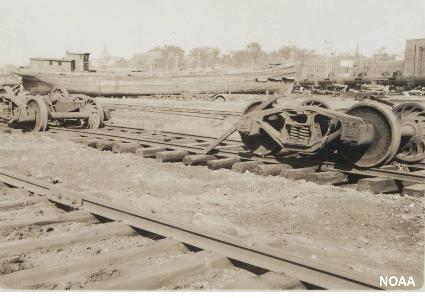
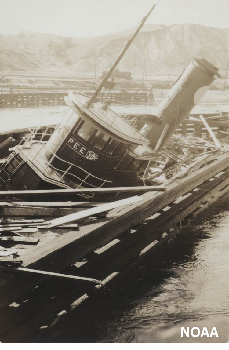
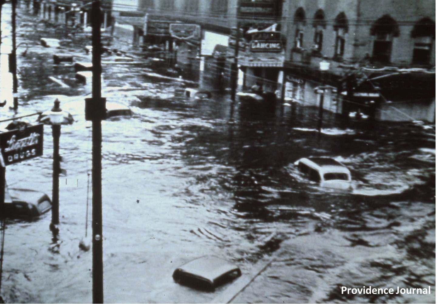
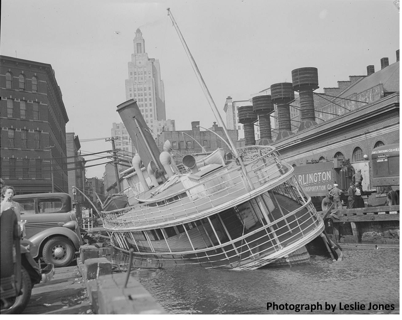
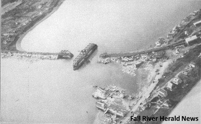
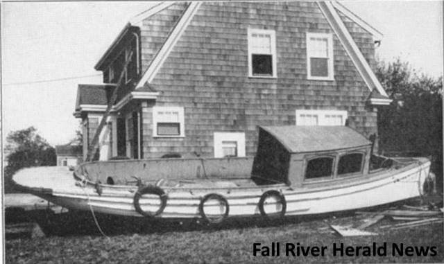
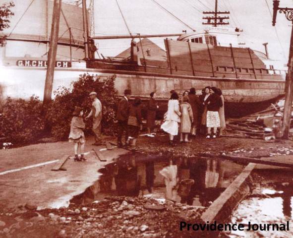
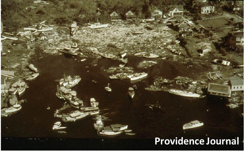
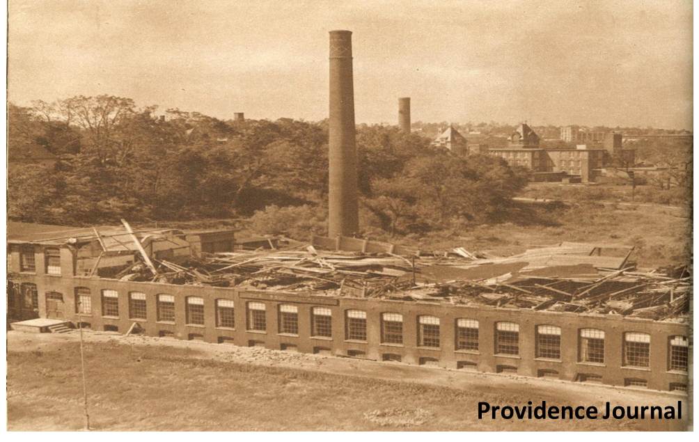
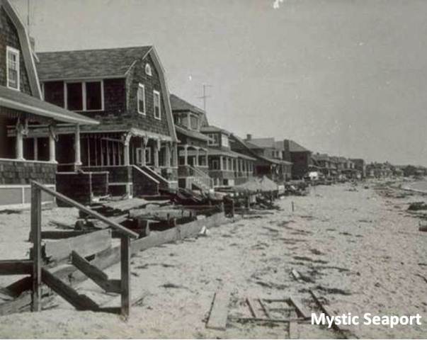
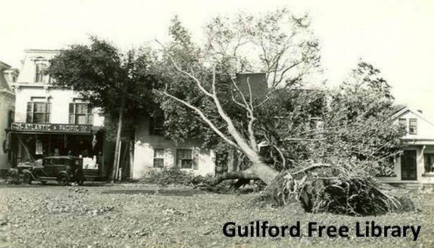
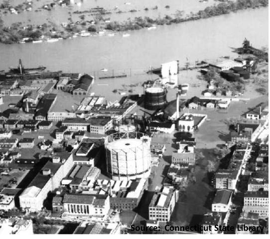
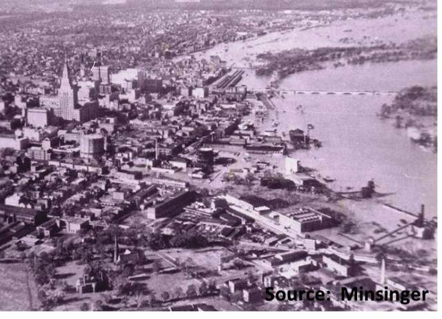
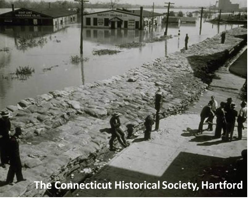
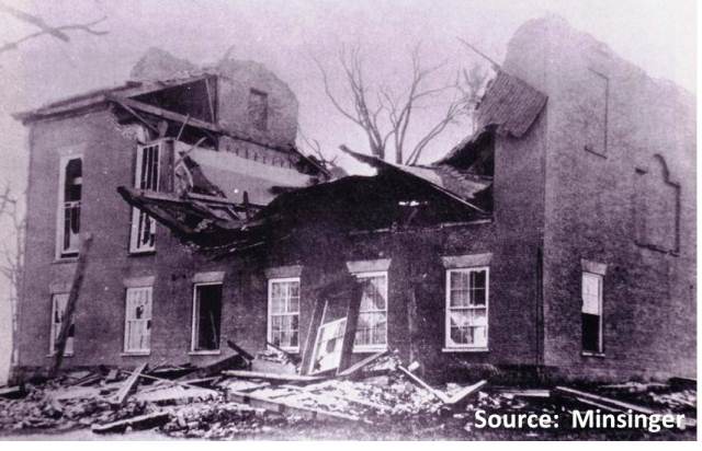
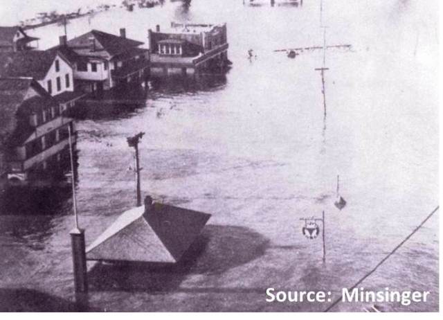
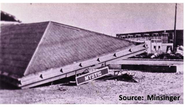
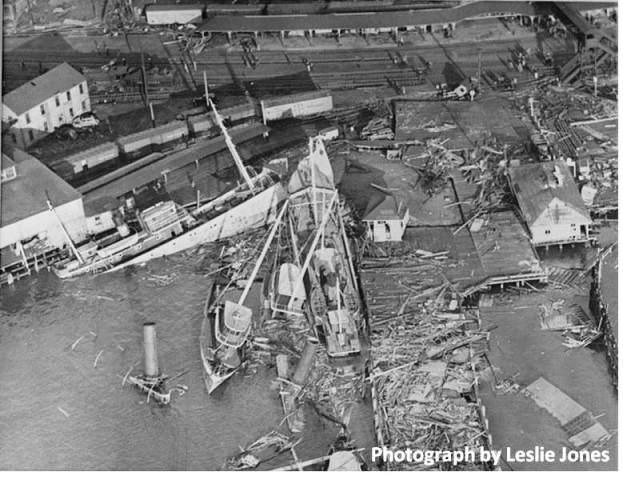
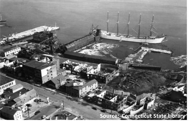
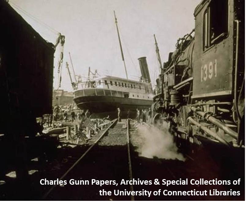
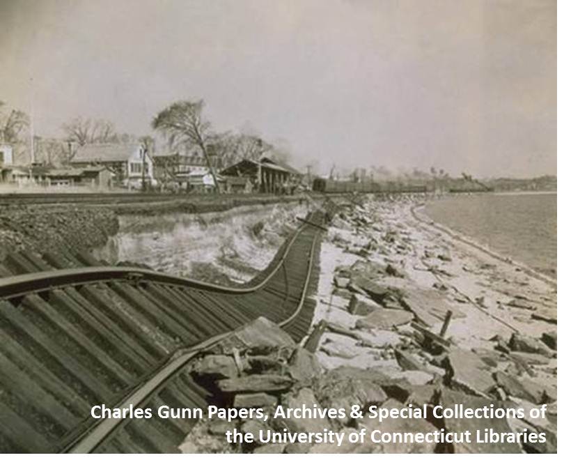
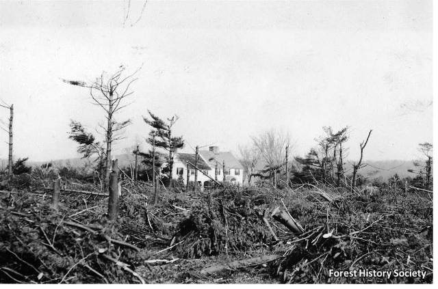
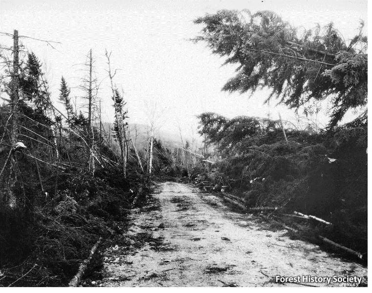
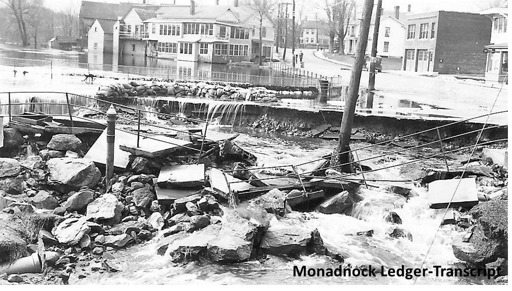
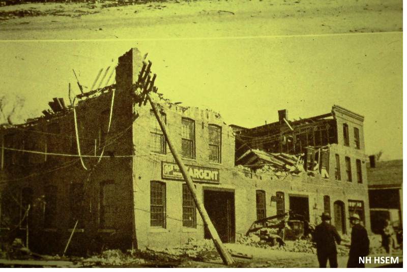
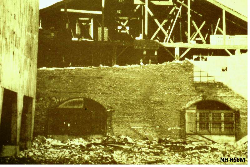
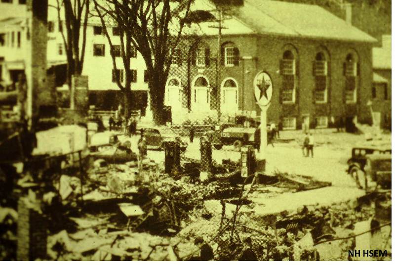
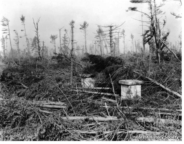
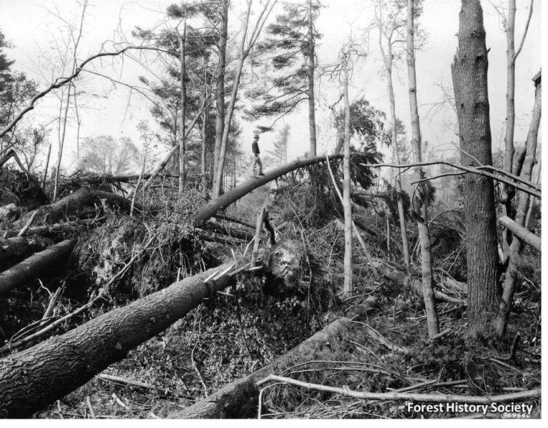
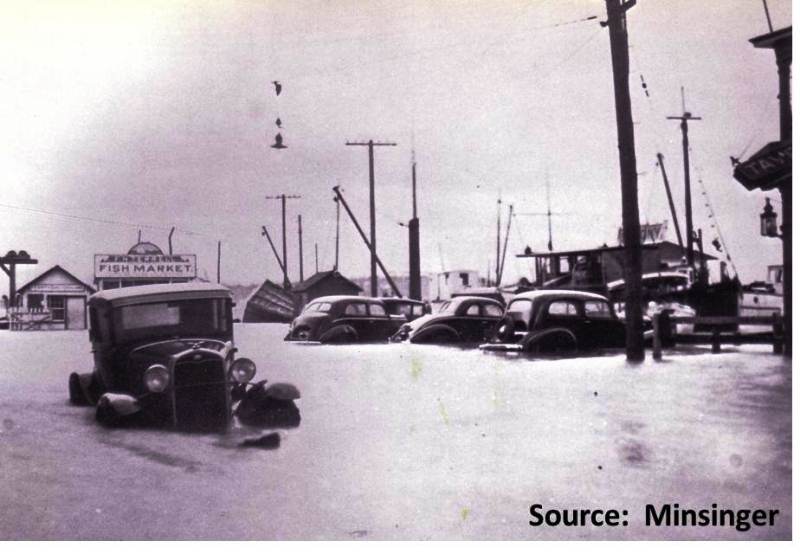
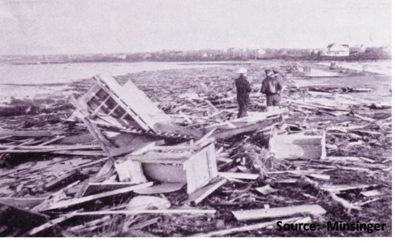
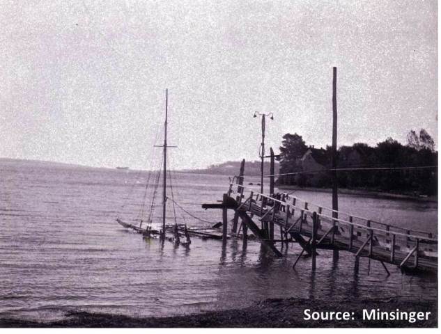
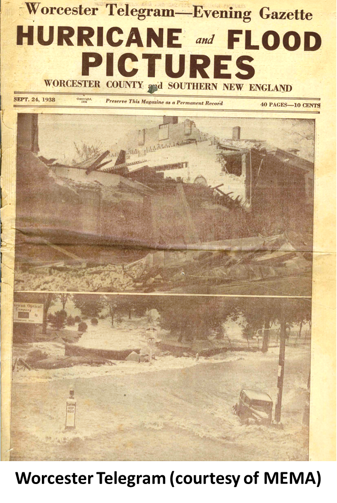
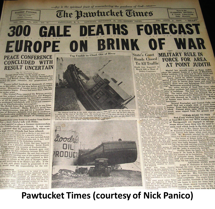
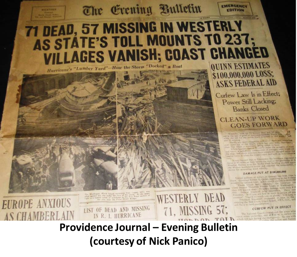
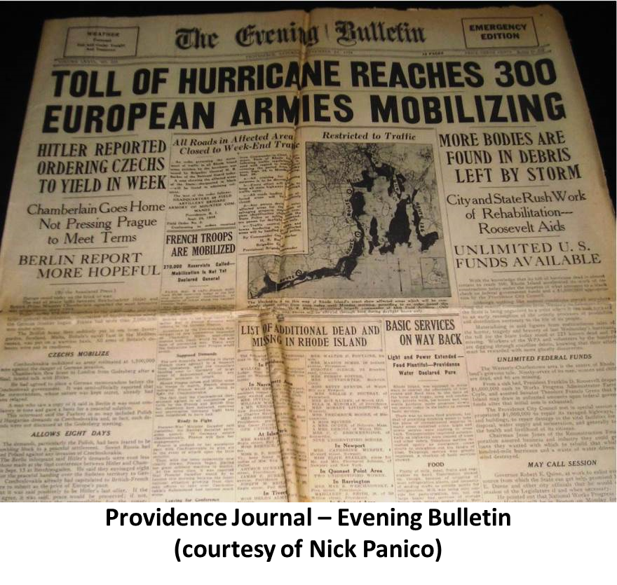
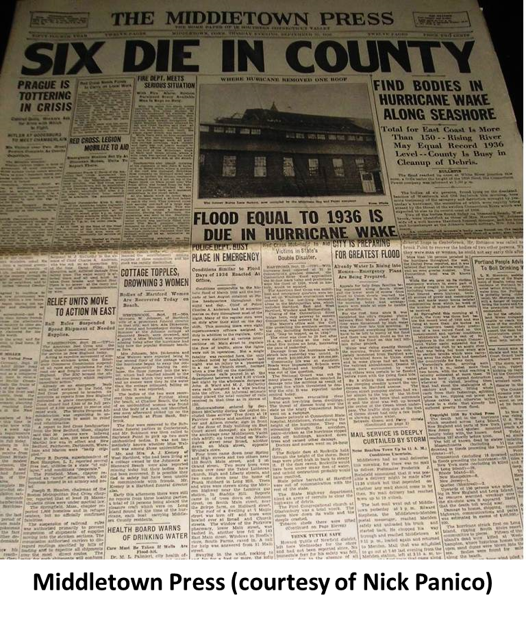
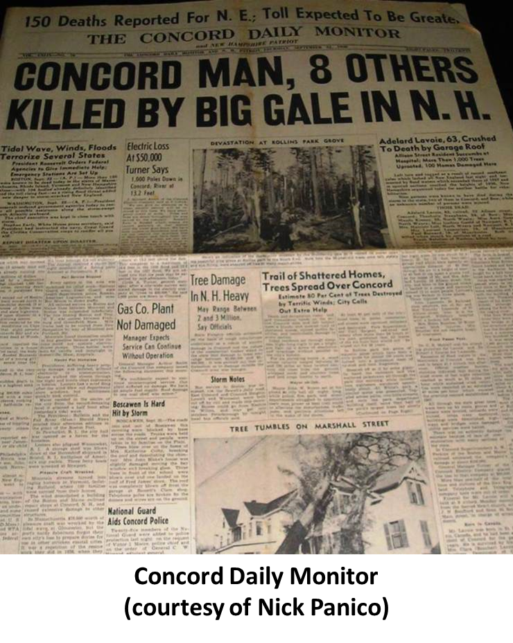
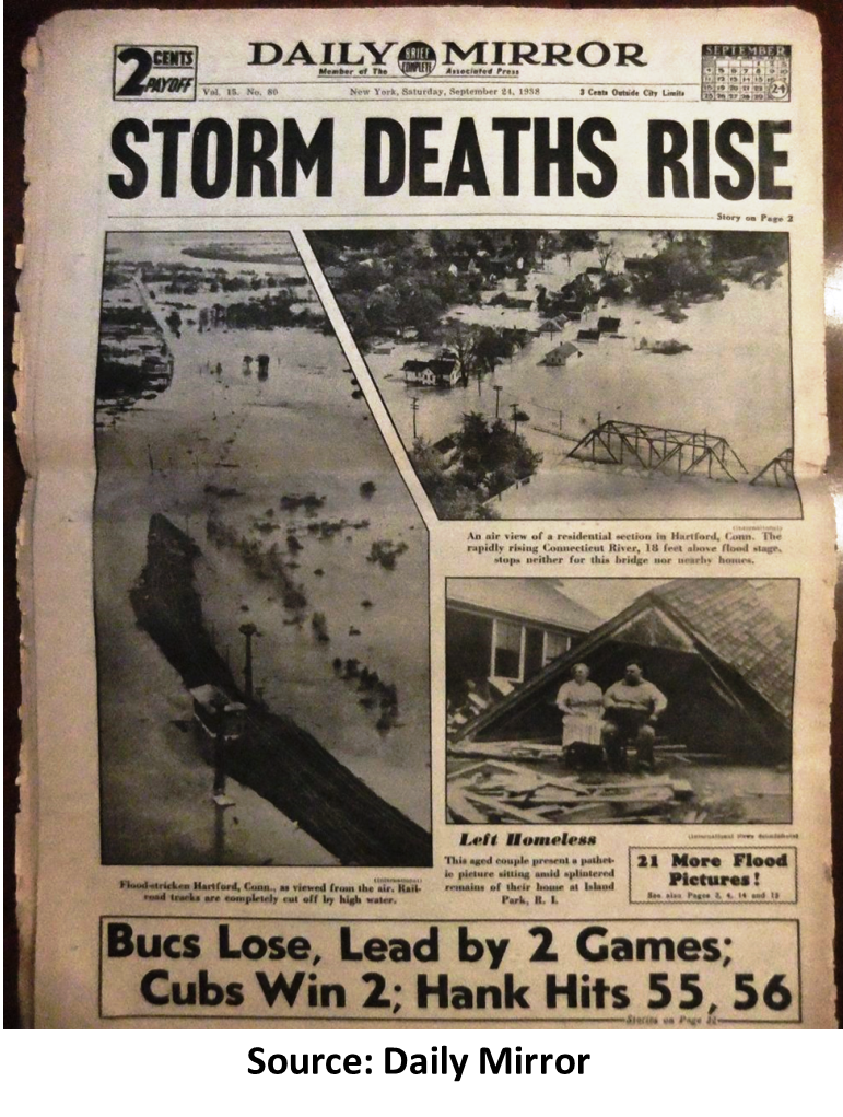
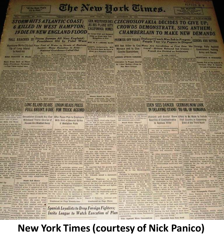
Sustained hurricane force winds occurred throughout most of Southern New England. The strongest winds ever recorded in the region occurred at the Blue Hill Observatory with sustained winds of 121 mph and a peak gust of 186 mph. Sustained winds of 91 mph with a gust to 121 mph was reported on Block Island. Providence, Rhode Island recorded sustained winds of 100 mph with a gust to 125 mph. Extensive damage occurred to roofs, trees and crops. Widespread power outages occurred, which in some areas lasted several weeks. In Connecticut, downed power lines resulted in catastrophic fires to sections of New London and Mystic. The lowest pressure at the time of landfall occurred on the south side of Long Island, at Bellport, where a reading of 27.94 inches was recorded. Other low pressures included 28.00 inches in Middletown, Connecticut and 28.04 inches in Hartford, Connecticut. The hurricane produced storm tides of 14 to 18 feet across most of the Connecticut coast, with 18 to 25 foot tides from New London east to Cape Cod. The destructive power of the storm surge was felt throughout the coastal community. Narragansett Bay took the worst hit, where a storm surge of 12 to 15 feet destroyed most coastal homes, marinas and yacht clubs. Downtown Providence, Rhode Island was submerged under a storm tide of nearly 20 feet. Sections of Falmouth and New Bedford, Massachusetts were submerged under as much as 8 feet of water. All three locations had very rapid tides increased within 1.5 hours of the highest water mark. Rainfall from this hurricane resulted in severe river flooding across sections of Massachusetts and Connecticut. Three to six inches fell across much of western Massachusetts and all but extreme eastern Connecticut. Considerably less rain occurred to the east across Rhode Island and the remainder of Massachusetts. The rainfall from the hurricane added to the amounts that had occurred with a frontal system several days before the hurricane struck. The combined effects from the frontal system and the hurricane produced rainfall of 10 to 17 inches across most of the Connecticut River Valley. This resulted in some of the worst flooding ever recorded in this area. Roadways were washed away along with sections of the New York, New Haven, and Hartford Railroad lines. The Connecticut River, in Hartford reached a level of 35.4 feet, which was 19.4 feet above flood stage. Further upstream, in the vicinity of Springfield, Massachusetts, the river rose to 6 to 10 feet above flood stage, causing significant damage. A total of 8,900 homes, cottages and buildings were destroyed, and over 15,000 were damaged by the hurricane. The marine community was devastated. Over 2,600 boats were destroyed, and over 3,300 damaged. Entire fleets were lost in marines and yacht clubs along Narragansett Bay. The hurricane was responsible for 564 deaths and at least 1,700 injuries in Southern New England. Damage to the fishing fleets in Southern New England was catastrophic. A total of 2,605 vessels were destroyed, with 3,369 damaged. |
 |
|
Summary
Widespread inland flooding, high winds inland, with severe coastal flooding. |
||
|
PUBLIC IMPACT
Deaths: 564 Injured: >1,700 |
BOATING IMPACT
Destroyed: 2,600 Damaged: 3,300 |
HOMES/BUILDINGS
Destroyed: 8,900 Damaged: > 15,000 Catastrophic fires touched off by powerlines in Connecticut! |
|
Source:
"Southern New England Tropical Storms and Hurricanes, A Ninety-eight Year Summary 1909-1997" by David R. Vallee and Michael R. Dion, National Weather Service, Boston / Taunton, MA |
||


|
Overview (click for larger view) |
Rainfall (click for larger view) |
Wind Speed (click for larger view) |
|
Storm Surge (click for larger view) |
Preparedness (click for larger view) |
|
Source Citation
F. Barrows Colton. "The Geography of Hurricanes." The National geographic Magazine April, 1939. Print. The Great Hurricane and Tidal Wave Rhode Island. Providence Journal, 1938. Print. Hurricane Pictures of Greater Fall River. Fall River Herald News, 1938. Print. Minsinger, William E. The 1938 Hurricane: An Historical and Pictorial Summary. Vermont: Greenhills Book, 1988. Print. Sheets, Dr. Bob, and Jack Williams. Hurricane Watch. New York: Vintage Books, 2001. Print. Emanuel, Kerry. Divine Wind. New York: Oxford, 2005. Print. Gordon, Bernard. Hurricane in Southern New England. Watch Hill RI: Book and Tackle Shop, 1976. Print. Jarvinen, Brian R. Storm Tides in 12 Tropical Cyclones (including Four Intense New England Hurricanes). 2006. Paulsen, Carl et al. Hurricane Floods of September 1938. 1940. Vallee, David R. and Michael R. Dion, "Southern New England Tropical Storms and Hurricanes, A Ninety-eight Year Summary 1909-1997" National Weather Service, Taunton, MA. Many thanks to the plethora of photos and interviews from the following sources: Risk Management Solutions Inc Scott A. Mandia from Suffolk County Community College Nick Panico Collection Dr. Isaac Ginis of University of RI Standard Times in New Bedford Springfield Republican in Springfield, MA The Westerly Sun in Westerly, RI Connecticut Valley Historical Museum Leslie Jones collection from the Boston Public Library Town of Bourne Archievs Edward Bellamy Memorial Association Newport Historical Society Connecticut State Archives Dick Shelton Mystic Seaport Guilford Free Library Connecticut State Library The Connecticut Historical Society, Hartford Charles Gunn Papers, Archieves and Special Collections of the University of Connecticut Libraries Forest History Society NH Homeland Security and Emergency Management MEMA Monadnock Ledger-Transcript Ruth Bates Donald Ellis |


 Follow us on YouTube