|
A developing, complex storm system across the lower Great Plains, featuring a trough of low pressure extending from north Texas through the western Rio Grande Valley, and aided by a vigorous upper level low, increased southerly flow of very warm air across the lower Rio Grande Valley and all of Deep South Texas. The result was two separate weather regimes, ranging from record heat from McAllen to Falfurrias west through Jim Hogg, Starr, and Zapata Counties, to wind gusts near or just above 50 mph along and near the highway 77 corridor, including Brownsville, McAllen, and extending to the coast. The same system produced a violent and deadly tornado outbreak across Arkansas and Tennessee (among other states), during the late afternoon and overnight.
The Heat...
The combination of west to southwest winds above the surface, 5000 foot temperatures surging to near 23°C (or around 75°F), and very dry air generally at or above 3000 to 5000 feet (Figure 1, below), mixed down to the Valley floor during the mid afternoon, just prior to the passage of the cold front. The mixing of dry air from higher levels of the atmosphere to lower levels almost always results in significant warming as the air descends. Meteorologically, we call this process "compression", since direct transfer of heat does not occur; rather, the "heat" is generated by the acceleration of gravity as the air mixes toward the surface. On February 5th, it was estimated that 13°C to 15°C of warming occurred between 5000 feet and the surface, resulting in afternoon high temperatures between 95 and 100°F, generally from Hidalgo and western Brooks County west to Zapata, Starr, and Jim Hogg Counties.
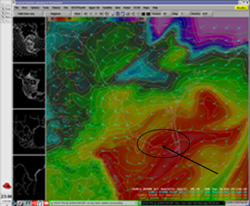
Figure 1. 850 mb temperature in °C (green contours), wind (blue barbs), and relative humidity (image background) at Noon CST on February 5th, 2008. Note nose of very warm temperatures concurrent with humidity near 10 percent (red image and orange contours). Click to enlarge. |
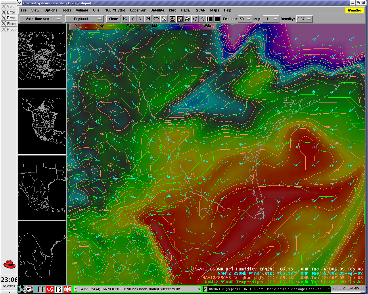
Figure 2. Atmospheric sounding, Viboras (northwest Starr County), at 3 PM CST, estimated by the Rapid Update Cycle model. Note the temperature profile (right side line) which indicates surface temperature near 37°C (98°F), and the nearly dry lapse rate all to nearly 25,000 feet (click to enlarge).
...and The Wind
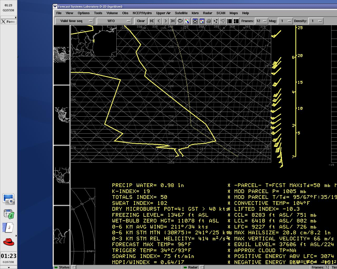
Exceptional winds, substantially higher than what usually occurs along and near the population centers of the eastern Lower Rio Grande Valley, continued through the night and into the morning of February 5th. The observed atmospheric sounding (below) from Brownsville, at around 6 AM CST, indicated more than 50 knots of southerly flow from near 1000 to near 2000 feet above the surface! Initially, most of these winds did not translate to the surface, perhaps slowed by more stable, viscous air at the ground. However, as the day progressed, two things happened: first, temperatures warmed a bit and clouds thinned, allowing a bit more wind to penetrate toward the ground, and second, the extensive heating west of McAllen allowed surface pressure to drop more than expected, increasing the difference in pressure from Starr County to the coast. This combination produced a very brief period of sustained winds around 40 mph in Brownsville and Harlingen, with gusts up to 51 mph in Brownsville, between 1 and 2 PM. These winds caused minor damage to unfastened or lightweight objects around the area, including signboards and portable basketball posts.
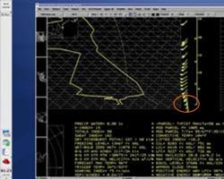
Figure 3. Atmospheric sounding, Brownsville, at 6 AM CST February 5th. Note the 54 and 49 knot winds (lower right corner, circled ("flag"), at around 1000 and 2000 feet above the surface (click to enlarge). |


 Follow us on YouTube